Country:
 City:
City:


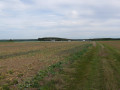
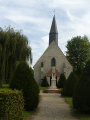

Park in the car park at Mittainville cemetery.
(S/E) Opposite the cemetery, on your right, there’s a small bus stop sign: right next to it, take the path that winds its way through the fields, running alongside the houses. You’ll come to a crossroads by the biogas plant.
(1) Turn slightly left, then keep left again at the next crossroads. Continue across the fields until you reach the village of Les Pâtis.
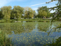
(2) Turn left onto Rue de la Mare (which is actually a path running alongside a garden for the first hundred metres). Walk through the village, taking in its pretty houses and peaceful atmosphere. After the small pond at the end of Rue de la Mare, turn right onto Rue de Vacheresse to reach the hamlet of the same name.
(3) Turn right, then cross the D113 to follow the path leading uphill to the left. Once at the top of the Butte du Moulin, turn left at the crossroads; a few hundred metres further on, you’ll come to the junction with the D307.4.
(4) Cross it carefully and continue straight ahead through the fields in the area known as Les Bergeries. Then cross the Ruisseau de la Maltorne before entering the village of Saint-Lucien.
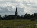
(5) Walk past the church on your left and pass a small pond. Just after this, look to your right for the Ruelle des Charbonniers – in fact, a path covered with a carpet of grass. Once on the other side, turn left onto Rue du Presbytère, then left again onto Rue des Pressoirs to quickly reach the junction with Rue du Petit Orme.
(6) Turn right onto it – this is the D307.2a – heading towards the cemetery, which is signposted by a small sign. Walk alongside the cemetery, continuing straight on along this quiet (if not deserted) little road, but keep your ears open in case you hear a vehicle approaching. You will then arrive at the hamlet of Saugis.
(7) Walk through it and take the gently ascending path opposite. Walk once more through the fields of Les Bruyères du Temple and you’ll arrive behind the Hauts de Pardaillan estate.
(8) Go round it on the left (please note: when we passed through, the path was in poor condition, but it is perfectly passable); go past the sand pit on your left and continue along the path opposite. You will then reach a four-way junction with a telecoms mast.
(9) Turn left; after a few dozen metres of gentle ascent, begin the descent towards Hermeray, which you can see below on the left. Near Les Pendants de Hautvilliers, carry on straight ahead to reach theGRP® des Yvelines.
(10) Turn left onto it and follow the yellow and red markings to enter Hermeray.
(11) Continue left along theGRP® to reach, shortly afterwards, a Y-junction at the entrance to the forest.
(12) Leave theGRP® here and turn right onto a footpath. Then rejoin theGRP®, follow it, and exit the forest. After a straight stretch, you’ll reach the Hermeray SPA Refuge shortly after the houses at La Berthière.
(13) Continue along theGRP® following the yellow and red markings. Enter the forest again at the Château Rouge junction. Carry on and you will soon come to a Y-junction near the Butte de Manimont.
(14) Turn right onto theGRP® and, as you leave the forest, you’ll reach the car park at Mittainville Cemetery (S/E).

 Visorando Member
 Easy
Easy