Country:
 City:
City:


Start from the small car park on Route de l’Église in Poigny-la-Forêt. For access by train, see the practical information.
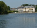
(S/E) From the car park, with your back to the church, head to the right. Turn right onto Route des Graviers. At the stop sign, turn left. Stay on the tarmac until you reach the Étang du Roi.
Red and white markings forthe GR®1
(1) Turn left, with the Étang du Roi on your right. At the Carrefour du Roi de Rome, take the second path on the left, the Route de la Mouche aux Rabières. You’ll cross a footpath.
(2) At the next three junctions, carry straight on, leaving the Croix Jouanne on your left each time. A little further on, turn left onto the first footpath. This leads down to the D107.
(3) Walk along the right-hand side of the road, behind the crash barrier. After the bridge, cross carefully the tarmac and enter the car park. At the far end of the car park, take the path up to the left. Turn right a little further on.
(4) At the three-way junction, head up to the far left. At the top, ignore the three-way junction to the left and the path leading down to the right. At the next three-way junction, follow the middle path. Keep to the edge of the rocks. After the fallen tree trunk lying across the path, head right onto an uphill path. At the five-way junction, take the second right. After a small bridge, you’ll reach the Carrefour des Rabières.
(5) Turn left. Ignore a path on the right, then keep right at the Fork in the road. Keep left at the next Fork in the road. Again, ignore a path on the right.
(6) Cross the power line, then ignore a path on the left. Take the wooden walkway at the Fork in the road. After the Chêne de la Pocqueterie, first turn right then left at the junction. Cross a forest track. Turn left at the Fork in the road.
(7) Take the first path on the right. At the junction, continue along the fence on your left.
(8) At the crossroads, follow the tarmac road. Leave the road on your right. Walk to the end of Route du Gâteau. Continue to the second stop sign and walk alongside the wall on your left. Ignore the dead-end road.
(9) At the traffic lights, turn left to cross the D 906 at the pedestrian crossing and take Rue des Écoles. Ignore the dead-end road. Stay at the edge of the field, then, at the crossroads, take the second left.
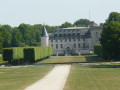
(10) Opposite the Ferme de Guéville, follow the road to the left until you reach the D 906. Take the cycle path to enter the Rambouillet Castle Park. Stay on the tarmac until you reach the car park in front of the Laiterie de la Reine.
(11) See practical information * if the gates are closed.
Turn right onto the path that runs alongside the canal on your left. At the gate, continue left along the water’s edge. Go through a gate, then turn left. Go round the Rondeau, keeping to the left and covering three-quarters of the way round it. Leave the Rambouillet Estate by going through the large gate on the right.
(12) Take the pedestrian crossing in front of the gate and walk past the bank. Take Rue Chasles against the flow of traffic (formerly Rue de l’Embarcadère). Go under the railway bridge and use the two pedestrian crossings to turn round.
Leave the red and whiteGR®1markings
(13) After the railway bridge, cross at the pedestrian crossing and continue right onto Rue Sadi Carnot. Turn left immediately onto Rue d’Angiviller. Stay on this street past the roundabout. Cross Rue Clémenceau. At the stop sign, turn left. Continue to the right along Rue du Général de Gaulle until you reach the town hall. Walk along the left-hand side of the park gate. At the three-way junction, keep to the left.
(14) Go through the park gate and cross the car park straight ahead. At a cobbled path leading down to a pond, take the path on the right. At the junction, follow the tarmac to the right. Stay on this path until you reach a gate. Go through it and continue straight ahead until you reach another gate.
(15) Cross the D936 at the pedestrian crossing, then take the cycle path on the left. Follow it to the end, for about 2 km.
(16) Turn left onto a forest track. Cross the Guesle, then leave the tarmac at the Fork in the road.
Carry straight on at the signpost with six directions. Ignore a path on the left, then one on the right. At the next junction, turn right.
(17) Follow the road to the left. At the roundabout, keep left. Continue to the very end of the Route de la Haie des Houx. Cross the Route de Rambouillet and follow it, carefully , on the right-hand side. Turn left onto the first path. At the end of the path, turn right. You’ll find the small car park on the left, next to the church (S/E).

 Visorando Member
 Easy
Easy 
 Moderate