Refine your search for walks in Chavannes-sur-l'Étang
Chavannes-sur-l'Étang walks
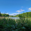
 Chavannes-sur-l'Étang pond trail

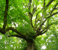
A superb hike on the border between Belfort and Haut Rhin. You will discover a landscape of countryside and forests with magnificent ponds. As a bonus, there is a discovery trail with information panels about the trees of our region.
 The Marnière circular in Foussemagne

This is a very pretty hike that will allow you to discover a charming village and its suburbs, an old synagogue and an "Arromanches" type bridge. It passes near the Porte d'Alsace area with the Fosses discovery trail, where you will learn to recognise the trees of our region. Not to mention the Étang de la Marnière, a vast wetland with flora and fauna to discover.
The hike is signposted.
 Aéroparc à Fontaine, Reppe et Larivière. Circuit des trois villages.

This pleasant hike will allow you to discover three typical villages: Fontaine, Reppe and Larivière, as well as the former Fontaine aerodrome.You will also see magnificent countryside landscapes and beautiful views of the Vosges mountains.This walk is signposted.
01/2026: the path has been diverted at the exit of Reppe to avoid traffic on the main road.
 Circular Courlis and Rhône-Rhine Canal

A pleasant hike in Montreux-Château, 15 km east of Belfort.
It will allow you to discover some very pretty villages:
- Autrage and Novillard with their pretty half-timbered houses.
- Petit-Croix with the Pégoud monument.
- Montreux-Château with its beautiful chapel and the motte castrale, the remains of a medieval castle.
The route is marked with a blue disc.
 Le Pré de la Caille, Frais route

A pleasant hike near Frais, located 10 km east of Belfort.
You can admire a rich architectural and natural heritage, beautiful half-timbered houses and a superb view of the Southern Vosges.
The route is marked with a red ring.
 Larivière Circular
A beautiful discovery of the region around the village of Larivière. In the clearing 10 km north-east of Belfort, this walk will introduce you to a varied landscape of forests, ponds, cultivated fields and pastures.
 Moulin loop between Lacollonge and Bethonvilliers

A beautiful walk in the countryside of Lacollonge and Bethonvilliers. 10 km east of Belfort. Beautiful view of the peaks of the Southern Vosges.
Countryside landscape watered by the Madeleine River. Beautiful old farms, a beautiful covered wooden bridge, a few beautiful ponds, an old mill...
The walk is signposted.
 The Bessoncourt high wood tour
A true journey through history, this hike alternates between remarkable sites and natural gems.
The route is marked with a yellow disc.
 Route des autres chênes (Other Oaks Route) towards Autrage

A pleasant hike through the countryside and forest. Beautiful views of the Jura mountains.
Very pretty villages of Novillard, Autrage and Autrechêne with artistic decorations.
Easily accessible, about ten kilometres south-east of Belfort.
This hike is marked.
 The cabbage trail in Chevremont
This hike is marked with cabbage-shaped markers.
It will allow you to discover the village of Chèvremont and some of the old military installations located in the commune.
You will discover its church dating from 1784, built by the architect Kleber, the town hall and the adjoining facilities: school, nursery, cultural centre, Chougalante, cemetery.
 Circular starting from Lachapelle-sous-Rougemont
Discover a splendid circular hiking loop starting from Lachapelle-sous-Rougemont in the Belfort gap, on the border with Alsace, 15 kilometres north-east of Belfort.
You will admire landscapes of cultivated fields, meadows and magnificent forests, not to mention the stork nests at Petitefontaine.
You can stop for refreshments at Lac de la Seigneurie.
Enjoy exceptional views of the Southern Vosges mountain range and the Swiss Jura.
Ideal for walking enthusiasts keen to discover the region's natural and cultural heritage.
The route is signposted.
 La Seigneurie and its lake from Petitefontaine

A pleasant hike near Petitefontaine, 20 km north-east of Belfort. You will discover a charming little village and countryside landscapes of forests with numerous ponds. You can take a short detour to admire Lac de la Seigneurie.
The hike is marked with a Green Ring.
 Walk around Mont Bonnet and the spinning mills of Anjoutey and Étueffont

A pleasant hike through the countryside and forest. It allows you to discover the villages of Anjoutey and Étueffont as well as beautiful landscapes along the Madeleine.
Beautiful view of the Vosges peaks without having to climb them.
It is easily accessible, about ten kilometres north-east of Belfort.
The route is marked with a red ring.
 The green escape from La Madeleine to Anjoutey

Explore the magic of the Madeleine River in Anjoutey: a captivating adventure with the added bonus of discovering the Moulin wetlands. Set off on a dynamic hike where the wild nature of the Belfort gap reveals an enchanting landscape. Explore the diversity of the landscape through vast meadows and peaceful ponds, not to mention superb views of the countryside and the Southern Vosges mountains. An enriching experience to fully enjoy the local natural heritage.
 Route de découverte in Bourogne

15 km south-east of Belfort, 4 km from the TGV station, Bourogne is a town that combines modern development with a rich historical past.
This short walk through the village and forest will allow you to discover a rich heritage with several beautiful buildings, superb fountains and the ruins of the castle.
Information panels help you appreciate these treasures.
Another special feature of the route is the petrifying spring.
 The remarkable lime tree of Grandvillars

Short excursion from Grandvillars to the remarkable lime tree
 Morvillars les Grandes Tannières circular loop

Discover a hike starting from Morvillars, a charming village located 20 km south-east of Belfort, near the N19 towards Delle and Switzerland. This route takes you into the heart of lush countryside and rich forest, offering the ideal setting for an authentic nature getaway. The trail offers magnificent views of the surrounding villages and the majestic Vosges mountain range, a panorama that is sublime in every season. This hike combines natural beauty and diverse landscapes, ideal for lovers of walking, photography or simply relaxing in contact with nature. An accessible route rich in discoveries that promises an unforgettable experience in every season.
 Boucle des Chevreuils via Tête Le Moine and Col des 7 Chemins
Loop starting from Étueffont-centre via the Chapelle du Mont Bonnet, the Tête Le Moine, the Trou du Loup, the small village of Lamadeleine Val des Anges, the Col des Sept Chemins (open shelter), the Tête des Mineurs and the place called Le Châtelat.Follow the Club Vosgien's "Anneau Jaune" (Yellow Ring) markings.
 Walk in Saint-Nicolas
Short walk to Saint-Nicolas via forest paths and small roads along ponds and a small river.
 Circular between Étueffont and Grosmagny

Discover a superb hike starting from Étueffont or Grosmagny, in the heart of a landscape offering a harmonious blend of forests, pretty authentic villages and peaceful ponds. Perfectly suited to nature lovers, this route will lead you to discover the splendid landscapes of the Southern Vosges. Let yourself be seduced by the tranquillity of the forests and the coolness of the ponds, true havens of biodiversity. The starting point is at the foot of the Vosges, about fifteen kilometres north of Belfort. The trail is signposted.
More walks in Chavannes-sur-l'Étang
Select a point of interest below:
