Refine your search for walks in Bragayrac
Bragayrac walks
 Between Saint-Thomas and Empeaux
 Visorando Member
 9.09 mi
 +617 ft
 -623 ft
 4h 45
4h 45
 Moderate
 Departure from Saint-Thomas (Haute-Garonne) (Haute-Garonne)
The route between Saint-Thomas and Empeaux is mainly on roads, winding through the valleys, with some stunning views of the Gers and the Pyrenees
Route du Lac de Saint-Thomas
 5.17 mi
+335 ft
-351 ft
2h 40
5.17 mi
+335 ft
-351 ft
2h 40
 Easy
Departure from Saint-Thomas (Haute-Garonne) (Haute-Garonne)
Easy
Departure from Saint-Thomas (Haute-Garonne) (Haute-Garonne)
A route mainly on roads, best done in winter as there is very little shade, but watch out for mud on the dirt section ofthe GR® 86.
Larribaut mill
 5.80 mi
+479 ft
-479 ft
3h 05
Easy
Departure from Empeaux (Haute-Garonne)
5.80 mi
+479 ft
-479 ft
3h 05
Easy
Departure from Empeaux (Haute-Garonne)
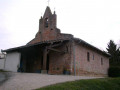
This route is mainly on roads and takes you to see an old watermill, through the valleys, starting from Empeaux Town Hall with a beautiful viewpoint at Vigie d'Azimont.
The Moulin d'Encor
 7.88 mi
+495 ft
-505 ft
4h 05
Moderate
Departure from Empeaux (Haute-Garonne)
7.88 mi
+495 ft
-505 ft
4h 05
Moderate
Departure from Empeaux (Haute-Garonne)
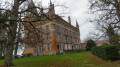
Starting from Empeaux town hall, take a stroll through the valleys to the Encor watermill, which has been converted into a rural lodge.
Between two lakes in Sainte-Foy-de-Peyrolières
 8.22 mi
+446 ft
-449 ft
4h 10
Moderate
Departure from Sainte-Foy-de-Peyrolières (Haute-Garonne)
8.22 mi
+446 ft
-449 ft
4h 10
Moderate
Departure from Sainte-Foy-de-Peyrolières (Haute-Garonne)
A bucolic hike linking Lake Sainte-Foy with Lake Parayre.
Rural landscapes.
Lac de la Parayre in Sainte-Foy-de-Peyrolières
 6.93 mi
+308 ft
-338 ft
3h 25
Moderate
Departure from Sainte-Foy-de-Peyrolières (Haute-Garonne)
6.93 mi
+308 ft
-338 ft
3h 25
Moderate
Departure from Sainte-Foy-de-Peyrolières (Haute-Garonne)
From the post office, take a walk to Lake Parayre along part ofthe GR® 86 trail, which offers some beautiful views.
Between the heights and the undergrowth of Saiguède
 5.68 mi
+413 ft
-387 ft
3h 00
Easy
Departure from Saiguède (Haute-Garonne)
5.68 mi
+413 ft
-387 ft
3h 00
Easy
Departure from Saiguède (Haute-Garonne)
This easy route allows you to explore some of the many paths in the commune, offering beautiful views of the Pyrenees and the rolling landscapes of Saiguède.
Avoid after heavy rain as some areas may be muddy.
The 31 km of the Route 31 starting from Saint Lys
 20.68 mi
+988 ft
-984 ft
8 hrs
20.68 mi
+988 ft
-984 ft
8 hrs
 Very difficult
Departure from Saint-Lys (Haute-Garonne)
Very difficult
Departure from Saint-Lys (Haute-Garonne)
A long route starting from the car park at the Saint-Lys boules ground, passing through several towns in Haute-Garonne. Much of the route follows theGR®86. This route can be shortened by omitting the circular route to Lake Parayre, reducing the distance by around ten kilometres.
This route was developed by the ENVOL association in Saint-Lys to raise funds to help in the fight against rare diseases.
The Moulin de Bélard route in Saint-Lys
 7.17 mi
+66 ft
-72 ft
3h 20
Moderate
Departure from Saint-Lys (Haute-Garonne)
7.17 mi
+66 ft
-72 ft
3h 20
Moderate
Departure from Saint-Lys (Haute-Garonne)
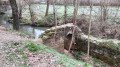
A circular route within the town of Saint-Lys and its bastide
The Ayguebelle greenway
 5.30 mi
+85 ft
-85 ft
2h 30
Easy
Departure from Saint-Lys (Haute-Garonne)
5.30 mi
+85 ft
-85 ft
2h 30
Easy
Departure from Saint-Lys (Haute-Garonne)
Start from the market square (Place de la Liberté) in Saint-Lys, following the Ayguebelle greenway to the secondary school, then return via the footpath running alongside the departmental road.
Walk around the Aussonnelle
 6.59 mi
+433 ft
-407 ft
3h 25
Moderate
Departure from Bonrepos-sur-Aussonnelle (Haute-Garonne)
6.59 mi
+433 ft
-407 ft
3h 25
Moderate
Departure from Bonrepos-sur-Aussonnelle (Haute-Garonne)
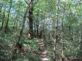
Come and escape to the bucolic surroundings of Bonrepos-sur-Aussonnelle, on the border between Haute-Garonne and Gers.
Around Lias
 7.53 mi
+633 ft
-630 ft
4h 00
Moderate
Departure from Fontenilles (Haute-Garonne)
7.53 mi
+633 ft
-630 ft
4h 00
Moderate
Departure from Fontenilles (Haute-Garonne)
Starting from the Fontenilles sports ground, a circular route towards Lias.
This route was used for the hike organised in aid of the Manon Hope Association, whose aim is to help fight leukaemia, particularly in children.
Around the Magnolias, starting from Fontenilles
 4.34 mi
+256 ft
-256 ft
2h 15
Easy
Departure from Fontenilles (Haute-Garonne)
4.34 mi
+256 ft
-256 ft
2h 15
Easy
Departure from Fontenilles (Haute-Garonne)
An extension of the Magnolias circular route allows you to enjoy splendid views of the neighbouring villages, the hillsides and, if you’re lucky, the Pyrenees.
There is just one minor challenge on the route: the climb through the Bois des Magnolias, but in dry weather it is accessible to everyone.
The Gascon Hills between Fontenilles and Bonrepos
 8.97 mi
+571 ft
-558 ft
4h 35
Moderate
Departure from Fontenilles (Haute-Garonne)
8.97 mi
+571 ft
-558 ft
4h 35
Moderate
Departure from Fontenilles (Haute-Garonne)
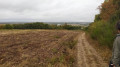
The Gascon Hills route, starting from the Fontenilles sports ground and heading towards the Roman road at Bonrepos through a succession of valleys
Bonrepos-sur-Aussonnelle circular
 5.21 mi
+256 ft
-256 ft
2h 35
Easy
Departure from Fontenilles (Haute-Garonne)
5.21 mi
+256 ft
-256 ft
2h 35
Easy
Departure from Fontenilles (Haute-Garonne)
Starting from Fontenilles Stadium, a circular route to Bonrepos-sur-Aussonnelle, with the outward leg through the Bois des Magnolias and the return via theGR®®86.
Bonrepos-sur-Aussonelle and Lias from Fontenilles
 13.42 mi
+1,168 ft
-1,165 ft
7h 10
13.42 mi
+1,168 ft
-1,165 ft
7h 10
 Difficult
Departure from Fontenilles (Haute-Garonne)
Difficult
Departure from Fontenilles (Haute-Garonne)
Circular, mainly in the forest or forest edge, with relatively little asphalt. May be muddy in places (field edges and tractor tracks) after rain. Some beautiful views of Lias, Bonrepos-sur-Aussonelle and the Toulouse plain.
Between Lias and Fontenilles
 5.52 mi
+318 ft
-305 ft
2h 50
Easy
Departure from Fontenilles (Haute-Garonne)
5.52 mi
+318 ft
-305 ft
2h 50
Easy
Departure from Fontenilles (Haute-Garonne)
Circular route of just over 8 km starting from Fontenilles Stadium, featuring an ascent through the Bois des Magnolias, followed by a descent and then a climb back up the valley where the Ruisseau des Crabères flows, before returning to the stadium.
The owner of the Bois des Magnolias has closed the old path that climbed along the southern edge of the woods but, in return, has given us permission to use a new path that winds a little further into the woods.
The Domaine de la Source, starting from Fontenilles
 9.35 mi
+98 ft
-105 ft
4h 25
Moderate
Departure from Fontenilles (Haute-Garonne)
9.35 mi
+98 ft
-105 ft
4h 25
Moderate
Departure from Fontenilles (Haute-Garonne)
The walk starts at the Fontenilles stadium, crosses the village to the Domaine de La Source and returns via a different route.
As always in Fontenilles, there is a section on tarmac, the length of which varies depending on the route.
Saint-Lys Maquis Circular Loop
 8.48 mi
+276 ft
-305 ft
4h 10
Moderate
Departure from Fontenilles (Haute-Garonne)
8.48 mi
+276 ft
-305 ft
4h 10
Moderate
Departure from Fontenilles (Haute-Garonne)
The route is almost entirely on tarmac, for days when the paths are impassable
During the route, there’s a special focus on the Maquis de Saint-Lys and the battles of 12 June 1940.
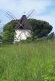
La Boule Bleue via the bamboo forest
 8.28 mi
+479 ft
-466 ft
4h 15
Moderate
Departure from Fontenilles (Haute-Garonne)
8.28 mi
+479 ft
-466 ft
4h 15
Moderate
Departure from Fontenilles (Haute-Garonne)
Starting from the Fontenilles sports ground, this circular route takes you to the Lias radar station (Boule Bleue), with plenty of trails and undergrowth.
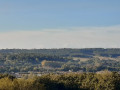
The blue ball and return via Lias
 8.70 mi
+597 ft
-597 ft
4h 30
Moderate
Departure from Fontenilles (Haute-Garonne)
8.70 mi
+597 ft
-597 ft
4h 30
Moderate
Departure from Fontenilles (Haute-Garonne)
A walking route starting from the Fontenilles stadium to the blue ball of the Lias radar, with the return journey taking a different route through the hills of the Gers. The blue ball is a landmark for the entire region, being located on high, open ground.