Tour of the Grand Bois de Fontenilles

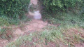
A route suitable for everyone, mostly along quiet roads, to be taken when the paths are impassable due to flooding and mud.

Details

4511383
Creation:
Last update:
Last review:
  • Walking
    Activity: Walking
  • ↔
    Distance: 4.97 mi
  • ◔
    Average duration: 2h 20 
  • ▲
    Difficulty: Easy

  • ⚐
    Back to start: Yes
  • ↗
    Ascent: + 30 ft
  • ↘
    Descent: - 30 ft

  • ▲
    Highest point: 702 ft
  • ▼
    Lowest point: 663 ft
  • ⚐ Country: France
  • ⚐ City: Fontenilles (31470)
  • ⚑
    Start/End: N 43.557206° / E 1.177668°
  • ❏
    IGN map(s): Ref. 2043ET, 2043O
  • Hour-by-hour weather

Photos

Description of the walk

Park in the car park at the Fontenilles sports ground next to the Maison des Sports.

(S/E) Leave the car park and head towards the roundabout. Before reaching it, cross the Route de Lias (D37c) with care (there is no pedestrian crossing) to join the D65 and continue towards the hamlet of Les Arramous.

(1) Leave the D65 and turn right towards the Grand Bois equestrian centre (Saint-Hubert). Continue to the junction at the entrance to the equestrian club’s clubhouse.

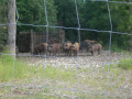
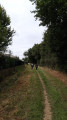
(2) Turn right onto the dirt track that runs past the equestrian club’s riding arena and carry on straight ahead until you reach a tarmac road. As the track runs alongside the woodland, you might be lucky enough to spot some black pigs coming to forage for something other than acorns.
Turn left onto the road and carry on to the roundabout at the Fontenilles bypass.

(3) Do not go all the way to the roundabout; turn your back on it and turn left onto the Route de Pujaudran (D 37d), which runs through the middle of the Grand Bois.
A second chance to spot the wild boars, but this time feeding on acorns.

(4) The road takes a 90° bend and crosses both a municipal boundary and a departmental boundary; it becomes the D533, Route de Fontenilles. Turn right and continue to the next junction, following the D533 as it bends to the left.

(5) Go straight on at the junction and follow the Chemin des Bordes, whilst the Route de Fontenilles turns right to cross over the RN 124. Continue to the next junction with a memorial stone topped by a cross.

(6) Take the Chemin de Secouris opposite, whilst the Chemin des Bordes continues to the right.
Walk past the recently restored property with horses and continue to the crossroads with the beautiful wooden house on the corner.

(7) Turn left onto the Chemin de Grousset, which is a dead end. Follow the tarmac road as it bends to the left.

(8) The track is a dead end and the road stops at the last houses in the hamlet.
As the path opposite is closed to all, take the dirt track on the right which leads towards the Grand Bois.
Cross the woodland, passing between the buildings of the Écuries du Grand Bois.

(2) Head straight ahead to find the Chemin de Saint-Hubert, a tarmac road that ends at the D65, which leads towards Les Arramous.

(1) Leave Les Arramous behind you and turn left onto the D65, which ends in front of the start car park (S/E).


Waypoints

  1. S/E : mi 0 - alt. 673 ft - Car park at the Fontenilles sports ground
  2. 1 : mi 0.58 - alt. 676 ft - D65 junction – Saint-Hubert
  3. 2 : mi 1 - alt. 682 ft - Les Écuries du Grand Bois Riding Club
  4. 3 : mi 1.83 - alt. 663 ft - Roundabout on the ring road
  5. 4 : mi 2.35 - alt. 673 ft - Gers–Haute-Garonne boundary
  6. 5 : mi 2.81 - alt. 673 ft - Chemin des Bordes
  7. 6 : mi 3 - alt. 682 ft - Memorial stone with a cross
  8. 7 : mi 3.26 - alt. 702 ft - A beautiful wooden house
  9. 8 : mi 3.52 - alt. 689 ft - Grousset hamlet
  10. S/E : mi 4.97 - alt. 673 ft - Car park at the Fontenilles sports ground

Notes

There are no accessible water points along the walk.
It is recommended that you wear a yellow high-visibility vest.

Worth a visit

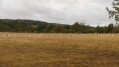
The central part of the Grand Bois is home to a farm raising ‘black pigs’, hence its nickname, the Bois des Cochons. The pigs can be seen at several points along the route.

Reviews and comments

4 / 5
Based on 3 reviews

Reliability of the description
4.3 / 5
Ease of following the route
4 / 5
Route interest
3.7 / 5
Domie Bo
Domie Bo

Overall rating : 4.3 / 5

Date of your route : Nov 12, 2025
Reliability of the description : ★★★★★ Very good
Ease of following the route : ★★★★★ Very good
Route interest : ★★★☆☆ Average
Very busy route : No

Easy hike, easily completed in 1 hour 45 minutes without overexerting yourself. Mainly on roads with little traffic, making it accessible to all without difficulty.

Machine-translated

Nath Duc
Nath Duc

Overall rating : 3.7 / 5

Date of your route : Oct 18, 2025
Reliability of the description : ★★★★☆ Good
Ease of following the route : ★★☆☆☆ Disappointing
Route interest : ★★★★★ Very good
Very busy route : No

Lovely walk with beautiful woodland but no signposting and the description is not precise enough.

Machine-translated

AJT-31
AJT-31

Hello,
Thank you for taking the time to leave a comment – a very positive one for me.
Why not come and join us for a walk?
To get an idea, have a look at our Facebook page “Marche à Fontenilles”

Machine-translated

Domidas
Domidas

Overall rating : 4 / 5

Date of your route : Feb 04, 2021
Reliability of the description : ★★★★☆ Good
Ease of following the route : ★★★★★ Very good
Route interest : ★★★☆☆ Average
Very busy route : No

An easy route with no significant elevation gain and, above all, plenty of sections on tarmac – which is why we chose it during this spell of heavy rain. The only dirt sections were indeed very muddy, but wide enough to find your way through. Best saved for gloomy weather.

Machine-translated

Other walks in the area

For more walks, use our search engine .

The GPS track and description are the property of this route's author. Please do not copy them without permission.