Country:
 City:
City:


Park on Place de la Liberté, between the church and Saint-Lys Town Hall.
(S/E) With your back to the church, cross the square and turn right onto Avenue du Languedoc. Pass between the town hall and the market hall, cross Avenue de Toulouse (D632) with care and take Rue du Chapeau Rouge opposite. Follow this street down, cross the D12 (Avenue de la Gascogne) with care and continue downhill to the junction towards Saiguède.
(1) At the crossroads, turn left onto Boulevard de la Piscine, leaving the park on your right. Turn onto Rue du Pigeonnier de Delhom, which climbs to the right and then, at the fork, to the left towards the Moulin de Bélard. When the road ends, take the footpath in the same direction, then head up to the right to admire the mill. Turn your back on the mill and head down towards the swimming pool junction. Cross the junction and take Rue du Moulin, which leads uphill opposite, until you reachthe first junction.
(2) Turn right onto Rue du 11 Novembre 1918 and follow it to the end. When you reach the D632 (Avenue des Pyrénées), cross carefully and continue towards Sainte-Foy-de-Peyrolières until you reach the first junction on the left. Leave the D632 and turn left onto Chemin de Barcelone until you reach Allée des Albizias.
(3) Turn left into the cul-de-sac and go right to the end. Then follow the small path which leads out onto Rue des Alouettes opposite, which joins Route de Cambernard (D37).
(4) Turn left onto the D37 and continue to the next Y-junction, where you should turn right onto Chemin des Nauzes. Continue to the end of the tarmac road and carry on along the dirt track that continues from there. Keep following this track, ignoring a branch coming from the right, until you reach a tarmac road.
(5) Turn left onto Chemin de Bartas, then immediately turn right onto Chemin de Mathieu au Prim. Follow this road to the end, remembering to look back to enjoy the scenery and perhaps catch a glimpse of the Pyrenees.
(6) The road joins the Route de Saint-Clar, which you take to the right but quickly leave behind, taking thefirst left onto the Route de la Souliguères (D19A). Follow this road to the junction with the D19, Route de Lamasquère.
(7) At the junction, turn left onto the D19 and head up towards Saint-Lys until you reach the path leading to the new cemetery.
(8) Leave the Route de Lamasquère and turn right onto the Chemin de la Moutonne. Pass the dog training facilities, then the new cemetery, until you can see the D12, Route de Muret.
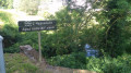
(9) Just before the junction with the D12, turn left onto the footpath running alongside the main road. Continue towards Saint-Lys until you reach the crossroads leading to the industrial and commercial estate. Use the pedestrian crossings to cross the crossroads carefully and take the footpath on the other side of the main road, still heading towards Saint-Lys, until you reach the sign for Le Lac des Pêcheurs.
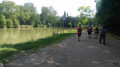
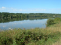
(10) At the end of the Roland Garros housing estate, turn right onto the dirt track leading to Lac des Pêcheurs. Stay on this path until you reach the lake. Ignore the path continuing straight ahead and turn right to walk round the lake, following the shore. Return to the path and continue to the right to cross over the Aiguebelle, then follow this stream through the municipal park until you reach the Route de Toulouse.
(11) Cross the D632 (Route de Toulouse) with care and turn left towards the town centre.
Cross Rue de l’Ayguebelle at the pedestrian crossing and continue towards the church, passing the skate park and the boules courts. Before Rue des Lilas, cross the departmental road with care to reach the church forecourt. Then cross the D19 using the pedestrian crossing to reach Place de la Liberté, the end of the walk (A/D)




 Visorando Member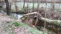
 Easy
Easy 
 Very difficult