Around the Magnolias, starting from Fontenilles

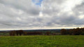
An extension of the Magnolias circular route allows you to enjoy splendid views of the neighbouring villages, the hillsides and, if you’re lucky, the Pyrenees.
There is just one minor challenge on the route: the climb through the Bois des Magnolias, but in dry weather it is accessible to everyone.

Details

4405986
Creation:
Last update:
Last review:
  • Walking
    Activity: Walking
  • ↔
    Distance: 4.34 mi
  • ◔
    Average duration: 2h 15 
  • ▲
    Difficulty: Easy

  • ⚐
    Back to start: Yes
  • ↗
    Ascent: + 256 ft
  • ↘
    Descent: - 256 ft

  • ▲
    Highest point: 928 ft
  • ▼
    Lowest point: 669 ft
  • ⚐ Country: France
  • ⚐ City: Fontenilles (31470)
  • ⚑
    Start/End: N 43.557273° / E 1.177357°
  • ❏
    IGN map(s): Ref. 2043ET
  • Hour-by-hour weather

Photos

Description of the walk

Park in the car park at the Fontenilles sports ground.

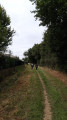
(S/E) Pass the sports centre on your right and the sports pitches on your left, then take the dirt track between the two sections of the Espèche industrial estate.

(1) At the end of the straight stretch, continue along the path, turning left. The path no longer runs alongside the industrial estate but now runs alongside the Magnolias housing estate.

(2) At the end of this second straight stretch, do not cross the bridge but turn right onto the path that leads into the woodland.
Head uphill through the woods, staying on the path as the woodland is private. Make sure you stay between the boundary fences.
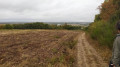
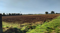
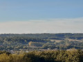
As you emerge from the woods, the path continues to the left and follows the edge of the woodland to the highest point of the walk (elevation 283). Superb view over the village of Lias and its hamlets, as well as the Fontenilles plain. A stop is recommended.

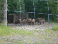
Head down to the left, continuing to follow the boundary path between the Gers and Haute-Garonne departments. Another viewpoint, this time over the village of Bonrepos-sur-Aussonnelle with the Pyrenees in the distance. Continue downhill to a crossroads where the path on the right enters a private property, La Miraclette, which keeps sheep.

(3) Ignore the path straight ahead which descends towards Lias and turn left onto the path leading down to Bonrepos. The path is made of broken bricks and tiles. Continue to the junction with tarmac roads.

(4) Turn left onto Chemin de Mondou, which becomes Chemin Garrousset as you cross into another municipality. Continue along this road, which is normally closed to traffic, until you reach the start of the hamlet of Taillade.

(5) Before you reach the first houses, turn left onto the dirt track that links up with the Magnolias housing estate.

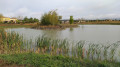
(6) Cross the path that goes round the housing estate and head towards the lake. Start walking round the lake, beginning on the left-hand side. The path follows the lakeshore before returning to the start of the walk.

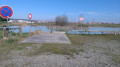
(6) Turn left onto the path that goes round Les Magnolias. At the end of the path, cross Avenue des Magnolias with care.

(7) Leave the residential estate behind you and take the path on the right which runs parallel to the ring road. Ignore the path on the right which passes under the ring road and walk past the indoor tennis courts; rejoin the old Lias road, go round the rugby pitch and arrive at the car park (S/E).


Waypoints

  1. S/E : mi 0 - alt. 673 ft - Car park at the Fontenilles Sports Ground
  2. 1 : mi 0.41 - alt. 682 ft - Western end of the Espèche industrial estate
  3. 2 : mi 0.87 - alt. 705 ft - Turn right towards the woods
  4. 3 : mi 1.76 - alt. 866 ft - La Miraclette
  5. 4 : mi 2.13 - alt. 722 ft - Mondou Path
  6. 5 : mi 3.08 - alt. 682 ft - Taillade
  7. 6 : mi 3.26 - alt. 682 ft - Lake
  8. 7 : mi 3.94 - alt. 676 ft - Entrance/exit to the Les Magnolias housing estate
  9. S/E : mi 4.34 - alt. 673 ft - Car park at the Fontenilles Sports Ground

Notes

There are no water points along the route.
On the climb through the Bois des Magnolias, walking poles may come in handy.

Worth a visit

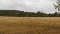
Stunning views of the ridges on the border between the Gers and Haute-Garonne.

(6) The walk round the lake is very pleasant.

Reviews and comments

4.3 / 5
Based on 3 reviews

Reliability of the description
4.7 / 5
Ease of following the route
4.3 / 5
Route interest
4 / 5
MAG ET JF LABAQUERE
MAG ET JF LABAQUERE

Overall rating : 4.7 / 5

Date of your route : Aug 22, 2022
Reliability of the description : ★★★★★ Very good
Ease of following the route : ★★★★★ Very good
Route interest : ★★★★☆ Good
Very busy route : No

A very pleasant walk with some lovely views.

Machine-translated

AJT-31
AJT-31

Hello,
You missed out, as we were in St Thomas this Sunday and the view of the Pyrenees was magnificent.
You can read the report on the morning’s walk on our Facebook page, ‘Marche à Fontenilles’, and why not come and join us for a walk?

Machine-translated

curepipe
curepipe

Overall rating : 4 / 5

Date of your route : Jan 03, 2021
Reliability of the description : ★★★★☆ Good
Ease of following the route : ★★★★☆ Good
Route interest : ★★★★☆ Good
Very busy route : No

Hello,
A lovely, relaxing little walk, despite the changeable weather which meant we couldn’t enjoy the view of the Pyrenees...
Kind regards.
Antoine

Machine-translated

AJT-31
AJT-31

Hello,
I’m glad to hear you enjoyed my walk
You can also visit our group’s Facebook page, ‘Marche à Fontenilles’, and why not come and walk with us?
Kind regards

Machine-translated

l'indienne
l'indienne

Overall rating : 4.3 / 5

Date of your route : Jan 03, 2021
Reliability of the description : ★★★★★ Very good
Ease of following the route : ★★★★☆ Good
Route interest : ★★★★☆ Good
Very busy route : No

a lovely time in the glorious sunshine

Machine-translated

Other walks in the area

For more walks, use our search engine .

The GPS track and description are the property of this route's author. Please do not copy them without permission.