Between Saint-Thomas and Empeaux

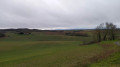
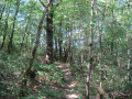
The route between Saint-Thomas and Empeaux is mainly on roads, winding through the valleys, with some stunning views of the Gers and the Pyrenees

Details

4447715
Creation:
Last update:
Last review:
  • Walking
    Activity: Walking
  • ↔
    Distance: 9.09 mi
  • ◔
    Average duration: 4h 45 
  • ▲
    Difficulty: Moderate

  • ⚐
    Back to start: Yes
  • ↗
    Ascent: + 617 ft
  • ↘
    Descent: - 623 ft

  • ▲
    Highest point: 1,047 ft
  • ▼
    Lowest point: 564 ft

Photos

Description of the walk

Park in the car park on the village square in Saint-Thomas.

(S/E) With your back to the town hall, leaving the D53 (Route de Sainte-Foy-de-Peyrolières) on your left, walk round the castle’s old moat towards Bragayrac. Continue straight on along the Chemin de Moulias, which becomes En Gachot after this hamlet. The road descends steadily towards the bed of the Ruisseau du Mésségué. Carry on to a Y-junction where the road ends.

(1) Take the hairpin bend to the right onto the road towards Le Perygué. The road climbs gently but steadily to another Y-junction with a cross in the middle.

(2) Take the road to Saint Lys on the right, pass the chapel and continue uphill. Pass the Lodge Le Perygué, where the road levels out slightly.

(3) Just past the hamlet of Le Saint-Martin, turn onto the dirt track on the left which descends to the bed of a small stream, then climbs again with a bend to the right at the top of the ascent. Just before the bend, the track becomes tarmac.

(4) Turn right onto the road that descends into the stream bed and continues to the road leading to the motor racing route. Turn right at the junction and head uphill to the roundabout with the D58.
Go through the roundabout and follow the Chemin de La Punto straight ahead until you reach a Y-junction.

(5) Take the track on the right (the other one opposite is a dead end) and head uphill until you join the D58G, the Bonrepos road. Follow it to the left until you reach thefirst farm on the right.

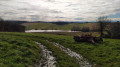
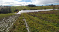
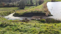
(6) Turn right, pass between the farm and its outbuilding, and head down towards the edge of the small wood. Follow the edge of the wood and take a sharp left-hand bend. Then head down the path, pass above the Aussonnelle, follow the embankment of the small lake and continue to the left, following the river until you reach the Bois de Nérat.

(7) Take the path on the right which climbs through the woods to the Roman road. When you reach the tarmac road, turn right until you reach the Marquise crossroads.

(8) Carry on to the right along the D19 Route d’Empeaux and follow this road to the next junction, taking in the view of the Pyrenees.

(9) When you reach the D58, turn left, pass the chapel on your left and carry on to the village square in Saint-Thomas (S/E).


Waypoints

  1. S/E : mi 0 - alt. 1,047 ft - Car park at the village square - Église Saint-Thomas (Saint-Thomas)
  2. 1 : mi 2.57 - alt. 564 ft - Signpost for Le Perygué. Near the - Boulouze (rivière)
  3. 2 : mi 3.6 - alt. 725 ft - Chapel
  4. 3 : mi 4.68 - alt. 827 ft - Dirt track leading to the motor racing route
  5. 4 : mi 5.15 - alt. 833 ft - T-junction
  6. 5 : mi 5.77 - alt. 945 ft - Fork in the road
  7. 6 : mi 6.38 - alt. 1,020 ft - Le Major Farm
  8. 7 : mi 6.89 - alt. 873 ft - Nérat Wood
  9. 8 : mi 7.2 - alt. 1,004 ft - La Marquise crossroads
  10. 9 : mi 8.35 - alt. 1,017 ft - Road from Empeaux to Saint-Thomas
  11. S/E : mi 9.09 - alt. 1,047 ft - Car park at the village square - Église Saint-Thomas (Saint-Thomas)

Notes

On Place de Saint-Thomas, near the boules club, there is a drinking water tap; a little further down, by Lac de Saint-Thomas, there is a picnic area.

Worth a visit

On the descent from the village centre, there’s a superb view of the Pyrenees.
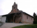
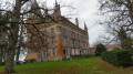
On the slight incline after the climb, near the ‘Le Perygué’ lodge, there is a superb view of the Gers countryside, the church of Saint-Thomas and Empeaux Castle.
On the dirt track between (6) and (7), you can see, on the left, the Empeaux dirt-track route
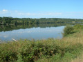
(7) On the descent, there’s a lovely view of the reservoir on the Aussonnelle, which forms a small lake.

Reviews and comments

4.3 / 5
Based on 3 reviews

Reliability of the description
4.3 / 5
Ease of following the route
4.7 / 5
Route interest
4 / 5
AJT-31
AJT-31

Thank you very much for that encouraging message.
We were there on Saturday morning and the conditions were almost perfect

Machine-translated

VincentLafon
VincentLafon

Overall rating : 4.3 / 5

Date of your route : Dec 18, 2023
Reliability of the description : ★★★★☆ Good
Ease of following the route : ★★★★★ Very good
Route interest : ★★★★☆ Good
Very busy route : No

Around 80 per cent of the walk is along a small, quiet tarmac track, which is ideal after several days of rain. The views of the Pyrenees and the rolling countryside are lovely. Well done to the route planner.

Machine-translated

grandin
grandin ★

AJT-31

"Walk in Fontenilles" rather than "Match in Fontenilles"

Machine-translated

AJT-31
AJT-31

Hello,
Thank you for taking the time to leave a review – a very positive one for me.
You can visit our Facebook page, Matche à Fontenilles, to find out more about us and perhaps come and walk with us

Machine-translated

JOADIE
JOADIE

Overall rating : 4 / 5

Date of your route : Feb 02, 2021
Reliability of the description : ★★★★☆ Good
Ease of following the route : ★★★★☆ Good
Route interest : ★★★★☆ Good
Very busy route : No

The perfect route for this time of year. Quiet country lanes and lovely views of the snow-capped Pyrenees. Just as described. Thank you for these suggested routes with recent reviews.

Machine-translated

AJT-31
AJT-31

Hello,
Glad to hear you enjoyed the walk
We’ll be doing it again this Sunday with the group
You can check out our Facebook page, Matche à Fontenilles, to find out more about us and perhaps come and walk with us

Machine-translated

pedro75
pedro75

Overall rating : 4.7 / 5

Date of your route : Jan 10, 2021
Reliability of the description : ★★★★★ Very good
Ease of following the route : ★★★★★ Very good
Route interest : ★★★★☆ Good
Very busy route : No

The sun didn’t make an appearance, so no view of the Pyrenees on the horizon – apart from that, it was fine

Machine-translated

Other walks in the area

For more walks, use our search engine .

The GPS track and description are the property of this route's author. Please do not copy them without permission.