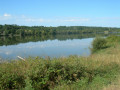
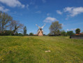
Around the lake by the stadium in Sainte-Foy-de-Peyrolières

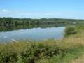
Starting from the Sainte-Foy stadium, the route takes you round the lake and along a section of theGR®86.

Details

4376317
Creation:
Last update:
Last review:
  • Walking
    Activity: Walking
  • ↔
    Distance: 6.41 mi
  • ◔
    Average duration: 3h 10 
  • ▲
    Difficulty: Moderate

  • ⚐
    Back to start: Yes
  • ↗
    Ascent: + 276 ft
  • ↘
    Descent: - 269 ft

  • ▲
    Highest point: 1,010 ft
  • ▼
    Lowest point: 755 ft

Photos

Description of the walk

Park in the car park at the Sainte-Foy-de-Peyrolières stadium.

(S/E) Turn your back on the changing rooms and take the path running alongside the tennis courts to the path leading to the lake.

(1) Turn left as you leave the stadium onto the path leading to the lake, which forms part of theGR® 86.

(2) Carry straight on, leaving the path on your left which you will take on the return journey. Walk the full length of the lake, then follow the course of the Ruisseau de la Galage, which feeds into it.

(3) At the signposts, carry on straight ahead, leaving the path on your left – you’ll take this one on the way back too.

(4) After a short while, pass through a residential area where the track gives way to a tarmac road, then returns to a track until you reach the start of the ranch’s premises.

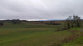
(5) Ignore the track on the left leading to the ranch, and head up towards the road from Saint-Thomas to Sainte-Foy. You’ll reach a junction offering a stunning view of the surrounding countryside, stretching as far as the Pyrenees.

(6) Leave the track that continues towards the road and take the path on the left to head down towards the ranch.

(7) After passing through the middle of the ranch, rejoin theGR® and turn left onto it.

(5) Turn right and follow the path you took on the way there until you reach the signposts.

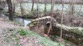
(3) Leave theGR® and turn right to walk round the lake. Cross the small wooden bridge over the stream and head uphill until you reach the tarmac road.

(8) Turn left onto the road heading towards the centre of Sainte-Foy.

(9) At the start of the climb, leave the road and take the path on the left which follows the lake shore.

(10) Leave the track leading towards the road to the stadium and follow the path on the left which runs along the top of the embankment.

(2) At the end of the embankment, turn right, rejoining theGR® and the path you took on the way there.

(1) Do not go all the way to the road; instead, take the path on the right a few metres before it, passing behind the tennis courts to reach the car park (A/D).


Waypoints

  1. S/E : mi 0 - alt. 755 ft - Sainte-Foy-de-Peyrolières Stadium near the - Ayguebelle (cours d'eau) - Affluent du Ruisseau de Goudourg
  2. 1 : mi 0.08 - alt. 768 ft - Lake Path
  3. 2 : mi 0.38 - alt. 794 ft - North-eastern tip of the lake
  4. 3 : mi 1.29 - alt. 801 ft - Signposts
  5. 4 : mi 1.91 - alt. 830 ft - Residential area
  6. 5 : mi 2.59 - alt. 889 ft - Junction
  7. 6 : mi 2.9 - alt. 1,007 ft - Viewpoint, turn left
  8. 7 : mi 3.3 - alt. 883 ft - Junction °°GR®°°
  9. 8 : mi 4.94 - alt. 840 ft - Junction °°GR®°°
  10. 9 : mi 5.3 - alt. 814 ft - Left-bank path
  11. 10 : mi 5.85 - alt. 794 ft - Lake embankment
  12. S/E : mi 6.41 - alt. 761 ft - Car park at the Sainte-Foy-de-Peyrolières stadium

Notes

There are no water points along the route, but you can buy a drink at the ranch bar.

Worth a visit

(7) This is the highest point on the route and the view of the surrounding area is superb; you may even be able to see the Pyrenees.

(10) When you’re on the embankment, there’s a lovely panoramic view of the lake, the stadium and the village.

Always be cautious and plan ahead when you're outdoors. Visorando and the author of this route cannot be held responsible for any accidents occurring on this route.

The GR® and PR® markings are the intellectual property of the Fédération Française de Randonnée Pédestre.

Reviews and comments

4.5 / 5
Based on 2 reviews

Reliability of the description
4.5 / 5
Ease of following the route
4.5 / 5
Route interest
4.5 / 5
AJT-31
AJT-31

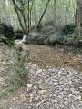
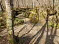
It’s true that the paths are muddy at this time of year, but the routes around the lakes at Sainte-Foy feature a mix of surfaces and always offer lovely views. Thank you for your feedback, and I’d recommend you try the Lac de la Parayre route in the same town, which is very much in the same vein.

Machine-translated

bardoumagniez
bardoumagniez

Overall rating : 4.3 / 5

Date of your route : Jan 23, 2024
Reliability of the description : ★★★★☆ Good
Ease of following the route : ★★★★☆ Good
Route interest : ★★★★★ Very good
Very busy route : No

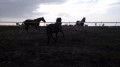
The paths were quite muddy in places, but that’s nothing out of the ordinary in January… A very pleasant walk through meadows with horses (stud farm), offering magnificent views of the Pyrenees (picnic between markers 6 and 7), along a small tarmac road with very few vehicles. The route description was accurate. In short, nearly 3 hours of brilliant walking!

Machine-translated

AJT-31
AJT-31

Thanks for that lovely comment

Machine-translated

mariepaule47200
mariepaule47200

Overall rating : 4.7 / 5

Date of your route : Mar 09, 2023
Reliability of the description : ★★★★★ Very good
Ease of following the route : ★★★★★ Very good
Route interest : ★★★★☆ Good
Very busy route : No

A pleasant walk. Very little tarmac. A lovely view above the riding centre.
At point 6, the GPX track heads diagonally into a large fenced-off field for horses. We crossed it as there were no horses there. But it’s certainly better to go round it at the top, following the fence.
Thank you for suggesting this walk.

Machine-translated

Other walks in the area

For more walks, use our search engine .

The GPS track and description are the property of this route's author. Please do not copy them without permission.