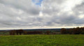
The Gascon Hills between Fontenilles and Bonrepos

The Gascon Hills route, starting from the Fontenilles sports ground and heading towards the Roman road at Bonrepos through a succession of valleys

Details

4345375
Creation:
Last update:
Last review:
  • Walking
    Activity: Walking
  • ↔
    Distance: 8.97 mi
  • ◔
    Average duration: 4h 35 
  • ▲
    Difficulty: Moderate

  • ⚐
    Back to start: Yes
  • ↗
    Ascent: + 571 ft
  • ↘
    Descent: - 558 ft

  • ▲
    Highest point: 968 ft
  • ▼
    Lowest point: 669 ft

Photos

Description of the walk

Park in the car park at the Plaine des Sports de Fontenilles, next to the sports centre.

(S/E) With your back to the sports centre, take the path running alongside the rugby pitch and then past the indoor tennis courts. After the tennis courts, take the path on the right between the sports ground and the Magnolias housing estate.

(1) Shortly after the end of the fence surrounding the sports grounds, take the footpath on the left, cross the Clos des Alisiers roundabout and continue along the footpath until you reach Avenue des Magnolias; cross it , taking care of cars, and continue along the footpath on the left towards the Étang de Lespèche.

(2) At the roundabout, turn left and follow the path along the edge of the lake – either on the left or the right – and head straight ahead to take the connecting path leading to the Chemin du Garrousset. Turn left and head due south.

(3) You’ll come out onto a road; follow it to the right along theGR®86(red and white markings). Carry on straight ahead (west) to Mondou.

(4) Follow theGR®86to the left and head down into the village, using the footpath on the right and then on the left-hand side of the road. Cross the D12 at the pedestrian crossing and continue to follow theGR® until you reach the bridge over the Ruisseau du Bosc.

(5) Just before the bridge, take the path on the left running alongside the stream. Cross via the footbridge at the end of the path, on the right, to enter the municipal park. Walk round the park either to the right or to the left and, on leaving, take the footpath on the left which passes in front of the sports hall. Cross the D62 Rue de l’Aussonnelle at the pedestrian crossing and continue to the left along the footpath.

(6) At the junction, take thefirst road on the right, Chemin de la Goutte, and carry on until the road bends.

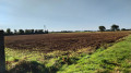
(7) Before the last house and the end of the road, take the path on the left which climbs alongside the field and then through the woods after a 90° bend. When the woods bend, take the wooded path on the left which leads into the woods and climb up to the Roman road.

(8) Turn right and continue along theGR®86, which follows the Roman road, until you reach the first clearing on the right.

(9) Before the clearing, turn right onto the wide, unwooded path that descends towards L’Aussonnelle. Ford the river and continue straight ahead. At the T-junction, turn right.

(10) Take thesecond path on the left, which goes uphill. You’ll come out onto a road; first turn left then right to go round the Embarro-Coucut farm on the left. Then continue along the path that descends towards the Chemin de Goujon.

(11) When you reach the road, turn right and carry on straight ahead to the village centre.

(12) Just before the church, turn left onto Rue du Guigneriou and continue along the footpath.

(5) After the stream, carry on along the path in the opposite direction to the outward journey. Take care when crossing the Saint-Lys road. Carry on to the junction you passed on the outward journey.

(4) Leave theGR® 86 and take the steep path opposite, heading due north. The tarmac gives way to earth and embankments made of bricks and crushed tiles.

(13) At the top of the slight incline, take the path on the right which runs alongside the sheep farm. This is the border between the Gers and Haute-Garonne departments; follow it until you reach the entrance to the path through the Bois des Magnolias. Initially, the path climbs, then descends, and follows the edge of the woodland.

(14) Once in the woods, follow the path which stays close to the edge and comes out opposite the southern end of the Magnolias residential complex.

(15) Take the path on the left which goes round the estate and follow it to the stadium car park (S/E).

Waypoints

  1. S/E : mi 0 - alt. 673 ft - Car park at the Fontenilles sports ground
  2. 1 : mi 0.5 - alt. 676 ft - Footpath
  3. 2 : mi 0.73 - alt. 682 ft - Lespèche Pond
  4. 3 : mi 1.12 - alt. 682 ft - Route – GR86
  5. 4 : mi 2.07 - alt. 725 ft - Junction of the Fontenilles circular loop
  6. 5 : mi 2.38 - alt. 709 ft - Junction of the Bonrepos circular loop
  7. 6 : mi 2.79 - alt. 719 ft - Crossroads after the - Aussonnelle (rivière)
  8. 7 : mi 3.29 - alt. 758 ft - Lagoute
  9. 8 : mi 3.8 - alt. 968 ft - Roman road
  10. 9 : mi 4.42 - alt. 958 ft - Clearing – Descent towards L’Aussonnelle
  11. 10 : mi 5.06 - alt. 801 ft - Junction
  12. 11 : mi 5.53 - alt. 768 ft - Chemin de Goujon towards the village centre
  13. 12 : mi 6.45 - alt. 719 ft - Église Notre-Dame-de-la-Nativité (Bonrepos-sur-Aussonnelle)
  14. 13 : mi 7.21 - alt. 866 ft - Entrance to the sheep farm
  15. 14 : mi 7.56 - alt. 866 ft - Entrance to the woods
  16. 15 : mi 8.09 - alt. 705 ft - Path running alongside the magnolias
  17. S/E : mi 8.97 - alt. 673 ft - Car park at the Fontenilles sports ground

Notes

Next to Bonrepos Town Hall, there is a fountain with a tap providing drinking water.

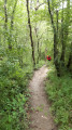
The ascents and descents through the woods can be muddy and therefore slippery; make sure you wear suitable footwear; walking poles may be helpful on these sections of the route.

To make the most of the magnificent views, a pair of binoculars will come in handy.

Worth a visit

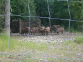
At the start of the route, on Chemin Garrousset, don’t miss the agroforestry area next to the sheep farm.
In Bonrepos’s local park, you can have a picnic, play table tennis and relax.

The dovecote at the park’s exit has been reconstructed; whilst not the original, it is modelled on those traditionally found in the region.

In front of the town hall, there is a former weighing station, and you can admire some trompe-l’œil paintings in the surrounding area.

The village of Bonrepos was the site of fighting by the Resistance during the Second World War. There is a memorial at the entrance to the village on the Saint-Lys side, and several commemorative plaques at the sites where the fighting took place.

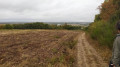
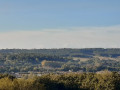
On the climb, just past the sheep farm, there is a view of the Haute-Garonne, Saint-Lys (water tower, church), Bonrepos and the Pyrenees.

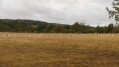
At the highest point of the route, you can admire the view of the Gers with the Lias radar station (blue sphere) and the Chaü mill next to the radio tower, as well as the view of Fontenilles and the sports ground.

Roman Road, halfway between [location] and [location] (9).

Always be cautious and plan ahead when you're outdoors. Visorando and the author of this route cannot be held responsible for any accidents occurring on this route.

The GR® and PR® markings are the intellectual property of the Fédération Française de Randonnée Pédestre.

Reviews and comments

4.7 / 5
Based on 2 reviews

Reliability of the description
5 / 5
Ease of following the route
4.5 / 5
Route interest
4.5 / 5
geneviève crokaert
geneviève crokaert

Overall rating : 5 / 5

Date of your route : Oct 05, 2024
Reliability of the description : ★★★★★ Very good
Ease of following the route : ★★★★★ Very good
Route interest : ★★★★★ Very good
Very busy route : No

I extended this walk to include part of the “Walk around the Aussonnelle” (from point 4 to point 10).
20 km and 380 m of elevation gain. Picnic by the Aussonnelle reservoir (above point 6).

Machine-translated

annemarie31
annemarie31

Overall rating : 4.3 / 5

Date of your route : Mar 20, 2021
Reliability of the description : ★★★★★ Very good
Ease of following the route : ★★★★☆ Good
Route interest : ★★★★☆ Good
Very busy route : Yes

A lovely little walk on the outskirts of Fontenilles, even if it is a bit urban.

Machine-translated

Other walks in the area

For more walks, use our search engine .

The GPS track and description are the property of this route's author. Please do not copy them without permission.