


Refine your search for walks in Augerolles
Augerolles walks
 Dore Valley: Saint-Just Chapel and Meymont Bridge
 Visorando Member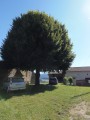
 7.38 mi
 +1,063 ft
 -1,083 ft
 4h 20
4h 20
 Moderate
 Departure from Tours-sur-Meymont (Puy-de-Dôme)
A hike in the heart of nature to discover a place steeped in history in the Dore river valley, on the borders of the Pays de Courpière, Cunlhat and Olliergues, in the heart of the Livradois-Forez Regional Nature Park.
Part of the route follows "the old path", the ancient medieval road that linked Meymont to Cunlhat via Tours Sur Meymont through Alligier, Les Gouttes, etc.
Les Quatre Vents - Olliergues
 Association / Club / Walk leader
 12.49 mi
+1,906 ft
-2,005 ft
7h 25
12.49 mi
+1,906 ft
-2,005 ft
7h 25
 Difficult
Departure from Courpière (Puy-de-Dôme)
Difficult
Departure from Courpière (Puy-de-Dôme)
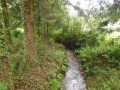
For the second stage of the route, we reach the right bank of Lake Aubusson, and after crossing the dam we follow aPR® path that climbs gently to take us to the village of Augerolles. We pass by the Pied de Bœuf site and reach the village of Olmet. We pass the Chamaly cross and descend gently towards the Dore valley to reach Olliergues town hall via a stepped street (Rue des Cors).
Around the Ruisseau de la Faye
 5.54 mi
+663 ft
-656 ft
3h 05
5.54 mi
+663 ft
-656 ft
3h 05
 Easy
Departure from Le Brugeron (Puy-de-Dôme)
Easy
Departure from Le Brugeron (Puy-de-Dôme)
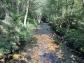
A pleasant walk in summer thanks to the cool, refreshing air. The stream is well-known to anglers, and the lucky few may even find some chanterelle mushrooms to pick. This is the realm of wild boar and roe deer…You’ll pass through old villages such as La Terrasse (with a very old house on the right), which was very important in the early 20th century. A victim of rural depopulation, Montolas is now nothing but ruins!
Olliergues – La Renaudie
11.84 mi
+2,933 ft
-1,230 ft
8h 00
Difficult
Departure from Olliergues (Puy-de-Dôme)
Starting from Olliergues town hall, we head uphill along the cobbled path. Most of this third stage follows the white and green-marked ‘Tour de Pays’ trail as far as Le Brugeron. From Le Brugeron, head towards Le Grun de Batailler, passing the Begue mill (waterfall). Cross Le Clef. At La Croix de Sainte-Agathe, take a small road, pass through the hamlet of Rochefolle to reach the village of La Renaudie, where you’ll find the communal lodge.
La Renaudie – Sainte-Agathe
12.96 mi
+1,673 ft
-2,661 ft
7h 25
Difficult
Departure from La Renaudie (Puy-de-Dôme)
This fourth stage of the route is the longest and most challenging. We will often be walking at high altitudes (highest point: 1,153 m). We will follow the River Couzon before descending along good paths through the woodland towards Vollore-Montagne. The walk through the Ayguebonne Forest, near the Grun de Chignore, will take us to Sainte-Agathe.
In the footsteps of the Hospitallers in Courtesserre
 6.17 mi
+371 ft
-374 ft
3h 10
Moderate
Departure from Courpière (Puy-de-Dôme)
6.17 mi
+371 ft
-374 ft
3h 10
Moderate
Departure from Courpière (Puy-de-Dôme)
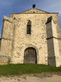
Today, the only remains still visible of the presence of the Knights Hospitaller of Saint John of Jerusalem, who were here from the Middle Ages until the French Revolution of 1789, are scattered: a deconsecrated church, a stone coat of arms serving as a base for a wayside cross, a round tower fitted with a gun port in a former fortified house, a chapel converted into a dwelling, and a few carved stones on the edge of a communal plot. Nothing suggested that the former parish of Courtesserre, which was merged with that of Courpière during the Revolution, would be home to a ‘chief’ commandery in a sparsely populated region described as infertile, far from any town, major transport route or path leading to a place of pilgrimage.
 Tour du Teilhet
4.14 mi
+853 ft
-827 ft
1.5 hrs
Easy
Departure from Marat (Puy-de-Dôme)
If you’re on holiday in Marat, here’s a short route for a walk or a horse ride starting from La Ramie.
The Gérize Stream as seen from Marat
6.73 mi
+981 ft
-981 ft
3h 55
Moderate
Departure from Marat (Puy-de-Dôme)
This walk takes you to the Ruisseau de Gérize from the village of Marat, taking in several hamlets within the municipality.
The Chestnut Circular in Marat
4.91 mi
+636 ft
-636 ft
2h 50
Easy
Departure from Marat (Puy-de-Dôme)
Chestnut walking trail in Marat.
Lit de la Vierge - Pas de la Vierge
 2.31 mi
+489 ft
-489 ft
1h 30
Moderate
Departure from Noirétable (Loire)
2.31 mi
+489 ft
-489 ft
1h 30
Moderate
Departure from Noirétable (Loire)
A pleasant, mostly shaded walk leading to a magnificent panorama from the summit (granite chaos at an altitude of 1,260 metres).
Walk around Grun de Côte
 2.61 mi
+358 ft
-354 ft
1h 30
Easy
Departure from Trézioux (Puy-de-Dôme)
2.61 mi
+358 ft
-354 ft
1h 30
Easy
Departure from Trézioux (Puy-de-Dôme)
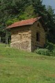
A short walk through woods and green pastures with beautiful views of the Château de Mauzun and the Monts du Forez.
From Trézioux to Neuville
 4.48 mi
+463 ft
-476 ft
2h 30
Moderate
Departure from Trézioux (Puy-de-Dôme)
4.48 mi
+463 ft
-476 ft
2h 30
Moderate
Departure from Trézioux (Puy-de-Dôme)
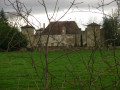
Walk in the Livradois plains, around "Trézioux - Neuville". During this walk, you can enjoy views of Mauzun Castle, the Monts du Forez and, finally, the Chaîne des Puys.
Balade à partir de Bertignat
6.38 mi
+863 ft
-863 ft
3h 40
Moderate
Departure from Bertignat (Puy-de-Dôme)
Circular starting from the village of Bertignat. Along the way, you will see the Virgin of Puybayou and then a beautiful view of the commune of La Chapelle-Agnon.
The Fossat valley and Pierre-sur-Haute from the Col du Béal
 10.13 mi
+1,785 ft
-1,781 ft
6h 15
Moderate
Departure from Saint-Pierre-la-Bourlhonne (Puy-de-Dôme)
10.13 mi
+1,785 ft
-1,781 ft
6h 15
Moderate
Departure from Saint-Pierre-la-Bourlhonne (Puy-de-Dôme)
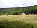
A beautiful circular walk starting from the Fossat valley.
From the Col du Béal to the Col des Supeyres
 17.18 mi
+1,936 ft
-2,024 ft
6 hrs
Moderate
Departure from Saint-Pierre-la-Bourlhonne (Puy-de-Dôme)
17.18 mi
+1,936 ft
-2,024 ft
6 hrs
Moderate
Departure from Saint-Pierre-la-Bourlhonne (Puy-de-Dôme)
Over two days, discover one of the most beautiful destinations in “France à Cheval”.
 From the Col du Béal to Pierre sur Haute
10.32 mi
+1,696 ft
-1,696 ft
6 hrs
Difficult
Departure from Saint-Pierre-la-Bourlhonne (Puy-de-Dôme)
On snowshoes or on foot, from the Col du Béal to the summit of Pierre-sur-Haute through the forest. Return via the ridges, still on theGR®3or a variant thereof.
Col du Béal – Col des Supeyres
 10.70 mi
+1,503 ft
-1,591 ft
6h 15
Moderate
Departure from Saint-Pierre-la-Bourlhonne (Puy-de-Dôme)
10.70 mi
+1,503 ft
-1,591 ft
6h 15
Moderate
Departure from Saint-Pierre-la-Bourlhonne (Puy-de-Dôme)
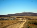
Stage 2: the most beautiful stage of the route. Spectacular, with heathland stretching as far as the eye can see, a boundless 360° view where stunted pines bend under the “burle”. Photos, scents – set aside the whole day.
GR®3route, partly well signposted.
Circular route across the Hautes Chaumes from the Col du Béal
8.71 mi
+1,506 ft
-1,516 ft
5h 20
Moderate
Departure from Chalmazel (Loire)
A circular walk starting from the Col du Béal. The route takes you via Peyre Mayou, the Refuge de la Roche, the Rochers de la Chapelle, Pierre sur Haute and then the burons de la Richarde. The return route is via the Rocher de la Chaize.
The Altar of the Barony and the Gilbernie Oak Tree
5.79 mi
+597 ft
-571 ft
3h 10
Easy
Departure from Noirétable (Loire)
An easy walk through fields and woods to discover a beautiful rock formation, the Autel de la Baronnie, with its wobbly stone, armchairs and potholes, followed by a large majestic oak tree at the Ferme de la Gilbernie.
The chestnut tree of La Bitortie
6.50 mi
+801 ft
-778 ft
3h 40
Moderate
Departure from Noirétable (Loire)
A walk in the Netrablaise countryside, across fields, from hamlet to hamlet, to discover an old and majestic chestnut tree.
Noirétable Lake and Puy de Rot
 4.64 mi
+472 ft
-476 ft
2h 35
Easy
Departure from Noirétable (Loire)
4.64 mi
+472 ft
-476 ft
2h 35
Easy
Departure from Noirétable (Loire)
A gentle hike to start your holiday in the Forez mountains.
The Path of Saint Agatha
60.70 mi
+10,633 ft
-10,335 ft
5 days
Difficult
Departure from Thiers (Puy-de-Dôme)
The route (a circular route) passes through the following villages: Thiers, Vollore-Ville, Augerolles, Olmet, Olliergues, Marat, Le Brugeron, La Renaudie, Vollore-Montagne, La Chambonie, and Sainte-Agathe. It passes through the municipalities of Escoutoux, Aubusson, Saint-Pierre-la-Bourlhonne and Celles-sur-Durolle.
The legend of Saint Agathe will inspire walkers along the route, much like other well-known trails (the Way of St James, the Stevenson Trail, etc.)
Thiers - Les Quatre Vents
11.38 mi
+1,998 ft
-1,526 ft
7h 00
Difficult
Departure from Thiers (Puy-de-Dôme)
This first stage of the Chemin de Sainte-Agathe gives us the opportunity to take different PR®® trails. We pass through charming little hamlets: Lamouroux, Sardier, Grand Cognet, Laurençon and cross a few streams. Beautiful trees line the route, as well as numerous views of the Chaîne des Puys.From the village of Vollore-Ville, passing close to the castle, we descend towards the plain and reach the Gîte des Quatre Vents via the hamlet of Sauvetat.
The fortress of the cutlers
3.47 mi
+715 ft
-689 ft
2h 15
Easy
Departure from Thiers (Puy-de-Dôme)
Thiers is a city of challenges. In this grandiose and isolated location in the heart of Auvergne, the inhabitants of Thiers have had to contend with a turbulent river, the Durolle, and the steep slopes of its gorges. Over time, thanks to numerous developments, this partially tamed river has ensured the industrial prosperity of the town, which is known as the cutlery capital of France.
The Valley of the Waterwheels in Thiers
 1.40 mi
+400 ft
-417 ft
1h 00
Easy
Departure from Thiers (Puy-de-Dôme)
1.40 mi
+400 ft
-417 ft
1h 00
Easy
Departure from Thiers (Puy-de-Dôme)
A trail themed around cutlery. As you follow the Durolle, you’ll step back in time as you discover the waterwheels, a type of mill powered by the river’s flow. They reveal the valley’s rich industrial past. The arrival of electrification in the 20th century eventually brought an end to these waterwheels.
In the Livradois hills in Auzelles
6.69 mi
+899 ft
-922 ft
3h 50
Moderate
Departure from Auzelles (Puy-de-Dôme)
Circular route passing through the Bois de la Frissonnette, then through meadows with unobstructed views, passing through the pretty hamlet of La Prulhière and running alongside the Miodet at the end of the route.