Country:

 City:
City:


Starting point in Marat: the car park by the town hall and the village hall. It is situated behind the town hall and is accessible via a small street leading onto the main street, 50 metres above the town hall (signposted).
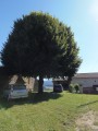
(S/E) Head towards the main street, turn right onto it and follow it as far as the church. Take the narrow passage between the church and the restaurant, then turn right onto the street until you reach a path leading down to the left.
(1) Turn left, then right, and cross the wetland (part of the route follows a wooden walkway), then take the road on the right which climbs towards Chantegrel.
(2) At the three-way junction, take the wide path on the left; it leads onto a small road.
(3) Turn left onto it, take the first path on the right, then immediately thefirst path on the left, and continue until you reach another road.
(4) Turn left onto it, then, after passing through the hamlet of Biot, take the track on the right to Repote (a small disused factory).
(5) Cross the footbridge over the Ruisseau de Gérize, then turn right twice straight away and follow the path which climbs behind the disused building to reach a crossroads.
(6) Follow the path on the right which passes beneath the Mayet estate, then continue straight on to the Ruisseau de Gérize and cross it (footbridge).
(7) Continue along the path which veers to the left towards La Sauvedie.
(8) Before leaving the hamlet of La Sauvedie, take the path on the left, then ignore the path leading uphill to the right until you reach a crossroads.
(9) Take the path leading uphill to the right, then, once you reach the top of the hill, head down the path opposite towards Fougère.
(10) In Fougère, turn right, then left to see the stone troughs.
(11) Turn round to return to the crossroads.
(10) Stay on the tarmac road that branches off to the right until you reach a three-way junction.
(12) Turn right, walk through the hamlet and continue along the path. At the next crossroads, take the road opposite, then take the first road on the left to cross through Darnapesse. Continue along the path opposite, which descends towards the Ruisseau de la Badoche. Cross the stream and walk back up the opposite side to a crossroads.
(13) Turn right. At the first houses in Marat, take the street on the right, then turn left to join the main road and reach the car park by continuing straight ahead (S/E).

 Visorando Member
 Easy
Easy 
 Association / Club / Walk leader
 Difficult