Country:

 City:



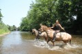
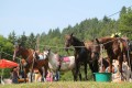
Starting from Lasdonas Park, on the banks of the Dore, in Courpière.
(S/E) Take the path through the park that runs alongside the old ramparts.
You’ll reach the junction of the D58 (Avenue Fleming) and the D304, known as the ‘Route des Fraises’.
(1) Follow this road to the left along the verge for 2 km until you reach Layat, then take the path on the left leading to the mill on the banks of the River Dore.
Continue along the path for 4 km, which runs alongside the River Dore on its left bank.
(2) Below Le Sangle, after a tricky section (with rocks), take the steep path uphill to the right, which leads down to the village.
Turn left onto the path that descends into the forest and leads you to the bridge at the Sauviat Dam (known as the Pont du Moulin Chalus).
(3) Leave the bridge on your left and turn right onto the tarmac road D304a. After a 700-metre climb, turn left onto the path that runs alongside the Miodet reservoir (Sauviat Dam) and continue along it until you reach the Moulin Neuf refreshment point, where you will rejoin the D304 ‘Route des Fraises’.
Follow the D304 on your left, cross the bridge over the Miodet, and carry on for 50 metres.
(4) Turn left, then immediately right onto the dirt track after the buildings of the old mill. Head back up to the village of Les Sittes. In the village, turn right and head down towards the south to rejoin the D304. Head straight ahead and climb westwards to Le Rochadet, which you’ll leave on your left. Continue along the tarmac road which descends and joins the Palles stream. After crossing a small bridge, walk uphill for 50 metres and take the path opposite which descends to the Miodet Gorges.
Follow the path that runs along the right bank of the stream and head up towards Les Giries.
(5) At the crossroads, turn right and head down to the Miodet ford (see photo), which you’ll come to after crossing a small coniferous woodland on a flat stretch of ground. Do not take the old path on the right leading to the Pradat mill.
After the ford, follow the path which winds its way along the left bank of the Miodet, overlooking the stream. You will arrive at Pradeau, then at Pontlatout.
(6) Cross the D58 ‘Route des Carrières’, which leads to Courpière. Head back up to Les Combes; you’ll be overlooking the D58, which you’ll cross below Cublas, after the house at La Combe.
Head east along the path leading to the Croix de Fer on the Chemin de Pintrand.
Continue north-east; you’ll pass beneath Le Clos.
(7) At the entrance to the village, take the path opposite which leads back down to the “Route des Fraises” (D304). Just before reaching the D304, turn left, heading due north, onto the path leading up to La Chassagne. Cross the village and join the D303.
Continue to the right along the verge until you reach the Croix du Sangle.
(8) At the crossroads, turn left, heading north-west, and head down to the Moulin de Layat stream. You’ll rejoin the D58 “Route des Carrières” and, opposite, take the path leading up to the Château. Walk through the village and turn right onto the tarmac road heading due north, which passes in front of the electricity substation.
(9) At the next crossroads, turn right onto the path leading down to La Côte. Before the goat farm, turn left onto the winding path that descends to Fayon.
(10) After Fayon, head back up to the left and take the first path on the right which passes through Puy Fourchy and leads to the Institut Saint-Pierre (ISP). Head down to the right towards the D304 and rejoin the original route.
(1) Continue straight on along the same route to go round the village, to the east and past the old ramparts. You will arrive at Lasdonas Park (S/E)

 Visorando Member
 Easy