


Refine your search for walks in Argent-sur-Sauldre
Argent-sur-Sauldre walks


 Sauldre Canal and Étang du Puits tower
 Visorando Member
 10.02 mi
 +52 ft
 -52 ft
 4h 40
4h 40
 Moderate
 Departure from Argent-sur-Sauldre (Cher)
This beautiful circular walk begins along the Canal de la Sauldre, with its locks, small bridges and weirs. It then enters the forest, along long paths lined with ponds, and ends with an almost complete tour of the Étang du Puits, via Cerdon beach, the pretty path that winds between the trees along a small disused railway line, the crossing of the Bois aux Moines and, finally, the path that runs alongside the Canal and the beach at Argent-sur-Sauldre.
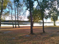
Circular Étang du Puits route via the Chemin des Prêtres and the Pointe des Anglais
 8.02 mi
+20 ft
-20 ft
3h 40
Moderate
Departure from Cerdon (Loiret) (Loiret)
8.02 mi
+20 ft
-20 ft
3h 40
Moderate
Departure from Cerdon (Loiret) (Loiret)
Whether on your own or with friends, this circular walk will delight you with its variety. Its shaded paths make it very pleasant in summer. Its short length will leave you time to stroll along the beaches of Étang du Puits or the banks of the Canal de la Sauldre.
Blancafort Water Tower Circular Route
 9.88 mi
+167 ft
-174 ft
4h 40
Moderate
Departure from Cher
9.88 mi
+167 ft
-174 ft
4h 40
Moderate
Departure from Cher
A very lovely route through the countryside of the Pays Fort. Sunken lanes, forests and ponds give it its charm.
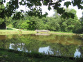
The Sauldre Canal in Blancafort: Blue route with variant
 Association / Club / Walk leader
 6.16 mi
+115 ft
-112 ft
2h 55
6.16 mi
+115 ft
-112 ft
2h 55
 Easy
Departure from Cher
Easy
Departure from Cher
An easy route, with a variant, open to pedestrians, cyclists and horse riders.
The Blue Route is rich in heritage that characterises Blancafort: the canal, the river, the old marl pits and the paths rehabilitated for the enjoyment of walkers by the Blancafort et Patrimoine Association.
Five other trails are suggested on the sign at the wash house (canal bridge, Euro monument).
From La Gravotte to Le Beuvron
 10.34 mi
+66 ft
-66 ft
4h 50
Moderate
Departure from Cerdon (Loiret) (Loiret)
10.34 mi
+66 ft
-66 ft
4h 50
Moderate
Departure from Cerdon (Loiret) (Loiret)
The wide-open spaces of Sologne offer a spectacle rich in woodland and scenic beauty. Orchids, carp leaping from the surface of a pond to snatch a flying insect, roe deer caught unawares at a bend in the path, not to mention ducks and their young – this is Sologne at its most bountiful.
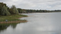
Circular walk around the Étang du Puits, starting from Cerdon
 9.21 mi
+72 ft
-72 ft
4h 20
Moderate
Departure from Cerdon (Loiret) (Loiret)
9.21 mi
+72 ft
-72 ft
4h 20
Moderate
Departure from Cerdon (Loiret) (Loiret)
The walk offers the chance to explore unspoilt countryside, much loved by those who adore the Sologne region, mainly through woodland. The Étang du Puits, with its water sports facilities, makes for a refreshing stop.
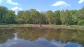
The Borne des Quatre Paroisses circular route from Cerdon-du-Loiret
 11.09 mi
+98 ft
-102 ft
5h 10
Moderate
Departure from Cerdon (Loiret) (Loiret)
11.09 mi
+98 ft
-102 ft
5h 10
Moderate
Departure from Cerdon (Loiret) (Loiret)
A very pretty circular route on the border between Cher and Loiret. Its long paths will take you to the Borne des Quatre Paroisses, the meeting point of the communes of Cerdon-du-Loiret, Brinon-sur-Sauldre, Villemurlin and Isdes. The walk through the forest on the border between Loiret and Cher is worth the detour alone.
Raboliot route from Brinon-sur-Sauldre
 10.30 mi
+131 ft
-98 ft
4h 50
Moderate
Departure from Brinon-sur-Sauldre (Cher)
10.30 mi
+131 ft
-98 ft
4h 50
Moderate
Departure from Brinon-sur-Sauldre (Cher)
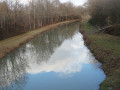
Set in the heart of the ‘Sologne des étangs’, this walk offers the chance to explore deciduous and coniferous forests, as well as the magnificent Sauldre Canal – a remnant of the major development works carried out in this province, which had long been neglected and only began to develop during the Second Empire.
The Sauldre Canal from Brinon-sur-Sauldre
 11.85 mi
+69 ft
-69 ft
5h 30
Moderate
Departure from Brinon-sur-Sauldre (Cher)
11.85 mi
+69 ft
-69 ft
5h 30
Moderate
Departure from Brinon-sur-Sauldre (Cher)
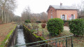
A journey back in time to when, during the Second Empire, the Sologne region emerged from poverty thanks to the canals designed to transport marl—a natural mixture of limestone and clay—to fertilise its land. The route follows the towpath of the Sauldre Canal, which features no fewer than six locks, then passes through deciduous and coniferous forests with undergrowth of heather, as well as some moorland. It even runs alongside a modern farm!
Fléchers Circular
 2.86 mi
+423 ft
-427 ft
1h 40
Easy
Departure from Barlieu (Cher)
2.86 mi
+423 ft
-427 ft
1h 40
Easy
Departure from Barlieu (Cher)
A short and pleasant walk in the countryside near Barlieu.
Sologne trails starting from Villemurlin
 6.28 mi
+66 ft
-66 ft
2h 55
Moderate
Departure from Villemurlin (Loiret)
6.28 mi
+66 ft
-66 ft
2h 55
Moderate
Departure from Villemurlin (Loiret)
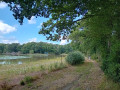
Mainly on dirt, sand or gravel paths, this fairly easy circuit takes you through the peaceful and varied landscapes of the Sologne: ponds, forests, hedgerow-enclosed pastures and interspersed crops. At the start and finish, the pretty village of Villemurlin offers a typical Sologne charm with its brick houses and blue ladders, reminders of a time when the attic was accessed from outside.
Initially shared with the family path of Villemurlin (the "chouette promenade" or "owl walk"), this route then takes a shortened version of the former "PR® des domaines de chasse et cultures" (hunting grounds and farmland), of which a few signs remain.
Circular Préchats: wading through the water at Ménétréol-sur-Sauldre
 6.69 mi
+69 ft
-66 ft
3h 10
Moderate
Departure from Ménétréol-sur-Sauldre (Cher)
6.69 mi
+69 ft
-66 ft
3h 10
Moderate
Departure from Ménétréol-sur-Sauldre (Cher)
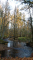
A very pretty circular walk through the Petite Sauldre Valley and the vast pine forest of the Domaine de Landeroyne. What makes this circular walk special? It takes you across a ford just past the hamlet of Les Préchats. There’s no footbridge here, and no facilities to help you cross. You’ll need to take your shoes off.
Circular of the Vieux Perroi in Brinon
 5.81 mi
+62 ft
-62 ft
2h 45
Easy
Departure from Brinon-sur-Sauldre (Cher)
5.81 mi
+62 ft
-62 ft
2h 45
Easy
Departure from Brinon-sur-Sauldre (Cher)
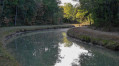
A beautiful circular in Sologne, the first part of this circular follows wide paths, while the second part quickly becomes wilder and more typical of the Sologne landscape.
Following the Aquiaulne from Saint-Gondon
 10.99 mi
+131 ft
-131 ft
5h 10
Moderate
Departure from Saint-Gondon (Loiret)
10.99 mi
+131 ft
-131 ft
5h 10
Moderate
Departure from Saint-Gondon (Loiret)
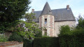
A village of Gallo-Roman origin, Saint-Gondon is situated on the borders of Berry, Sologne and the Loire Valley. The first part of the walk takes in the bucolic charm of the Aquiaulne Valley, whilst the second follows little-used paths, winding through a mix of woodland and farmland, not to mention a few heathlands.
Old stone buildings and sunken lanes in the Pays Fort
 8.41 mi
+548 ft
-554 ft
4h 20
Moderate
Departure from Vailly-sur-Sauldre (Cher)
8.41 mi
+548 ft
-554 ft
4h 20
Moderate
Departure from Vailly-sur-Sauldre (Cher)
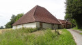
A rolling bocage landscape, typical houses in black and ochre sandstone, and a pyramid-shaped barn – a walk to reconnect with unspoilt nature.
Through the Berry hedgerows
 8.06 mi
+656 ft
-673 ft
4h 15
Moderate
Departure from Vailly-sur-Sauldre (Cher)
8.06 mi
+656 ft
-673 ft
4h 15
Moderate
Departure from Vailly-sur-Sauldre (Cher)
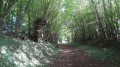
A beautiful route for appreciating the landscapes of the Pays Fort. Moving from sunken paths hidden beneath hedgerows (known as ‘bouch’tures’) to open grassy tracks with views of the rolling hills of the Sancerrois offers walkers a variety of wild landscapes typical of the Sologne region of the Berry.
Heritage and history trail in Gien
3.81 mi
+92 ft
-115 ft
1h 50
Easy
Departure from Gien (Loiret)
This route is offered by the Gien Town Hall to explore the town while learning about its history and discovering its heritage. As you progress, you will find information boards with explanations of the various historical points of interest identified. I am sharing it here, with my personal modifications to the route and the various points of interest, which are more or less in the same positions.
Sange Valley Circuit
 6.32 mi
+102 ft
-98 ft
3h 00
Moderate
Departure from Saint-Aignan-le-Jaillard (Loiret)
6.32 mi
+102 ft
-98 ft
3h 00
Moderate
Departure from Saint-Aignan-le-Jaillard (Loiret)
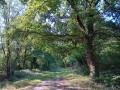
On the edge of the Sologne, this circuit brings together the typical landscapes that make up the charm of this natural region near the Loire: meadows, ponds, forests, interspersed with crops and pretty brick houses. The little river Sange brings it to life and gives it a little relief.
Marked in yellow, this route is also signposted in places as "PR® de la Vallée de la Sange - P 11". Despite two sections on the road, 70% of this circuit is on unpaved paths.
From Gien to Briare
 7.96 mi
+49 ft
-128 ft
3h 40
Moderate
Departure from Gien (Loiret)
7.96 mi
+49 ft
-128 ft
3h 40
Moderate
Departure from Gien (Loiret)
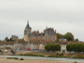
This first stage runs along the Loire to take you to Briare, a charming little town full of flowers, with its small river port.
Please note: this hike can be done either as part of the 3-stage Gien - Cosne-sur-Loire hike, or on its own by taking the train from Briare back to Gien.
Historic Trail of the Vallée des Rois from Viglain
 7.12 mi
+66 ft
-66 ft
3h 20
Moderate
Departure from Viglain (Loiret)
7.12 mi
+66 ft
-66 ft
3h 20
Moderate
Departure from Viglain (Loiret)
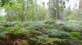
Nestled on the edge of the Sologne region, Viglain reveals the riches of its countryside, with its woods, heathland, ponds and streams, not to mention the Sully-sur-Loire golf course, a vast green space dotted with trees of various species.
 From the white sands to the Lamotte Beuvron forest
 28.06 mi
+131 ft
-131 ft
4 hrs
Moderate
Departure from Vannes-sur-Cosson (Loiret)
28.06 mi
+131 ft
-131 ft
4 hrs
Moderate
Departure from Vannes-sur-Cosson (Loiret)
This circular route follows white sandy paths lined with broom-covered heathland and heather-filled undergrowth, crossing numerous streams. It passes through the Lamotte Beuvron State Forest and winds its way through the beautiful villages of Vannes-sur-Cosson, Souvigny-en-Sologne and Sennely.
On either side of the Cosson
 8.47 mi
+36 ft
-36 ft
3h 55
Moderate
Departure from Vannes-sur-Cosson (Loiret)
8.47 mi
+36 ft
-36 ft
3h 55
Moderate
Departure from Vannes-sur-Cosson (Loiret)
The walk follows the famous Chemin des Sables, with its heather, broom, mosses and lichens, and sections through mixed woodland. Beautiful farmhouses and homes dot the route.
The Trognards Route in Vannes-sur-Cosson
 2.40 mi
+620 ft
-604 ft
1h 40
Easy
Departure from Vannes-sur-Cosson (Loiret)
2.40 mi
+620 ft
-604 ft
1h 40
Easy
Departure from Vannes-sur-Cosson (Loiret)
An easy family walk through the typical landscapes of Sologne, featuring several hedgerows of pollarded oaks: these pollarded oaks served as the farmers’ timber supply and formed hedgerows on an embankment enclosing the pastures.