Blancafort Water Tower Circular Route

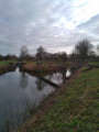
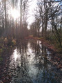
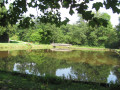
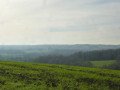
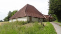
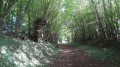
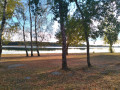
A very lovely route through the countryside of the Pays Fort. Sunken lanes, forests and ponds give it its charm.

Details

1592581
Creation:
Last update:
Last review:
  • Walking
    Activity: Walking
  • ↔
    Distance: 9.88 mi
  • ◔
    Average duration: 4h 40 
  • ▲
    Difficulty: Moderate

  • ⚐
    Back to start: Yes
  • ↗
    Ascent: + 167 ft
  • ↘
    Descent: - 174 ft

  • ▲
    Highest point: 712 ft
  • ▼
    Lowest point: 545 ft
  • ⚐ Country: France
  • ⚐
    Area: Sologne
  • ⚐ City: Cher (18)
  • ⚑
    Start/End: N 47.530772° / E 2.529189°
  • ❏
    IGN map(s): Ref. 2321E, 2321SB, 2322SB, 2421SB, 2422SB
  • Hour-by-hour weather

Photos

Description of the walk

To reach the start of this route: from Blancafort town centre, take the D30 towards Aubigny-sur-Nère. Park in the car park on the right just after crossing the bridge over the Canal de la Sauldre.

(S/E) From the car park, join the D30 and turn left towards the town centre. After crossing the bridge, keep left, follow the canal downstream along the right bank (north-west) and continue until you reach a footbridge over the canal.
Carry on with your back to the footbridge, cross a car park and join the D8. Cross at the pedestrian crossing with care, turn right and walk alongside the school until you reach the end of the playground.

(1) Turn left onto Chemin de la Fontaine, then left again onto Chemin de la Fontaine Saint-Marc. Continue along the main path, skirting the cemetery, and ignore all side paths until you reach a road.

(2) Cross the small road (metal cross) and continue along the path opposite, marked in yellow, until you reach a junction.

(3) Turn right and carry on until you reach the entrance to the hamlet of La Courterie.

(4) Turn left, following the yellow markings, and at the Y-junction, take the path on the right, which is still marked in yellow. You will reach the Chemin de Châtillon.

(5) Turn right, follow this path – marked ‘Variante’ – until you reach an inverted Y-junction. Then take the left-hand branch, leaving the alternative route to the right.
Carry on until you reach the D39. Cross it with care and continue straight ahead towards Anséfort. Cross the farmyard, veer slightly to the right and follow this unmarked path. You’ll emerge at the edge of the forest.

(6) Turn left before reaching the road. Continue along this long path, ignoring all side paths. A little further on, you’ll come across the yellow markings at elevation 194. Cross a small road carefully and continue straight on, skirting a series of ponds, until you reach another small road.

(7) Follow the road to the left for about 100 metres, then turn right onto the path signposted ‘Les Tailles’. Continue to the next junction.

(8) Turn left and follow this unmarked grassy path. Pass an inverted Y-junction and continue straight on to reach the D39 at the water tower.

(9) Cross the D39 with care and carry on straight ahead, following the yellow markings.

(10) Take a left-hand bend, leaving a private track opposite. At the next junction, continue straight on until you reach a four-way crossroads.

(11) Turn left; a Yellow Cross marks the end of the signposting. At the next junction, ignore the ‘Variante’ sign on the left. Continue straight on until you reach a Y-junction at a place called La Haie, near a small pond.

(12) Follow the path on the right, then cross over a wider path. Continue straight ahead on an unmarked path. Reach the D8 and follow it, taking care, to the left for about 170 metres.

(13) Cross the D8, taking care, take the path signposted ‘Les Alexandres’ and reach the Canal de la Sauldre at the bridge. Cross the canal.

(14) Turn left and follow the canal along the towpath to the footbridge at the junction with the feeder channel.

(15) Cross the feeder branch via the footbridge, then walk alongside the Écluse de la Cantine. At the eastern end of the lock, turn right, cross a small footbridge and continue along the path that runs alongside the canal. Pass what appears to have been a barrier and reach a small road (Chemin de l’Aunay).

(16)First turn left then right, walk alongside the Écluse de l’Aunay, then continue along the towpath
Pass the Moulin du Crot and head for the car park (S/E).

Waypoints

  1. S/E : mi 0 - alt. 571 ft - Car park on the right after the bridge
  2. 1 : mi 0.32 - alt. 577 ft - Turn left onto Chemin Fontaine
  3. 2 : mi 1.07 - alt. 659 ft - Road crossing (cross)
  4. 3 : mi 1.34 - alt. 679 ft - Turn right towards the hamlet of Courterie
  5. 4 : mi 1.59 - alt. 689 ft - Path on the left
  6. 5 : mi 2 - alt. 699 ft - Chemin de Châtillon on the right
  7. 6 : mi 3.09 - alt. 702 ft - On the left as you walk alongside the forest
  8. 7 : mi 4.71 - alt. 623 ft - Turn left onto the road
  9. 8 : mi 4.99 - alt. 633 ft - Turn left onto the grassy path
  10. 9 : mi 5.53 - alt. 663 ft - Water tower
  11. 10 : mi 6.2 - alt. 640 ft - Path on the left
  12. 11 : mi 6.88 - alt. 650 ft - Path on the left (end of yellow signposting)
  13. 12 : mi 7.76 - alt. 656 ft - A place known as La Haie
  14. 13 : mi 8.3 - alt. 594 ft - Turn right onto the path towards Les Alexandres
  15. 14 : mi 8.56 - alt. 554 ft - Turn left onto the towpath. Near the - Grande Sauldre (rivière) - Affluent de la Sauldre
  16. 15 : mi 8.78 - alt. 554 ft - Turn left over the footbridge
  17. 16 : mi 8.94 - alt. 564 ft - Up to the car park at Lons-du - Canal de la Sauldre
  18. S/E : mi 9.88 - alt. 571 ft - Car park on the right after the bridge

Notes

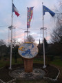
Blancafort, a village in northern Cher, on the border between Berry and Sologne, covering 6,435 hectares, was designated the first geographical centre of the euro in December 1998.

Blancafort was already known by this name in 1064. The fortified castle was built in the 15th century by the Boucard family on the site of the former seigneury, which had been constructed in the 11th century. A castle built of pink brick, its French-style garden and grounds overlook the banks of the canal and the River Sauldre.

The Church of Saint-Étienne, the oldest parts of which date from the 11th century, has been listed in the Inventory of Historic Monuments since 1926. Its 16th-century bell tower and porch rests on four wooden beams and rises to a height of 30 metres.

Blancafort is crossed by the Sauldre and the 47-kilometre-long canal, which features 22 locks and was built under Napoleon III based on an idea by Leonardo da Vinci. Its purpose was drainage, irrigation and, above all, the transport of marl – 30,000 m³ in 1885 – to Lamotte-Beuvron.

This ‘marne transport’ helped to enrich the limestone-poor soils of the Sologne region.

Source: Blancafort Town Hall website

Worth a visit

Reviews and comments

4.4 / 5
Based on 3 reviews

Reliability of the description
4.7 / 5
Ease of following the route
4.7 / 5
Route interest
4 / 5
Founthim
Founthim

Overall rating : 4.3 / 5

Date of your route : Apr 14, 2024
Reliability of the description : ★★★★★ Very good
Ease of following the route : ★★★★★ Very good
Route interest : ★★★☆☆ Average
Very busy route : No

Poorly maintained tracks with lots of ruts and mud, forcing you to take a detour.
It’s a shame, as the countryside is varied and very peaceful.

Machine-translated

Karel Van Cauwenberghe

Overall rating : 5 / 5

Date of your route : Aug 21, 2020
Reliability of the description : ★★★★★ Very good
Ease of following the route : ★★★★★ Very good
Route interest : ★★★★★ Very good
Very busy route : No

The walk is very peaceful and very scenic. The final stretch along the canal is particularly lovely.
Sometimes the signs with yellow markings are hard to spot.

Machine-translated

Joyeux  randonneur
Joyeux randonneur

Overall rating : 4 / 5

Date of your route : Feb 10, 2020
Reliability of the description : ★★★★☆ Good
Ease of following the route : ★★★★☆ Good
Route interest : ★★★★☆ Good

A pleasant route, offering variety with some very wet paths. The signposting is not well maintained or clearly visible, so make sure you check the route on a map before setting off and ignore the bridlepath markings, which can be misleading. I spotted two roe deer but saw plenty of game tracks.

Machine-translated

Other walks in the area

For more walks, use our search engine .

The GPS track and description are the property of this route's author. Please do not copy them without permission.