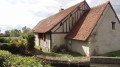
The Sauldre Canal in Blancafort: Blue route with variant

An easy route, with a variant, open to pedestrians, cyclists and horse riders.
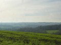
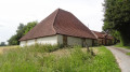
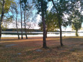
The Blue Route is rich in heritage that characterises Blancafort: the canal, the river, the old marl pits and the paths rehabilitated for the enjoyment of walkers by the Blancafort et Patrimoine Association.
Five other trails are suggested on the sign at the wash house (canal bridge, Euro monument).

Details

653493
Creation:
Last update:
Last review:
  • Walking
    Activity: Walking
  • ↔
    Distance: 6.16 mi
  • ◔
    Average duration: 2h 55 
  • ▲
    Difficulty: Easy

  • ⚐
    Back to start: Yes
  • ↗
    Ascent: + 115 ft
  • ↘
    Descent: - 112 ft

  • ▲
    Highest point: 682 ft
  • ▼
    Lowest point: 545 ft
  • ⚐ Country: France
  • ⚐
    Area: Sologne
  • ⚐ City: Cher (18)
  • ⚑
    Start/End: N 47.530594° / E 2.529361°
  • ❏
    IGN map(s): Ref. 2321E, 2321SB, 2322SB, 2421SB, 2422SB
  • Hour-by-hour weather

Photos

Description of the walk

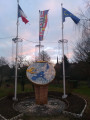
Park near the communal wash house and Euro monument. The route sign shows the six routes in the commune.

(S/E) Follow the Sente Bleue towards Argent. You will come to the first bridge over the canal, the Moulin du Crot, which has been beautifully restored.

(1) Continue straight ahead to reach the hamlet of Launay.

(2) Walk along the lock, opposite the lock keeper's house. At the bridge, leave the Sente Bleue and head down towards the Launay site, which is marked by an information board. Take the time to visit this wonderfully restored site.

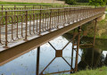
(3) To leave the site, take the Eiffel-type footbridge and head towards the next bridge on the left bank of the canal. For horse riders who are unsure about using the footbridge, return to the Sente Bleue. Cross the Gué Rognon bridge. Here, you can take the right bank to follow the alternative route that leads to the woods on the northern slope of the Sauldre valley. Otherwise, take the path opposite the bridge to reach the Argent - Blancafort road (D8). At the stop sign, turn right towards Blancafort. Take care on the 400-metre stretch of road. At the top of the hill, take the path on the left, after the Cantine. You will come to a crossroads.

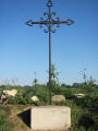
(4) Take the first path on the right, going around a ruined house, and continue to the next crossroads, marked with a cross.

(5) Continue along the path opposite, reaching the cemetery at the crossroads where a cross has been erected.

(6) Follow this path on the left to reach the Coullons road (D30). Cross the road and follow Chemin des Vignes to the D8 stop sign. Descend to the right towards the village until you reach the castle driveway.

(7) Go up towards the castle and, opposite the entrance, take the small path on the right that goes down towards the church.

(8) Walk past the church along Rue de l'Abbé Morin. On the left is a gate with the Templar cross engraved on the lintel. At the end of this small street, take Chemin de Beauregard on the left, at the corner of Bacchus. Follow the canal to the left, i.e. the right bank, until you reach the next lock.

(9) You will arrive at the Remblai lock and the basin that was once the port for barges. Continue along the towpath on the right bank, passing in front of the tunnel used by wagons loaded with marl, which they came to dump into the boats. Continue to the beginning of the canal.

(10) Return via the other bank (left bank) to reach the car park where you started (S/E).

Waypoints

  1. S/E : mi 0 - alt. 568 ft - Route sign at the wash house - Grande Sauldre (rivière) - Affluent de la Sauldre
  2. 1 : mi 0.63 - alt. 564 ft - Beautifully restored watermill
  3. 2 : mi 0.99 - alt. 554 ft - Water intake, oven, Eiffel footbridge, 0 km marker
  4. 3 : mi 1.32 - alt. 554 ft - A legendary meeting place for young people
  5. 4 : mi 2.21 - alt. 679 ft - House that hosted clandestine dances
  6. 5 : mi 2.48 - alt. 659 ft - Cross dated 1800, a reminder of a duel
  7. 6 : mi 3.09 - alt. 614 ft - Cross rebuilt in 2011.
  8. 7 : mi 3.65 - alt. 600 ft - Château des Senteurs
  9. 8 : mi 3.75 - alt. 574 ft - The church to visit
  10. 9 : mi 4.34 - alt. 577 ft - Former port for "péniches" (barge boats)
  11. 10 : mi 4.95 - alt. 577 ft - Second water intake of the - Canal de la Sauldre
  12. S/E : mi 6.16 - alt. 571 ft - Euro monument and wash house

Notes

You can follow the variant at the Gué Rognon bridge, which will take you to the La Haie loading station and allow you to use part of the magnificent Argent path in Châtillon-sur-Loire.

This 6.5km variant is marked in blue with a white "Variante" sign.

The route on the map is marked in blue, not to be confused with thePR® which is also blue, but with a thicker line.

The variant joins the Blue route at L'Orme, marked by a cross dated 1800, at the corner of the paths (see (5)).

Worth a visit

Things to see on this route:
- Le Moulin du Crot.
- Visit the Launay site: the shortest leat of the canal, the water intake dam, kilometre 0 marker, bread oven, dry dock, Eiffel-type footbridge and locks.
- Le Gué Rognon, where many children learned to swim.
- Ruins of a house where clandestine dances were held during the last war.
- Cross commemorating the duel between the Lords of Launay and La Haye (Croix Roulaine...) dated 1800.
- View of the farm and Château de Fontbel.
- The Duranty Cross in homage to the Lord of Blancafort (rebuilt by the Blancafort et Patrimoine association).
- The Château de Blancafort, Château des Senteurs.
- The church and the former coaching inn, whose porch is engraved with the Templar cross.
- The Remblai basin, then the marl tunnel on the left 100 metres away, and the start of the canal.

Always be cautious and plan ahead when you're outdoors. Visorando and the author of this route cannot be held responsible for any accidents occurring on this route.

The GR® and PR® markings are the intellectual property of the Fédération Française de Randonnée Pédestre.

Reviews and comments

4.7 / 5
Based on 6 reviews

Reliability of the description
4.8 / 5
Ease of following the route
4.8 / 5
Route interest
4.3 / 5
rand@23
rand@23

Overall rating : 4 / 5

Date of your route : May 10, 2024
Reliability of the description : ★★★★☆ Good
Ease of following the route : ★★★★☆ Good
Route interest : ★★★★☆ Good
Very busy route : No

A very interesting route with many points of interest.
The first part of the route along the canal is interesting. The walk is not very busy.
The section through Blancafort is interesting, and the church is worth a look.
The end of the route is less interesting (return trip along the canal).
Highly recommended!

Machine-translated

marie daubigny
marie daubigny

Overall rating : 4.3 / 5

Date of your route : Sep 16, 2023
Reliability of the description : ★★★★★ Very good
Ease of following the route : ★★★★★ Very good
Route interest : ★★★☆☆ Average
Very busy route : No

The first part of the canal-side route is interesting, but then it becomes more monotonous.
But it's a nice little walk.

Machine-translated

sc.didier
sc.didier

Overall rating : 5 / 5

Date of your route : May 29, 2023
Reliability of the description : ★★★★★ Very good
Ease of following the route : ★★★★★ Very good
Route interest : ★★★★★ Very good
Very busy route : No

A very interesting route with lots of points of interest. The description is good, and we had no difficulty following the itinerary. The walk is not very busy (only a few fishermen).
We particularly enjoyed the sections along the canals, which were very peaceful and pleasant, and sometimes surprising (the start of the canal, for example). However, we didn't see the marl tunnel, which was probably hidden by vegetation.
Finally, the section through Blancafort is also very interesting, and the church is worth a look.
Highly recommended!

Machine-translated

Moudujnou
Moudujnou

Overall rating : 5 / 5

Date of your route : Aug 18, 2022
Reliability of the description : ★★★★★ Very good
Ease of following the route : ★★★★★ Very good
Route interest : ★★★★★ Very good
Very busy route : No

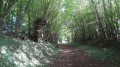
A very beautiful hike on a shaded route, which is much appreciated during these heatwaves.

Machine-translated

Fred cliff
Fred cliff

Overall rating : 5 / 5

Date of your route : Jun 23, 2020
Reliability of the description : ★★★★★ Very good
Ease of following the route : ★★★★★ Very good
Route interest : ★★★★★ Very good
Very busy route : No

We are not experienced hikers, and this route was perfect!

The canal, the tranquillity, the wash house, the zero marker! Wild strawberries along the way...
Plenty of shade on this very sunny day, and our dogs enjoyed it as much as we did!
I highly recommend it!

Machine-translated

B.P.
B.P.

Hello,

Thank you for your comments, which we greatly appreciate. The Blancafort et Patrimoine Association sincerely thanks you and invites you to discover its five other marked routes.

Kind regards

Machine-translated

Sirmaelle
Sirmaelle

Overall rating : 4.7 / 5

Date of your route : Jan 01, 2020
Reliability of the description : ★★★★★ Very good
Ease of following the route : ★★★★★ Very good
Route interest : ★★★★☆ Good

We chose this walk as a way to "digest" after New Year's Eve, to enjoy the beautiful weather.
A well-balanced walk between the canal bank and the very pleasant sunken paths. Easy and well described, our small group of friends also enjoyed it very much.

Machine-translated

Other walks in the area

For more walks, use our search engine .

The GPS track and description are the property of this route's author. Please do not copy them without permission.