Raboliot route from Brinon-sur-Sauldre

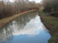
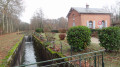
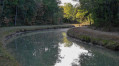
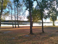
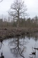
Set in the heart of the ‘Sologne des étangs’, this walk offers the chance to explore deciduous and coniferous forests, as well as the magnificent Sauldre Canal – a remnant of the major development works carried out in this province, which had long been neglected and only began to develop during the Second Empire.

Details

1655461
Creation:
Last update:
Last review:
  • Walking
    Activity: Walking
  • ↔
    Distance: 10.30 mi
  • ◔
    Average duration: 4h 50 
  • ▲
    Difficulty: Moderate

  • ⚐
    Back to start: Yes
  • ↗
    Ascent: + 131 ft
  • ↘
    Descent: - 98 ft

  • ▲
    Highest point: 522 ft
  • ▼
    Lowest point: 440 ft

Photos

Description of the walk

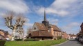
The route starts at the car park near the church in Brinon-sur-Sauldre.

Signposting: Raboliot Route and Yellow/Red (GR® de Pays de Sologne)

(S/E) Walk past the church’s bell tower and go round the church via the Place de l’Eglise (D77E) towards Isdes. Leave the Rue de la Coudre on your right and stay on the main road until you reach the Fork in the road.

(1) Turn onto the left-hand track, ‘le Vivier’, signposted ‘Isdes 12km’. Ignore the various turn-offs and pass the cemetery.

(2) At the crossroads, take the CR42 on the right, which leads back to the D77E; follow this to the left for 600 metres.

(3) Turn right onto the CR3. Follow this lane, ignoring the side roads, and pass through the hamlet of Les Richoudières.

(4) Cross the bridge over the Sauldre Canal and head along the left-hand bank. Follow the canal along the towpath to the next bridge.

(5) Leave the canal by taking the path on the right until you reach the D77E. Follow it to the left for 300 metres.

(6) Leave the D77E and take the first path on the right, the CR85. This takes you round the Monteaux estate. Turn left when you reach the cross-path.

End of the yellow-red markings

(7) At the three-way junction, leave theGR® de Pays de Sologne and continue straight ahead. Pass the ponds.

(8) At the next crossroads, turn right at a right angle onto the CR90. This lane runs alongside a pond. At the fork in the road, take the small road on the left – the only public access.

(9) At the junction, continue along the small tarmac road to the left for nearly 3 km.

(10) Once past the Étangs des Brosses, turn right onto the CR55, signposted ‘les Landes’. Follow this track until you come to a crossroads.

(11) Turn left onto the CR11, then carry on along the small tarmac road, taking the left-hand lane at the Fork in the road. This crosses the Sauldre Canal and leads to the hamlet of La Bergerie.

(12) Once past the first houses in Brinon, keep left onto the D77, which leads to the village church, the starting point of the walk (S/E).

Waypoints

  1. S/E : mi 0 - alt. 453 ft - Car park near Brinon Church. Close to the - Grande Sauldre (rivière) - Affluent de la Sauldre
  2. 1 : mi 0.17 - alt. 459 ft - Left-hand route
  3. 2 : mi 0.6 - alt. 482 ft - CR42 on the right
  4. 3 : mi 1.38 - alt. 518 ft - CR3 on the right
  5. 4 : mi 2.96 - alt. 502 ft - Bank on the left-hand side after the bridge - Canal de la Sauldre
  6. 5 : mi 3.47 - alt. 495 ft - Path on the right
  7. 6 : mi 4.13 - alt. 472 ft - CR85 on the right
  8. 7 : mi 4.61 - alt. 466 ft - Junction with the path, straight ahead
  9. 8 : mi 5.03 - alt. 453 ft - CR90 on the right
  10. 9 : mi 6.35 - alt. 456 ft - Tarmacked road on the left
  11. 10 : mi 8.12 - alt. 499 ft - CR55 signposted ‘les Landes’ on the right
  12. 11 : mi 8.62 - alt. 459 ft - CR11 on the left
  13. 12 : mi 9.91 - alt. 486 ft - Turn left onto the D77
  14. S/E : mi 10.3 - alt. 456 ft - Car park near the - Église Saint-Barthélémy (Brinon-sur-Sauldre)

Notes

The route is well-marked and presents no difficulties. It can be enjoyed in all seasons.

It should be noted, however, that the banks of the Sauldre Canal are unstable and closed to motorised vehicles. However, they do not pose any particular danger to walkers provided they stay at least one metre away from the canal (follow the towpath).

Worth a visit

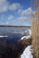
  • Look out for birds (ducks in particular) on the ponds, as well as the wildlife along the Sauldre Canal.

Always be cautious and plan ahead when you're outdoors. Visorando and the author of this route cannot be held responsible for any accidents occurring on this route.

The GR® and PR® markings are the intellectual property of the Fédération Française de Randonnée Pédestre.

Reviews and comments

4.7 / 5
Based on 2 reviews

Reliability of the description
4.5 / 5
Ease of following the route
5 / 5
Route interest
4.5 / 5
Jerame
Jerame

Overall rating : 4.3 / 5

Date of your route : Sep 28, 2021
Reliability of the description : ★★★★☆ Good
Ease of following the route : ★★★★★ Very good
Route interest : ★★★★☆ Good
Very busy route : No

I didn’t follow this route exactly, as there is another route of the same name (as has already been pointed out) that is slightly different and shorter. I did a mix of the two. In any case, it’s a lovely route through typical Sologne countryside, with just one drawback: there are a few too many stretches on the road.

Machine-translated

Guygui
Guygui

Overall rating : 5 / 5

Date of your route : Sep 05, 2021
Reliability of the description : ★★★★★ Very good
Ease of following the route : ★★★★★ Very good
Route interest : ★★★★★ Very good
Very busy route : No

You need to follow the instructions and the signposting; people don’t always follow the signposting along this route. Something to be done.

Machine-translated

Other walks in the area

For more walks, use our search engine .

The GPS track and description are the property of this route's author. Please do not copy them without permission.