


Refine your search for walks in Airolo
Airolo walks


 From Airolo to Andermatt via the Via Gottardo
 Visorando Member
 12.12 mi
 +3,245 ft
 -2,267 ft
 2 days
 Difficult
 Departure from Airolo (Ticino)
A superb route that crosses the famous St Gotthard Pass. You will set off from Airolo, a pretty Italian-speaking village, and arrive at the famous German-speaking resort of Andermatt. You will spend a night at the Ospizio del San Gottardo. This pass, which is very busy during the day with numerous tourists, quickly returns to calm and tranquillity in the evening.
Airolo - Gottardo Passo
 4.10 mi
+3,136 ft
-39 ft
4h 35
Difficult
Departure from Airolo (Ticino)
4.10 mi
+3,136 ft
-39 ft
4h 35
Difficult
Departure from Airolo (Ticino)
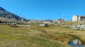
This first stage will take you to the St Gotthard Pass. The village of Airolo is located at the foot of two major Swiss passes: the Nufenen Pass and the Gottardo Passo. The climb to St Gotthard is challenging, with an elevation gain of nearly 1,000 metres over less than seven kilometres. At times, the trail follows the old St Gotthard road, which is entirely paved all the way to the pass.
Ospizio del San Gottardo – Capanna Piansecco
 12.17 mi
+4,423 ft
-4,921 ft
9h 25
Difficult
Departure from Airolo (Ticino)
12.17 mi
+4,423 ft
-4,921 ft
9h 25
Difficult
Departure from Airolo (Ticino)
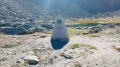
This third stage of the Vier Quellen Weg will take you from the Hospice da Saint Gothard to Capanna Piansecco. During the day, you’ll walk alongside the stunning Lake Lucendro. As you approach the Col de Lucendro, you’ll discover one of the sources of the Reuss (Gothardreuss). The final stretch of the route leading to Capanna Piansecco overlooks the Ticino.
Gottardo Passo - Andermatt
 8.02 mi
+108 ft
-2,228 ft
3h 45
8.02 mi
+108 ft
-2,228 ft
3h 45
 Moderate
Departure from Airolo (Ticino)
Moderate
Departure from Airolo (Ticino)
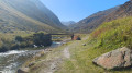
This second stage will take you to the charming village of Andermatt. Descending from the Passo Gottardo, you will follow the Gotthardreuss to Hospental, which joins the Furkareuss to form the Reuss. You will quickly leave theItalian-speaking canton of Ticinoand enter the German-speaking canton of Uri. Andermatt is a renowned winter sports resort.
Vermigel Hütte – Ospizio Gottardo
 7.32 mi
+2,746 ft
-2,539 ft
5h 45
Difficult
Departure from Andermatt (Canton of Uri)
7.32 mi
+2,746 ft
-2,539 ft
5h 45
Difficult
Departure from Andermatt (Canton of Uri)
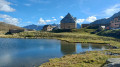
This second stage of the Vier Quellen Weg will take you from Cappana Vermigel to the Hospice da Saint Gothard. Although this route does not take you to a spring, reaching the Saint Gothard Pass serves as a reminder that the eponymous massif is home to the four sources featured on the route: the Rhine, the Reuss, the Ticino and the Rhône.
Capanna Piansecco – Obergesteln
 11.78 mi
+2,028 ft
-4,055 ft
7h 10
Difficult
Departure from Bedretto (Ticino)
11.78 mi
+2,028 ft
-4,055 ft
7h 10
Difficult
Departure from Bedretto (Ticino)
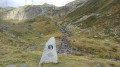
This fourth stage of the Vier Quellen Weg will take you from Cappana Piansecco to Obergesteln. During the day, you’ll discover the source of the Ticino (Tessin). An engraved marker indicates this source. You’ll cross the Nufenen Pass, which will take you to Obergesteln, a charming little village on the banks of the Rhône.
Vier Quellen Weg
 50.77 mi
+15,958 ft
-15,315 ft
5 days
Difficult
Departure from Tujetsch (Grisons)
50.77 mi
+15,958 ft
-15,315 ft
5 days
Difficult
Departure from Tujetsch (Grisons)
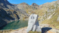
This magnificent Four Springs Trail (Vier Quellen Weg) will take you to the headwaters of the Rhine, the Reuss, the Ticino and the Rhône. You’ll pass through the cantons of Uri, Graubünden, Ticino and Valais, crossing six major mountain passes: the Maighels Pass, the Sella Pass, the Gotthard Pass, the Lucendro Pass, the Nufenen Pass and the Furka Pass.
Oberalppass – Vermigel Hütte
8.47 mi
+2,612 ft
-2,621 ft
6h 10
Difficult
Departure from Tujetsch (Grisons)
This first stage of the Vier Quellen Weg will take you from the Oberalppass to the Capanna Vermigel. During the day, you’ll discover Lake Tuma, one of the sources of the Rhine. An engraved marker indicates this source. As you climb towards the Col de Maighels, you’ll walk alongside another branch of the Rhine (Rein da Maighels), which has its source at the Maighels Glacier.
Tour of the Göscheneralpsee via Damahütte
 7.23 mi
+3,199 ft
-3,215 ft
2 days
Difficult
Departure from Göschenen (Canton of Uri)
7.23 mi
+3,199 ft
-3,215 ft
2 days
Difficult
Departure from Göschenen (Canton of Uri)
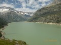
If you’re looking to hike in the high mountains and discover a beautiful Swiss glacial lake, here’s what you need: a walk around the Göscheneralpsee (a lake with a dam) and an overnight stay at the “Dammahütte”, a small, friendly mountain hut with 20 beds at an altitude of 2,440 metres..
Tour of the Göscheneralpsee - Ascent to the Dammahütte
 3.25 mi
+2,687 ft
-584 ft
3h 50
Difficult
Departure from Göschenen (Canton of Uri)
3.25 mi
+2,687 ft
-584 ft
3h 50
Difficult
Departure from Göschenen (Canton of Uri)
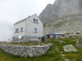
The first stage of this two-day circuit involves climbing up to the Damahütte via a path on the southern shore of the lake.
Tour of the Göscheneralpsee - Descent via the Panorama trail
3.98 mi
+512 ft
-2,657 ft
2h 15
Moderate
Departure from Göschenen (Canton of Uri)
The second stage of this circuit starts at the Dammahütte and follows a "Panorama" trail through a glacial cirque, then continues along the northern shore of the lake.
From Foroglio to Calneggia
6.52 mi
+1,785 ft
-1,765 ft
4h 35
 Easy
Departure from Cevio (Ticino)
Easy
Departure from Cevio (Ticino)
A magnificent hike in Val Bavona, dotted with typical stone houses.
Park at the beautiful spot called Ritorto. Follow the small forest path along the Bavona for about 1 km before arriving at the very picturesque and authentic village of Foroglio, which you cross in the direction of Calneggia. You then climb very quickly up the 100 metres of the waterfall via a path consisting of numerous stone steps. You will then arrive in Val Calneggia, where you will pass a few small stone houses and cross a small bridge. The hike then follows the stream to the alpine village of Calneggia, surrounded by a cirque. Return by the same route, accompanied by the sound of the crystal-clear stream. Magnificent!
The Sidelhorn from the Grimsel Pass, on the shores of Lake Totensee
 5.13 mi
+1,978 ft
-1,962 ft
5 hrs
5.13 mi
+1,978 ft
-1,962 ft
5 hrs
 Very difficult
Departure from Oberwald (Valais)
Very difficult
Departure from Oberwald (Valais)
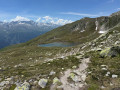
Starting from the Grimsel Pass in the Bernese Alps, this mountain hike ascends to the summit of the Sidelhorn before descending through the valley of the high-altitude lakes. The route first climbs above the Totensee and its mountain-pass hotel, along a stony path that soon overlooks the Rhône Valley and the surrounding glacial peaks. The final ascent involves scrambling up a rocky ridge to a wide viewpoint overlooking the High Bernese Alps and their glaciers. The return route runs alongside the Jostsee, a small mountain lake, before following a balcony-like path back towards the pass. A true alpine ascent, to be attempted only in the height of summer, in fine, dry weather, and reserved for seasoned walkers wishing to experience the Swiss high mountains.
Obergesteln – Belvedere Furka
 11.02 mi
+4,150 ft
-1,178 ft
8h 40
Very difficult
Departure from Obergestein (Valais)
11.02 mi
+4,150 ft
-1,178 ft
8h 40
Very difficult
Departure from Obergestein (Valais)
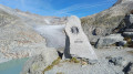
This fifth stage of the Vier Quellen Weg will take you from Obergesteln to the source of the Rhône. This magnificent route will have the Rhône as your constant companion. Right from the start, it will be by your side; you’ll follow it upstream to its source via the Furka Pass, then descend towards the historic Hotel Belvédère at the foot of the glacier. As with the other sources, you’ll find an engraved marker indicating the Rhône.
Circular walk around the Sunniggrat Hütte
 9.93 mi
+4,199 ft
-4,091 ft
2 days
Difficult
Departure from Gurtnellen (Canton of Uri)
9.93 mi
+4,199 ft
-4,091 ft
2 days
Difficult
Departure from Gurtnellen (Canton of Uri)
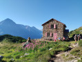
A two-day route in magnificent surroundings with stunning panoramic views of the peaks of the canton of Uri and Lake Lucerne.
The hike presents no major difficulties, with a few sections secured by chains on the second day, though these pose no difficulty in dry weather. There is also little shade.
Arnisee – Sunnigrathütte
3.70 mi
+2,559 ft
-433 ft
3h 55
Moderate
Departure from Gurtnellen (Canton of Uri)
A two-day hike with an overnight stay at the Sunniggrathütte. This route takes you up to the Sunniggrathütte along the Leitschachbach
The ascent suggested here is steady but offers little shade. A more direct but steeper ascent is possible by taking the path at the far end of the lake
Ascent to the Sunnig Grat from Arnisee
 4.52 mi
+2,365 ft
-2,346 ft
4h 10
Moderate
Departure from Gurtnellen (Canton of Uri)
4.52 mi
+2,365 ft
-2,346 ft
4h 10
Moderate
Departure from Gurtnellen (Canton of Uri)
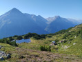
Hike up to the Sunnig Grat (2,034 m) from Lake Arnisee and enjoy the panoramic views of numerous peaks in the canton of Uri, stretching as far as Lake Lucerne and Lucerne itself. Stop at the Sunniggrathütte to leave your rucksacks and have a snack or spend the night. Return via the same route.
Rifugio Margaroli - Salecchio Superiore
 6.83 mi
+1,565 ft
-3,812 ft
4h 30
Difficult
Departure from Formazza (Verbano-Cusio-Ossola)
6.83 mi
+1,565 ft
-3,812 ft
4h 30
Difficult
Departure from Formazza (Verbano-Cusio-Ossola)
This third stage is very wild and not very busy. After Lago Vannino and Passo Busin, you will discover another lake, Lago Busin Inferiore. During the descent to Salecchio, you will notice the Walser habitat as you pass through hamlets such as Case Francoli and Salecchio Superiore. The dormitory at Rifugio Zum Gora dates back to the 17th century.
Bosco/Gurin - Capanna Alzaska
 9.83 mi
+4,478 ft
-3,740 ft
8h 25
Difficult
Departure from Bosco Gurin (Ticino)
9.83 mi
+4,478 ft
-3,740 ft
8h 25
Difficult
Departure from Bosco Gurin (Ticino)
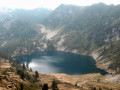
At the edge of the village, follow the path towards Cerentino. Descend to the village of Cerentino, then follow the road to Cevio for about 2.7 km. As a guide, about 2 km along, in a 180° bend, a sign indicates a path to Niva, and about 700 m further on, on the right, at a bus stop, the path to Capanna Alzasca begins. The path is shaded (chestnut, oak, hazel and other deciduous trees), but the climb is quite steep up to Alpe Orsalii. The climb to Bocchetta di Cansgei is more pleasant and well marked. The bochetta offers a magnificent view of Lago Alzasca. Descend to the sheepfold (Cortic di Cima) and follow the signs for Capanna Alzasaca. From the capanna, Lago Alzasca is about 20 minutes away. Lago Alzasca is considered the most beautiful natural lake in Ticino.Markings: White-Red-White.
Sunniggrathütte – Arnisee
 6.23 mi
+1,640 ft
-3,658 ft
4h 20
Moderate
Departure from Gurtnellen (Canton of Uri)
6.23 mi
+1,640 ft
-3,658 ft
4h 20
Moderate
Departure from Gurtnellen (Canton of Uri)
The hike starts at the Sunniggrathütte (see Day 1) and follows the Hohenweg, which leads to the Leutschachhütte, before descending along the Leitschachbach to reach the Arnisee and the cable car
Loop starting from Silenen, above Amsteg, canton of Uri.
 10.64 mi
+3,547 ft
-5,394 ft
8h 00
Difficult
Departure from Silenen (Canton of Uri)
10.64 mi
+3,547 ft
-5,394 ft
8h 00
Difficult
Departure from Silenen (Canton of Uri)
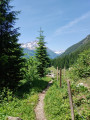
This loop can be completed in a day, but it is more comfortable to spend the night in the welcoming Windgällenhütte. A beautiful balcony trail once you have crossed the very steep Bockistock corridor. The steep climb is then rewarded. Swimming is possible in the charming little Golzerensee lake.
Capanna Efra - Pollegio
 9.84 mi
+1,362 ft
-7,057 ft
5h 45
Moderate
Departure from Frasco (Ticino)
9.84 mi
+1,362 ft
-7,057 ft
5h 45
Moderate
Departure from Frasco (Ticino)
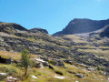
More than 2,000 metres of descent are on the agenda for the day. The trail to Passo Gagnone starts just behind the Capanna d'Efra. This is the only climb of the day. From the pass, the long descent begins, first into Val Gagnone and then to Bedra. The trail then enters the woods and overlooks the torrent. A few houses along the way in Marzoch, Gallina and Monastei allow you to check your position on the map. The path continues along the torrent to Bacino Val d'Ambra. Continue downhill to reach the village of Personico. Then follow the signs for Pollegio/Biasca to the bridge that crosses the Ticino river. Continue along the path to an underpass beneath the motorway to finally enter the village of Pollegio.Markings: GR® White-Red-White. Via Alpina Red R87.
Salecchio Superiore - Crampiolo
 6.83 mi
+3,392 ft
-2,431 ft
6h 05
Difficult
Departure from Premia (Verbano-Cusio-Ossola)
6.83 mi
+3,392 ft
-2,431 ft
6h 05
Difficult
Departure from Premia (Verbano-Cusio-Ossola)
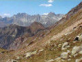
This fourth stage is marked by the crossing of two passes, the Passo Muretto and the Bocchetta di Scarpia. You will also cross several mountain pastures such as Alpe de Salecchio, Alpe de Pojola and Alpe de Sangiatto. In the evening, upon arrival in Crampiolo, you will have the opportunity to visit Lago Devero.
Salecchio Superiore - Bosco/Gurin
 9.32 mi
+4,993 ft
-4,869 ft
8h 40
Very difficult
Departure from Premia (Verbano-Cusio-Ossola)
9.32 mi
+4,993 ft
-4,869 ft
8h 40
Very difficult
Departure from Premia (Verbano-Cusio-Ossola)
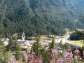
Return to Switzerland, in Ticino via the Guriner Furka. From Salecchio, take the same path as the day before to Alpi di Vova and follow the signs for Antillone and Fondovalle. Shortly after Altillone, the path joins the road, which you follow for 500 metres to the village of Fondovalle. A good path through the woods climbs towards the Guriner Furka via Alpe Stavello. Finally, a pass appears, the Passo della Foglia, but this is not the Guriner Furka. It takes another quarter of an hour to reach it via the path that branches off to the left. From Guriner Furka, you can see the chalets of Grossalp and the village of Bosco/Gurin. The descent is easy and pleasant. Bosco/Gurin is a Walser village, and German is commonly spoken there, even though it is located inTicino Markings: White-Red-White.
More walks in Airolo
Select a point of interest below: