Vermigel Hütte – Ospizio Gottardo

This second stage of the Vier Quellen Weg will take you from Cappana Vermigel to the Hospice da Saint Gothard. Although this route does not take you to a spring, reaching the Saint Gothard Pass serves as a reminder that the eponymous massif is home to the four sources featured on the route: the Rhine, the Reuss, the Ticino and the Rhône.

This walk is part of a multi-day hike: Vier Quellen Weg

Details

n°107647796
Creation:
Last update:
Last review:
–
  • Walking
    Activity: Walking
  • ↔
    Distance: 7.32 mi
  • ◔
    Average duration: 5h 45 
  • ▲
    Difficulty: Difficult

  • ⚐
    Back to start: No
  • ↗
    Ascent: + 2,746 ft
  • ↘
    Descent: - 2,539 ft

  • ▲
    Highest point: 9,160 ft
  • ▼
    Lowest point: 6,699 ft

Photos

Description of the walk

The starting point for this stage is at Vermigel Hütte

Signposting: Signposts bearing the No. 49 symbol on a green background (Vier Quellen Weg).

(S) From the Vermigel Hütte, head back ontothe Unterwegstrasse and head south-west. Continue until you reach a Fork in the road (sign No. 49).

(1) Take the path on the left (leaving the blue path on your right) and begin the long climb towards the Col de la Sella. Follow a few hairpin bends to reach the foot of the Zingelfurtflue.

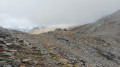
(2) Continue the ascent south-westwards through scenery that becomes increasingly rocky. Go round an unnamed peak (elevation 2580) on the left and head west-south-west to reach the pass.

(3) Follow the direction indicated by Sign No. 49 carefully. Initially, this is the same path as the one leading to the Giübin summit. You will find another Sign No. 49 at the fork situated directly below the summit.

(4) Turn right (south-west) and follow the ridge across large scree slopes. Keep a close eye out for the white-red-white markings. This will take you to the Col de Posmeda.

(5) Follow a much more pleasant path westwards to a fork in the path near a building.

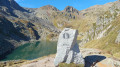
(6) Turn left (west) and leave the building on your right. Descend gently at first, then more steeply to reach the Lago della Sella dam.

(7) Walk along the crest of the dam.

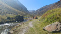
(8) On the other side, follow a track to the left, which soon gives way to a path.

(9) At the junction, carry straight on. Walk westwards to the shore of Lake Piazza.

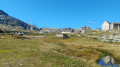
(10) Turn left, passthe Albergo San Gottardo and arrive immediately atthe Ospizio San Gottardo (E).

Waypoints

  1. S : mi 0 - alt. 6,827 ft - Vermigel Hütte
  2. 1 : mi 0.24 - alt. 6,860 ft - Sign No. 49 – Fork in the road
  3. 2 : mi 1.1 - alt. 7,431 ft - Zingelfurtfleu (2232 m)
  4. 3 : mi 3.09 - alt. 9,022 ft - Sign No. 49 - Sella Pass
  5. 4 : mi 3.26 - alt. 9,160 ft - Sign No. 49 – Junction - Giübin (2776 m)
  6. 5 : mi 3.84 - alt. 8,599 ft - Passo Posmeda
  7. 6 : mi 4.19 - alt. 8,445 ft - Intersection – Baracca Posmeda
  8. 7 : mi 5.54 - alt. 7,585 ft - Dam at the - Lago della Sella
  9. 8 : mi 5.74 - alt. 7,562 ft - Sign No. 49 - Lago della Sella
  10. 9 : mi 6.33 - alt. 7,208 ft - Crossroads
  11. 10 : mi 7.24 - alt. 7,031 ft - T-junction - Lago della Piazza
  12. E : mi 7.32 - alt. 7,034 ft - Ospizio San Gottardo – Albergo San Gottardo - Ospizio del San Gottardo

Notes

Hike completed by the author on 14 September 2026

The route for this hike follows the Vier-Quellen-Weg, which is marked on Swiss maps.

Signposting: at every major junction, you will find signposts:
- Sign No. 49 or P49 with a sticker No. 49 indicating this trail.
- R sign: a yellow sign with a hiker pictogram

Before setting off, it is advisable to check the Suisse Topo website for any trail closures and diversions. This information is updated in real time.

As well as the Visorando app, you can also download the free swisstopo app, where you will find this information too.

Transport: Timetables

Weather: before setting off, check the Swiss Weather Service or Météo Blue

Hiking equipment, particularly good walking boots.

Accommodation: Ospizio Gottardo

Worth a visit

  • The Sella Pass
  • Lake Sella
  • Mount Giübin
  • Posmeda Pass
  • The Saint Gotthard Pass

Other walks in the area

For more walks, use our search engine .

The GPS track and description are the property of this route's author. Please do not copy them without permission.