


jluca

 Visorando Member
 Premium user
 Sign up:
Published route(s)
 From Gilhoc-sur-Ormèze to Grozon in a circular route along the ridges
 9.03 mi
 +1,463 ft
 -1,467 ft
 5h 25
5h 25
 Moderate
 Departure from Gilhoc-sur-Ormèze (Ardèche)
A fairly wild hike, with little tarmac, from the countryside to the ridges, with goodGR® yellow-white country signposting.
Circular starting from Col des Fans
9.95 mi
+764 ft
-787 ft
5h 15
Moderate
Departure from Alboussière (Ardèche)
A pleasant, fairly flat route with little tarmac and some lovely views in beautiful countryside. The natural surroundings are stunning and the route is varied.
The only downside is the 500 m stretch along the D533 at the end of the route to return to the starting point. It is possible to reach point 1 from point 8 to avoid the D533, adding an extra kilometre.
Up to (6), the signposting is adequate, but after that it is sometimes discreet, so pay attention. A map and GPS are useful on this section.
Col de la Buffaz, Col de l’Ovine and Glières plateau, circular route
10.04 mi
+2,936 ft
-2,936 ft
7h 10
Moderate
Departure from Thônes (Haute-Savoie)
A beautiful but long hike with magnificent views of the Aravis range, the Glières plateau, Mont Lachat, La Tournette, and Mont Blanc in the background. The climb to the Col de l’Ovine is challenging as it is long and steep, but the view is well worth the effort. The rest of the hike is gentle, apart from a short climb on the path after La Rosière. This forest path has a few steep sections. Signposts are placed at all junctions.
From the fortified house of La Frette to the Château du Touvet, a circular route
 4.66 mi
+938 ft
-928 ft
2h 55
Moderate
Departure from Le Touvet (Isère)
4.66 mi
+938 ft
-928 ft
2h 55
Moderate
Departure from Le Touvet (Isère)
An easy route in the hills above Le Touvet, from one castle to another, with the first part in the forest and the return via the hamlets on the road, including 250 m on the D29, but without any danger.
Circular route from Château du Touvet to Château du Montalieu
 4.11 mi
+807 ft
-797 ft
2h 35
4.11 mi
+807 ft
-797 ft
2h 35
 Easy
Departure from Le Touvet (Isère)
Easy
Departure from Le Touvet (Isère)
An easy circular route, half through woodland and half along small tarmac roads, from one castle to another. This circular route can be combined with another circular route, from the fortified house of La Frette to Château du Touvet.
Circular route around Sainte-Marie-du-Mont
5.27 mi
+1,050 ft
-1,033 ft
3h 20
Moderate
Departure from Sainte-Marie-du-Mont (Isère)
A route offering stunning views of the Chartreuse, Belledonne, Maurienne and, time and again, Mont Blanc (especially when the trees have no leaves or have shed them).
Numerous streams and torrents create a lovely atmosphere, but require good footwear, unless you fancy having wet feet.
Unfortunately, my route description seems to be causing problems, so I strongly recommend using GPS and the map on your phone!
The Jonier and Ferrière ridges, a circular route from the Col de l'Arzelier
 5.21 mi
+1,946 ft
-1,965 ft
4h 05
Moderate
Departure from Le Gua (Isère) (Isère)
5.21 mi
+1,946 ft
-1,965 ft
4h 05
Moderate
Departure from Le Gua (Isère) (Isère)
A circular route mainly through woodland with magnificent panoramic views. Some sections are steep, though not precipitous.
Note: this hike begins with a 125-metre descent and ends with a 125-metre climb, but the setting is lovely and it’s a very pleasant walk.
A circular on the heights of Chapareillan
6.55 mi
+1,434 ft
-1,424 ft
4h 15
Moderate
Departure from Chapareillan (Isère)
A charming circular route in the hills above Chapareillan, facing Mont Blanc, between vineyards and forests, from village to village. This route, in the direction described, offers a long, gentle climb and ends with an hour-long descent, the first part of which is sustained without being very steep. A third of the route is on quiet tarmac roads, so 1 km of what I would call a tarmacGR®.
Please note: several hikers suggest doing the route in the opposite direction to climb the steepest part, especially if the ground is wet. In this case, a map and GPS are recommended as the description loses its usefulness.
Montvernier hairpin bends and the Bérold circuit from Pontamafrey
 6.20 mi
+1,762 ft
-1,739 ft
4h 25
Moderate
Departure from Pontamafrey-Montpascal (Savoie)
6.20 mi
+1,762 ft
-1,739 ft
4h 25
Moderate
Departure from Pontamafrey-Montpascal (Savoie)
An unusual hike, half tarmac (with little traffic) and half footpath, through some remarkable landscapes. Beautiful views of the Montvernier hairpin bends, the Bérold Tower, the Aiguilles d’Arves and Saint-Jean-de-Maurienne. The descent along the Ravoire torrent is also well worth a look.
Circular route between Saint-Jean-d'Hérans and the Drac Gorges.
 5.05 mi
+1,181 ft
-1,178 ft
3h 20
Moderate
Departure from Saint-Jean-d'Hérans (Isère)
5.05 mi
+1,181 ft
-1,178 ft
3h 20
Moderate
Departure from Saint-Jean-d'Hérans (Isère)
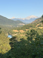
A beautiful variety of landscapes, beautiful views of the Drac gorges, the upper reaches of Lake Monteynard and, of course, the Vercors, Oisans, Obioux, etc.
Yellow markings will guide you along the way, and there are numerous hiking signs to help you find your way.
Cabins at Combe du Fer and Serre du Play, circular trail
5.42 mi
+1,775 ft
-1,759 ft
4h 00
Moderate
Departure from Corrençon-en-Vercors (Isère)
A hike through the forest and across the sharp limestone pavement, in the realm of the Vercors cave explorers, off the beaten track, with few markings and no signs.
The view opens up between the two huts, offering a spectacular view of the wild Vercors.
The climb to the Combe du Fer hut from the car park requires a GPS and a map (offline!) as there are many paths and the various junctions are not described here.
Lac de Crop via Le Rafour – a circular route from Pré Marcel
 6.89 mi
+3,035 ft
-3,015 ft
5h 50
6.89 mi
+3,035 ft
-3,015 ft
5h 50
 Difficult
Departure from Sainte-Agnès (Isère) (Isère)
Difficult
Departure from Sainte-Agnès (Isère) (Isère)
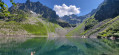
A lovely circular route that takes you above Lac de Crop, offering a bird’s-eye view. The route is partly off the beaten track, but the path is sometimes steep, difficult to follow, and even slightly exposed on a short section just after Le Rafour. You’ll need sure-footedness and good footwear!
I’d also recommend taking a map and a GPS.
Circular route via the hamlets of Sollières and Ruche
4.42 mi
+981 ft
-974 ft
2h 55
Easy
Departure from Goncelin (Isère)
A circular route in a secluded area, passing through two pretty hamlets. Two-thirds of the route is on tarmac roads, but there is very little traffic as they are dead-ends.
Circular from Col du Sénépy to Pierre Plantée
 6.33 mi
+1,362 ft
-1,345 ft
4h 05
Moderate
Departure from Susville (Isère)
6.33 mi
+1,362 ft
-1,345 ft
4h 05
Moderate
Departure from Susville (Isère)
A beautiful hike with magnificent views of the Trièves and Dévoluy regions, on a sunny hillside, ideal for the off-season. The slopes are moderate but the atmosphere is mountainous. It is possible to climb to the summit of Sénépy along the way.
Circular route starting from the Tour d'Avalon
5.57 mi
+1,119 ft
-1,138 ft
3h 30
Moderate
Departure from Saint-Maximin (Isère) (Isère)
A lovely start from the beautiful Tour d'Avalon, followed by a fairly varied circular route through forests and villages.This route is difficult to describe due to the numerous roads and paths in this area, so a GPS and an online map (for example, downloaded via the Visorando app) are recommended. The Tour d’Avalon serves as a good landmark.
Tour de la Villette between Theys and the Col du Barioz
5.83 mi
+1,073 ft
-1,076 ft
3h 35
Moderate
Departure from Theys (Isère)
Circular route through the beautiful valley between Theys and the Col du Barioz, ideal for a sunny winter’s afternoon. Yellow signposts mark the route, as do wooden ‘Tour de la Villette’ signs.Note: half of the route is on tarmac roads (narrow and with little traffic).
A circular route in Champsaur via the Chapelle des Pétètes
6.59 mi
+1,158 ft
-1,188 ft
4h 00
Moderate
Departure from Les Infournas (Hautes-Alpes)
A varied countryside walk with spectacular views over the Champsaur and the Dévoluy. Unfortunately, there are a few tarmac sections, but these roads are very quiet. The route passes the Trois Croix viewpoint and the curious Chapelle des Pétètes, also known as the Chapelle Saint-Grégoire.
From Chapelle-du-Bard to Pont du Diable via Beauvoir
6.13 mi
+1,601 ft
-1,591 ft
4h 15
Moderate
Departure from La Chapelle-du-Bard (Isère)
A lovely hike with beautiful views and scenery, quite varied, a little bit of tarmac but not much, with good signposting. Doable almost all year round, except in muddy conditions after rain, of course. At the Pont du Diable, you will cross the Dauphiné-Savoie border, with its pretty, colourful boundary stone. By whom?
Circular Saint-Pierre-d’Entremont loop, via the bottom of the Cirque de Saint-Même
9.14 mi
+1,804 ft
-1,781 ft
5h 45
Moderate
Departure from Saint-Pierre-d'Entremont (Savoie) (Savoie)
A circular route around Saint-Pierre-d’Entremont via the Cirque de Saint-Même, returning via the Torrent du Cozon gorges. The views are magnificent all along the way, and you reach the cirque on foot, rather than by car, to see the first waterfall. The route is marked and well signposted with numerous signs.
Circular via the summit of Sénepy, on the southern slope
 8.23 mi
+1,913 ft
-1,880 ft
5h 25
Moderate
Departure from Susville (Isère)
8.23 mi
+1,913 ft
-1,880 ft
5h 25
Moderate
Departure from Susville (Isère)
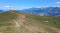
A hike to reach the summit of Sénépy via good paths or trails, mainly on the southern slope. A very beautiful hike for cool or cold seasons, with splendid views.
Circular route between La Chapelle Saint-Christophe and Saint-Pierre-d'Allevard
4.81 mi
+1,683 ft
-1,677 ft
3h 40
Moderate
Departure from Saint-Pierre-d'Allevard (Isère)
A pleasant walk, with a bit of an uphill climb but a lovely atmosphere as you pass through hamlets, heading towards a chapel that apparently doesn’t exist. The views are lovely in any case, and the hamlets are pretty too. A very pleasant change of scenery.