Country:

 City:


Park in the hamlet of Les Pras, in the Les Rochettes car park (signposted), which has 7–8 spaces, near the recycling bins.
(S/E) Return to the nearby D113 (about 30 m to the east), ‘which you no doubt arrived on’, cross it carefully, and head up the path into the forest. Note the sign pointing towards the Col du Nizet and the Pierre-Percée. A little further up, go through a gate and reach a flat area with several trailheads. Ignore the first one on the right (Yellow Cross), but look out for a small, inconspicuous path that starts just above it, also heading to the right. Climb up and reach the ridge.
(1) Follow it to the Col de Nizet sign (elevation 1091 on the IGN map).
(2) Continue along the ridge, heading south towards the Pierre Percée. You’ll reach a bend in a tarmac road.
(3) Follow it to the right for about twenty metres until you can see the rest of the path, marked by a sign for the Pierre Percée. See Practical Information.
Continue southwards until you reach a junction with a sign for Les Chareyres (the IGN map shows ‘Le Crey’).
(4) Leave the ridge and head down to the right, into the forest, along a straight and somewhat steep path towards Notre-Dame-de-Vaulx. You’ll reach a small tarmac road signposted ‘Les Oches’.
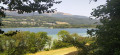
(5) Follow this down for a few hundred metres, then find the continuation of the path which descends into the forest on your right. You’ll rejoin the same road further down and cross it again. Shortly afterwards, you’ll come to another road; cross this and head down to reach a pretty circular pond, the Bassin du Père Borel.
(6) At this fork in the road, around the pond, head up to the left (it is also possible to go right) to reach a tarmac road in Notre-Dame-de-Vaulx. Follow it down to the right and continue to the edge of the village, at the hairpin bend.
(7) Leave the road and take a path to the left. A sign points towards Saint-Jean-de-Vaulx, the next stop. Walk northwards along this path through woods and meadows. After the sewage treatment plant, the path is joined by another path coming from the right. Continue for about a hundred metres until you reach a 90° bend to the left.
(8) Join the D113 (signposted ‘Les Perrins’), cross the road carefully, then head up a track towards Saint-Jean-de-Vaulx until you reach a major crossroads with no clear signposting.
(9) Enter the hamlet of Les Perrins via the tarmac roads, head up the Chemin de la Côte on the right, then take the Route de Chambel, and continue in this direction, following the yellow markings, until you reach the four-way junction.
(10) Turn left, then right, onto the D113c (Route de Saint-Jean), and you’ll reach a wash house (Lavoir du Villaret). Continue for about a hundred metres until you reach the junction.
(11) Carry on in the same direction (signposted for Saint-Jean-de-Vaulx to the north), and you’ll immediately spot a path running alongside the road, below it. Follow this path, leaving Le Villaret behind, and carry on until you reach the entrance to Saint-Jean-de-Vaulx and its church.
(12) Pass the school on your left (ignore the signposting for a few minutes, as it directs you to pass the school on your right), then take a wide bend to the right. Pass beneath the town hall, go down a flight of steps, and head down onto the road just before a hairpin bend, above the village bread oven. Then head north-east, following this road down to the junction sign, where there are numerous signs on the left-hand side.
(13) Continue downhill, straight ahead, on the D113c; pass the sign marking the exit from Saint-Jean-de-Vaulx, and reach a right-hand bend at a place called Le Pas des Blanches.
(14) Leave the road and follow the track towards the hamlet of Les Pras, the starting point. At the entrance to the hamlet, go down the tarmac road to reach the Rochettes car park (S/E).

 Visorando Member


 Easy