Country:

 City:
City:


Park at the Col de la Core, accessible via the D17; plenty of spaces available.
(S/E) From the Col de la Core, head down the D17 road towards Bethmale (northwards) and look out for the path that climbs up through the pasture on the right-hand side, about fifty metres past the bend. Take this path, crossing the fence (wire with an insulated handle at this point). Follow this path as it enters the forest, climbing steadily but gently, then remaining almost level for about 3 km, until you reach a junction with a rutted forest track.
(1) Follow this track downhill for 30 m to rejoin the path on the other side and cross a fence; continue along the path you have rejoined.
(2) At this barely marked Fork in the road, turn sharply right and head south-east uphill to reach the ridge at the Col de Bas.
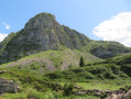
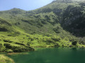
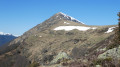
(3) Follow the ridge to the left (north-north-west) to reach a small, rounded summit, the Tuc des Pelades. The view is magnificent across these pastures dotted with large granite boulders.
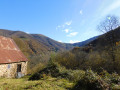
(4) Continue along the ridge heading north-west, on a gentle descent. Look out for a small building with an aerial on it. The track to follow runs past the building, descending to reach the Col de l’Arrech, visible to the north-west.
(5) At the Col de l’Arrech, the turning point, there are two options:
Option 1: follow the clearly visible track (Route Forestière de la Grande Rédille), which heads south-southeast to join the tarmac D17 road, 1 km below the Col de la Core. In this case, you must head up the D17 from IGN elevation 1315 to the Col de la Core car park (IGN elevation 1395).
Option 2: follow the track shown on the map, which branches off slightly to the left of this track. A slight dip in the ground hints at the path through the grass, and a trail through the ferns then reveals it. The track remains visible on your right for a few hundred metres and can still be reached via the forest if the path becomes unclear. First along the edge of the woodland on a gentle incline, then through the forest on level ground, the path leads to the junction you passed on the way there below the Col de Bas.
(2) Carry on straight ahead, in the opposite direction to the outward journey, and you’ll reach the Col de la Core and its car park (S/E).
 Visorando Member