


ardechom

 Visorando Member
 Premium user
- Gender: woman
Sign up:
Published route(s)
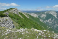
 But de l’Aiglette from Marignac-en-Diois
 8.30 mi
 +3,307 ft
 -3,281 ft
 6h 40
 Difficult
 Departure from Marignac-en-Diois (Drôme)
A beautiful walk offering a wide variety of landscapes and splendid panoramic views from the ridge of the But de l’Aiglette, over the peaks of the Vercors, the Diois and the Baronnies, and across the Drôme and Quint valleys.
Around Rompon
 11.59 mi
+1,942 ft
-1,913 ft
7h 00
 Moderate
Departure from Rompon (Ardèche)
If you’re not keen on small tarmac roads, this walk won’t be for you. However, these relatively quiet stretches of road in no way detract from the beautiful views from the ridges.
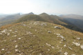
Serre de Montué ridges and Urle cliff ridges from Font d'Urle
 7.07 mi
+1,670 ft
-1,660 ft
4h 40
Moderate
Departure from Bouvante (Drôme)
A very beautiful hike on the ridges of Font d'Urle: peaks of Vercors, Dévoluy, Mont Ventoux and Mont Blanc on a clear day. Beautiful panorama of the magnificent and very rugged cliffs of Font d'Urle.
Please note: During the summer months, there are numerous herds and patous (shepherd dogs).
Even dogs on a leash are prohibited by the department from 1 June to 30 October.
Close the gates to the animal enclosures securely.
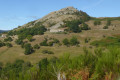
The Don Volcano from Marcols-les-Eaux
 8.98 mi
+1,614 ft
-1,624 ft
5h 30
Moderate
Departure from Marcols-les-Eaux (Ardèche)
Starting from Marcols, after a climb through woodland and sheep pastures, the ascent to the summit of the Don volcano (a basalt neck featuring the ruins of a castle built in the12th century and a viewpoint) offers an exceptional panorama of the Monts d’Ardèche (Gerbier, Mézenc, Sara) and, on a clear day, the Alps (Mont Blanc, Oisans...).For the return journey, there are two options. The one described here: those who dislike tarmac should avoid it and choose thesecond option (practical information).
Tête de la Dame - Bec Pointu - Courcousson from Les Arbods
 9.34 mi
+3,593 ft
-3,593 ft
7h 25
Difficult
Departure from Omblèze (Drôme)
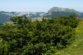
A magnificent ridge hike offering a wide variety of landscapes and sublime panoramas in a mountainous environment.
This route is closed to hikers from 1 November to 1 May, by order 0601.
Roche Chérie via the Orgues de Bauzon
 9.65 mi
+1,558 ft
-1,549 ft
5h 50
Moderate
Departure from Saint-Pons (Ardèche) (Ardèche)
This route runs along the foothills of the Coiron massif on paths that are not marked on IGN maps but nevertheless exist, with very improbable markings.
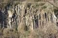
The path runs alongside the beautiful basalt columns or Orgues de Bauzon parallel to the Chaix stream, then climbs back up to the plateau where the panoramic views are superb. The descent via a rocky ridge leads to Roche Chérie: a remnant of the massif's significant volcanic past. A small chapel is built against the neck.
The summit of Charray Mountain from Veyras
 9.50 mi
+1,703 ft
-1,699 ft
5h 50
Moderate
Departure from Veyras (Ardèche)
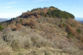
Starting from Pierre Plantée, this beautiful route offers magnificent panoramic views of Coiron, the Ouvèze and Mézayon valleys, Baronnies and Vercors. An interesting discovery is the site of the former Priory of Charray.
Please note that some sections of the balcony trail may be uncomfortable for those prone to vertigo.
Between Monts du Matin and Combe d'Oyans in Rochefort-Samson
 9.35 mi
+2,910 ft
-2,907 ft
6h 50
Moderate
Departure from Rochefort-Samson (Drôme)
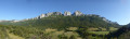
A very pretty and long hike around the Combe d'Oyans with beautiful panoramic views of the cliffs of Musan, Pierre Chauve and L'Epenet. The ruins of Rochefort-Samson Castle offer a beautiful view of the valley. Information board at the summit.
 The Baudinard Gorges from Artignosc-sur-Verdon
 10.38 mi
+164 ft
-161 ft
4 hrs
Moderate
Departure from Artignosc-sur-Verdon (Var)
A magnificent and spectacular canyon lined with sheer or overhanging cliffs 100 to 150 metres high, with gaps of around ten metres. This very wild canyon forms the first part of the Lower Verdon Gorges.The rock faces are pierced by numerous caves, the entrances to which can be seen from the bed of the Verdon, where the water flows out at a temperature of between 8 and 10°C from the dam (see § Practical Information).
Around the Ajoux Rock
 8.54 mi
+2,096 ft
-2,080 ft
5h 45
Moderate
Departure from Pourchères (Ardèche)
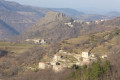
A beautiful and varied hike in the Monts d'Ardèche Regional Nature Park. The superb site of the Rocher d'Ajoux.
The Serre de Barrès and Dent de Rez from Saint-Remèze
 8.75 mi
+1,437 ft
-1,437 ft
5h 15
Moderate
Departure from Saint-Remèze (Ardèche)
A beautiful hike typical of southern Ardèche, alternating between stony paths, sharp limestone pavement, rocks, trails, tracks and small roads, starting from the charming little village of Saint-Remèze, which was once fortified. The "castle", the Romanesque church, a few fountains and a wash house are some of the highlights of the visit.
Beautiful views of the Rocher de Sampzon, Mont Lozère, the Baronnies, Ventoux and Vercors.
The ridges of Saint-Andéol-de-Berg
 8.39 mi
+1,017 ft
-1,017 ft
4h 45
Moderate
Departure from Saint-Andéol-de-Berg (Ardèche)
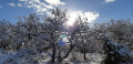
A beautiful hike on the ridges of the Monts de Berg, offering some lovely views. A visit to the well-restored village is a must: cobbled streets with arcades connecting the façades, shops at the bottom of old houses, an old oven. In terms of nature, the town is built at the foot of a typical Mediterranean forest, which offers an astonishing spectacle as you walk through its plots, separated by clapas, lavender, almond trees, mulberry trees and olive trees.
Col de Corne Noire and Pointe de Combe-Bénite
 5.01 mi
+1,719 ft
-1,719 ft
3h 50
Difficult
Departure from Granier (Savoie)
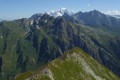
A superb, wild hike along the ridge, which is at times narrow and exposed. The summit offers a magnificent 360° panorama of Mont Coin, the Roc de la Charbonnière, Mont Blanc, the peaks and the Tarentaise valley.
This walk features sections of very steep terrain which may be dizzying for those prone to vertigo.
Grand Mont via the Rognoux mountain pastures
 9.40 mi
+4,075 ft
-4,101 ft
7h 50
Difficult
Departure from Beaufort (Savoie) (Savoie)
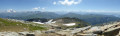
At an altitude of 2,686 metres, this imposing summit is the highest point in the south-western part of the Beaufortain massif.
A magnificent hike offering exceptional, breathtaking views of Mont Blanc, Grand Combin, Grand Paradis, Vanoise, Écrins and Grandes Rousses, Lauzière, Chartreuse, Bauges, Tournette and Aravis.
For experienced hikers with a good sense of direction, to be undertaken only in good weather.
Pass and summit of Roche Plane
 7.28 mi
+3,379 ft
-3,353 ft
6h 15
Moderate
Departure from Beaufort (Savoie) (Savoie)
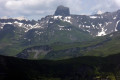
A very beautiful hike leading to the summit of Roche Plane, from where, on a clear day, a superb view stretches out over Mont Blanc, the Beaufortain peaks including the famous Pierra Menta, the Aravis, the Bornes, Mont Charvin, Les Saisies and the Aiguille Croche.
For walkers accustomed to walking in mid-mountain terrain, with no fear of heights.
The Musan mountain in Beauregard-Baret
 8.23 mi
+3,002 ft
-3,025 ft
6h 25
Difficult
Departure from Beauregard-Baret (Drôme)
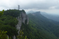
Almost entirely through undergrowth and forest, this pretty, fairly challenging hike offers beautiful views of the Vercors and the Romans valley on a clear day. The ridge route, passing by the Rocher de Chantemerle where the Beauregard TV transmitter is located, is a succession of ascents and descents, sometimes close to or far from the cliffs, sometimes over rocks or sharp limestone pavement.
Around Souspierre
 9.80 mi
+2,638 ft
-2,638 ft
6h 50
Difficult
Departure from Souspierre (Drôme)
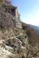
For experienced hikers, this is a beautiful hike, partly through the woods on unmarked trails. After a very beautiful passage along the ridge, they lead to cliffs followed by a dizzying descent into a rocky ridge to the Grotte de l'Ermite, a natural excavation in the rocks. Above, stand the summit of Châtelard and the ruins of an ancient watchtower dating from the Middle Ages, destroyed during the Wars of Religion. The panoramic view over the valley is superb.
Around La Garde-Adhémar
 7.61 mi
+928 ft
-958 ft
4h 20
Moderate
Departure from La Garde-Adhémar (Drôme)
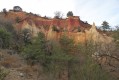
A beautiful route for exploring history and its vestiges. The geology of a little-known site (very beautiful passage through the ochre cliffs of a mini-Colorado). Gallo-Roman cult at the Val des Nymphes, springs and priory. Lapidary tanks reminiscent of ancient work dating back to Gallo-Roman times (millstones, known as "sacrificial stones", ancient wine presses dating from late Antiquity to the 12th or 13th century). Medieval fiefdom of the Adhémar family in the 12th century.
Roche Chérie in Saint-Pons
 6.35 mi
+1,135 ft
-1,142 ft
3h 55
Moderate
Departure from Saint-Pons (Ardèche) (Ardèche)
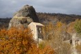
This route runs along the foothills of the Coiron massif on existing but not very obvious paths. Follow the yellow markings carefully.
The route passes through some beautiful basalt columns, crosses the plateau with its superb panoramic views, then descends via a rocky ridge to Roche Chérie: a remnant of the massif's significant volcanic past. A small chapel is built against the neck.
Monte Scaletta via the Roburent lakes
 10.08 mi
+3,550 ft
-3,543 ft
7h 45
Difficult
Departure from Larche (Alpes-de-Haute-Provence)
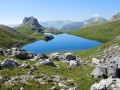
A magnificent and very varied hike, offering superb panoramic views of numerous peaks and lakes.
Numerous military remains bear witness to the strategic importance of this summit (bunkers, shelters, tunnels, cable car with the wheel still in place).
The return route, equipped with chains and handrails on a fairly short section, then follows a splendid balcony path in a dolomitic landscape.
This is an aerial route, so you must not be prone to vertigo.
La Tête de Viraysse and the military fortifications at Saint-Ours
 11.22 mi
+3,212 ft
-3,215 ft
7h 55
Moderate
Departure from Meyronnes (Alpes-de-Haute-Provence)
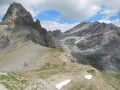
At an altitude of 2,772 metres, the Tête de Viraysse and its high military fortifications offer a magnificent panorama of Italy, the Mercantour and the Ubaye in a rugged mountain landscape between the Meyna and the rocks of Saint-Ours.
Le Serre Chauvière via the Col du Royet, La Fescle, the Colombe trail
 12.31 mi
+3,159 ft
-3,150 ft
8h 25
Moderate
Departure from Aurel (Drôme)
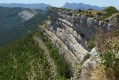
On a clear day, the Serre Chauvière plateau offers a magnificent 360° panorama of the peaks of the Devoluy, Vercors, Baronnies and Diois.
The Balcon de la Colombe is a very pretty trail.
The Roc de Gourdon
 10.15 mi
+1,978 ft
-1,969 ft
6h 25
Moderate
Departure from Gourdon (Ardèche) (Ardèche)
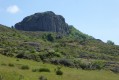
A lovely walk through very wild countryside. The Roc de Gourdon, with its ship’s-bow-like silhouette—a remnant of intense volcanic activity—is a superb promontory offering a 360° panorama of the Boutières, the Cévennes and the Bas-Vivarais. The path leading up to the summit of the Roc de Gourdon has now been cleared. It differs very slightly from the original route but is clearly marked amongst the blackthorns.
(It would be a good idea to bring a small pair of secateurs, as we do, to keep this lovely little path in good condition and maintain it.)
The ridges of Labastide-sur-Bésorgues
7.93 mi
+2,123 ft
-2,119 ft
5h 30
Moderate
Departure from Labastide-sur-Bésorgues (Ardèche)
Superb hike on the Cime de Rouyon and the Rocher de Faux-Fay. Splendid panorama on the sides of the Bésorgues valley where paths, paved slanting streets, terraces and pastures draw the Ardèche mountain landscape: exceptional and wild landscape, magnificent basalt rocks, streams, torrents, impetuous waterfalls.
The terrain: valleys, gorges and streams around Saint-Laurent-sous-Coiron
 11.94 mi
+1,801 ft
-1,804 ft
7h 05
Moderate
Departure from Saint-Laurent-sous-Coiron (Ardèche)
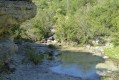
A long but very beautiful hike offering varied landscapes and superb panoramic views. This route follows paths and tracks leading from greenhouses to gorges, with small fords and abundant little streams to cross.
Please note, however, that some sections of the circuit are unmarked and require a good knowledge of map reading and orientation.
Bois de Laoul, Ravin de Bardalène and Rimouren balcony trail
 8.74 mi
+1,207 ft
-1,230 ft
5h 05
Moderate
Departure from Bourg-Saint-Andéol (Ardèche)
Here, there are no spectacular 360° panoramic views, but a very pleasant walk through the Bois de Laoul forest along wide, easy tracks as well as lovely, shaded, winding paths.The route takes you past ravines, a magnificent and wild balcony path overlooking the Gorges du Rimouren with its superb cliffs, and a mule track, with some beautiful views of the Rhône valley from Serre-Court.A walk best suited to winter.
Please note: This walk passes through a sensitive wildlife area; please keep a low profile and follow the signs along the trail.
The Maladrerie des Templiers in the Gorges de l'Ardèche
 9.42 mi
+1,919 ft
-1,916 ft
6h 00
Difficult
Departure from Le Garn (Gard)
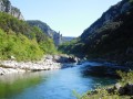
A very beautiful walk, partly along the river, leading to the exceptional site of La Maladrerie, situated opposite the Cirque de la Madeleine. Ruins of an ancient monastery, probably dating from the 12th century, with an uncertain origin. Fact or myth of the Knights Templar?
Follow the yellow markings on the ground carefully between (6) and (7), and avoid this route during periods of high water in the Ardèche. As the riverbed is subject to change, some sections of the route may be difficult to access (water, branches, mud, etc.).To check water levels and flow rates: https://www.rdbrmc.com/hydroreel2/statio...
On the trails of the Ardèche Gorges
 7.47 mi
+1,296 ft
-1,270 ft
4h 35
Difficult
Departure from Labastide-de-Virac (Ardèche)
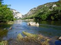
A beautiful hike in the heart of the Ardèche Gorges, during which you will:- descend a valley, follow the river along a path equipped with cables and ladders for a short section. Cirques, cliffs, small caves, rocks, needles, rapids, sandy or pebble beaches follow one after another. Many birds inhabit the cliffs.- climb back up another beautiful valley, offering some stunning views of the gorges and their meanders, to reach the plateau.
The Serre des Aigles in Aouste-sur-Sye
 9.39 mi
+1,115 ft
-1,142 ft
5h 15
Moderate
Departure from Aouste-sur-Sye (Drôme)
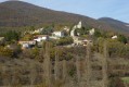
A lovely autumn hike offering numerous views of the Vercors, the peaks of the Saoû forest and the Baronnies. The route crosses rural farmland, where vineyards and fields give way to forest. There is a bit of road at the start.
La Vanige and the Clavelière ridges
 7.85 mi
+3,120 ft
-3,120 ft
6h 20
Difficult
Departure from Montferrand-la-Fare (Drôme)
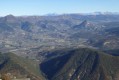
A superb hike with magnificent panoramic views: the peaks of the Baronnies, Ventoux, Dévoluy, Écrins, Queyras and Southern Alps on a clear day.
La Vanige, at an altitude of 1,391 metres, overlooks a number of nearby peaks. La Clavelière, the "border of Provence", shows its two opposite slopes.
Loop in the Vernoux region
 12.77 mi
+2,054 ft
-2,031 ft
7h 40
Difficult
Departure from Vernoux-en-Vivarais (Ardèche)
This route follows theGR®420for the most part, offering beautiful views of the Mézenc, the Gerbier des Joncs, the Baronnies and the Vercors.
Vast and beautiful wild landscapes, numerous hamlets and the ruins of the Château de la Tourette overlooking the Ève valley reveal their charms.
From Pont de Chervil, the Glo, Chalencon, Le Vigneron and "Dolce Via" route
 10.11 mi
+2,123 ft
-2,126 ft
6h 30
Moderate
Departure from Chalencon (Ardèche)
This very pretty and varied walk, offering beautiful scenery, follows old paths, tracks and quiet country lanes, climbing up to the lovely village of Chalencon before descending along the magnificent Eyrieux valley via the “Dolce Via” (a former railway line that has been converted).
The Serre Chauvière Plateau via La Colombe, Fontcouverte and Col de Royet
 10.77 mi
+2,697 ft
-2,697 ft
7h 20
Difficult
Departure from Aurel (Drôme)
On a clear day, the Serre Chauvière plateau offers a magnificent 360° panorama of the peaks of Devoluy, Vercors, Baronnies and Diois.
A major effort has been made to re-mark and clear the trails on this superb hike, which adds considerable value.
The Cheylard rock in Labastide-sur-Bésorgues
 10.35 mi
+2,831 ft
-2,844 ft
7h 15
Difficult
Departure from Labastide-sur-Bésorgues (Ardèche)
This magnificent hike in Vivarais Cévenol follows trails and ridge paths offering beautiful views. The Bésorgues river, blocked by basalt flows, has shaped some remarkable sites. The ancient lava lake of Ranc Ranier and the prismatic neck of the Cheylard rock, from which you can enjoy a vast and exceptional 360° panorama, are geological curiosities not to be missed.
The cornices of the Eyrieux
 8.89 mi
+1,726 ft
-1,713 ft
5h 35
Moderate
Departure from Saint-Michel-de-Chabrillanoux (Ardèche)
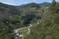
This pleasant hike along picturesque and varied trails offers superb views of the beautiful and wild Eyrieux Valley. The first part follows theGR®427.
Summit of Croix Juliau and the hamlet of Roche in Alba-la-Romaine
 10.96 mi
+1,614 ft
-1,604 ft
6h 25
Moderate
Departure from Alba-la-Romaine (Ardèche)
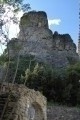
This lovely hike offers magnificent viewpoints over the Montmirail Dentelles, Mont Ventoux, the Baronnies, the Vercors, the Montagne Ardéchoise, the Coiron, the Necks of Sceautres, of Roche Chérie, of Roche, and a 360° panoramic view from the summit of Croix Juliau.
The superb medieval hamlet of Roche is well worth the detour.
Charray Mountain and ruins of the former Priory
 3.27 mi
+797 ft
-774 ft
2h 10
Difficult
Departure from Pourchères (Ardèche)
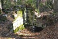
A beautiful route offering magnificent panoramic views of the Coiron, the Ouvèze and Mézayon valleys, Baronnies and Vercors. An interesting discovery of the site of the former Priory of Charray.
Circular of the Grand Bois in Flaviac
 12.62 mi
+2,713 ft
-2,707 ft
8h 10
Difficult
Departure from Flaviac (Ardèche)
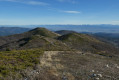
A magnificent walk through deciduous woodland offering beautiful panoramic views of the Monts d'Ardèche, the Ouvèze and Rhône valleys, and the Vercors.
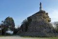
The Abbey of Aiguebelle in Réauville
 9.91 mi
+1,076 ft
-1,073 ft
5h 30
Moderate
Departure from Réauville (Drôme)
This is a pleasant family walk, the first part of which takes place in the forest and leads to the Monastery of Aiguebelle, located on the loop. The second part leads through heathland and lavender fields to a plateau where the view gradually opens up to Mont Ventoux, the Dentelles de Montmirail, La Lance, the Baronnies and, closer by, the Château de Grignan and the Donjon de Chamaret.
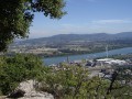
Le Serre du Gouvernement at Pouzin
 3.56 mi
+866 ft
-850 ft
2h 25
 Easy
Departure from Le Pouzin (Ardèche)
This is a very pleasant walk that quickly takes you to the Grads plateau, which overlooks Pouzin and the confluence of the Ouvèze and Rhône rivers. The path overlooking the Ouvèze valley is very pleasant but may be vertiginous for some. The ridges offer a beautiful panoramic view of the Baronnies and the Vercors.
Never stray from the route, which is now very well marked.
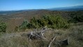
Valvignères: the Crêtes tour
 13.02 mi
+1,749 ft
-1,752 ft
7h 30
Difficult
Departure from Valvignères (Ardèche)
A long and beautiful hike through vineyards, then along the ridges of the Berg forest, offering stunning panoramic views of the Dent de Rez, the Dentelles de Montmirail, Mont Ventoux, the Baronnies, the Vercors, the Montagne Ardéchoise, and more. There are also beautiful views of the villages of Alba, Saint-Andéol de Berg, Saint-Thomé, and the Rhône Valley. To the north is the Coiron plateau with the Tour de Mirabel and Neck de Sceautres.
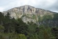
Circular Baïn in Châtillon-en-Diois
 7.21 mi
+2,028 ft
-2,018 ft
5h 05
Moderate
Departure from Châtillon-en-Diois (Drôme)
Discover the Combe de Baïn below the cliffs of Glandasse.
Loop from the Col de Mézilhac to Lachamp-Raphaël, Knoll of Montivernoux
 9.62 mi
+2,326 ft
-2,303 ft
6h 25
Moderate
Departure from Mézilhac (Ardèche)
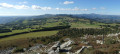
This is a beautiful hike through wild, unspoilt landscapes in the heart of the Ardéchoise mountains, with all their splendour and curiosities. The flora and fauna are rich and diverse, with some rare protected species.
On a clear day, the summit of Montivernoux offers an exceptional panorama of the Cévennes, the Monts Lozère, the Tanargue, the knolls of the Ardèche plateau, Mont Gerbier de Jonc, Mézenc, Montfol, Mont Ventoux, the Alps and Mont Blanc.
Saint-Julien-du-Gua: from Auzène to Intres, via Serre des Fontettes
 7.91 mi
+1,765 ft
-1,768 ft
5h 10
Moderate
Departure from Saint-Julien-du-Gua (Ardèche)
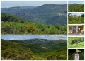
Shaded route between the banks of the Auzène and the hamlet of Intre. From the Fontettes ridges, there is a beautiful view of the Ardèche mountains, the Rocher d'Ajoux, the Volcan des Chirouzes and the Roc de Gourdon.
Tour of Ranc Chabrier and Mas Valley
8.57 mi
+1,624 ft
-1,624 ft
5h 20
Moderate
Departure from Antraigues-sur-Volane (Ardèche)
A very beautiful hike in volcanic Ardèche: magnificent scenery, rocky peaks, scree, clapas. The lava flow at Antraigues, from the young Aizac volcano (approximately 80,000 years old), invaded the Mas, Bise and Volane valleys due to the steepness of the terrain, leaving numerous traces of this eruptive period.
The promontory on which the village is built, with its variety of colours and shapes, is surprising.
Pont-en-Royans: Les Trois Châteaux, Serre Cocu
 8.62 mi
+2,959 ft
-2,943 ft
6h 30
Moderate
Departure from Pont-en-Royans (Isère)
The Trois Châteaux viewpoint offers a bird's eye view of Pont-en-Royans.From the Serre-Cocu orientation table, there is a beautiful panorama of the eastern ridges of the Vercors, from Grande Moucherolle to Grand Veymont.This hike takes place partly in the forest and follows roads to avoid private property.
Gilhac-et-Bruzac: for lovers of wild mountain landscapes
 10.08 mi
+1,555 ft
-1,558 ft
6h 00
Moderate
Departure from Gilhac-et-Bruzac (Ardèche)
Not for those allergic to tarmac!
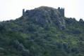
A pleasant and varied hike, some sections of which follow small tarmac roads, as is often the case in the Ardèche. The first part takes place in the forest, where only birdsong disturbs the peace and quiet of the area. The second part follows theGR®42andGR®42Btrails, offering beautiful views of the Ardèche mountains, the Vernoux valley and the Rhône valley.
Pierregourde Castle is very close to this circuit.
Saint-Médard Chapel
 9.04 mi
+2,503 ft
-2,474 ft
6h 20
Moderate
Departure from Piégros-la-Clastre (Drôme)
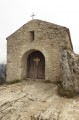
This chapel is on the ridge of the Forest of Saoû, above the ruins of an old priory. At the top of the climb from La Clastre, hikers have breathtaking views of the hanging valley of Saoû.
The lands and hamlets of Pierregourde Castle
 12.25 mi
+2,287 ft
-2,290 ft
7h 40
Moderate
Departure from Saint-Laurent-du-Pape (Ardèche)
A beautiful, long hike combining history and nature. Passing through numerous ancient hamlets that were under the authority of the Lord of Pierregourde, you will reach the ruins of the old seigneurial castle, perched on top of a rocky peak over 600 metres high.
A short detour to the wild summit of Serre de Girbaud offers a superb 360° panorama of the Rhône and Eyrieux valleys.
From Alba-la-Romaine to Neck de Sceautres: a great journey back in time
 12.97 mi
+2,060 ft
-2,070 ft
7h 45
Moderate
Departure from Alba-la-Romaine (Ardèche)
From the ancient city to the largest basalt neck in Europe, this beautiful hike takes you along a route with varied terrain: limestone plains, petrified lava blocks and the volcanic plateau of the Coiron Massif. The Sceautres neck, the jewel of the Coiron, is a basalt plug resulting from an eruption 8 million years ago. Cleared by erosion, it rises 150 metres above the valley.