But de l’Aiglette from Marignac-en-Diois

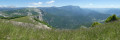
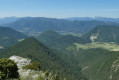
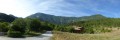
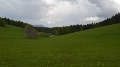
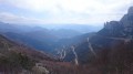
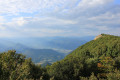
A beautiful walk offering a wide variety of landscapes and splendid panoramic views from the ridge of the But de l’Aiglette, over the peaks of the Vercors, the Diois and the Baronnies, and across the Drôme and Quint valleys.

Details

10586269
Creation:
Last update:
Last review:
  • Walking
    Activity: Walking
  • ↔
    Distance: 8.30 mi
  • ◔
    Average duration: 6h 40 
  • ▲
    Difficulty: Difficult

  • ⚐
    Back to start: Yes
  • ↗
    Ascent: + 3,307 ft
  • ↘
    Descent: - 3,281 ft

  • ▲
    Highest point: 5,052 ft
  • ▼
    Lowest point: 1,890 ft

Photos

Description of the walk

(S/E) From the small ‘hikers-only’ car park in the hamlet of Les Chambards, follow the track to the right as far as the La Fare mast.

(1) Ignore the path on the left leading up to the Col de Vassieux and continue along the track heading south towards Sainte-Croix. A little further on, ignore a track branching off to the left and carry on to the next junction.

(2) At this junction, take the track on the left running alongside the fields, towards Serre de l’Adret, until you reach the next Fork in the road.

(3) Take a wide path on the left, following the yellow and green markings closely, though they are sometimes sporadic. You will reach the Serre de l’Adret mast.

(4) Take the track on the left towards But de l’Aiglette and head for the Bouillane mast.

(5) Take the path on the left towards the Col de Vassieux and But de l’Aiglette. Make sure you stay on this path, which becomes increasingly steep.

(6) Pass via the small Collet du Chapeau Rouge (unmarked but easily recognisable) and continue the climb through the woodland, heading north. Shortly after a hairpin bend to the right, you’ll reach the Rocher de la Cru.

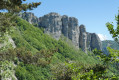
(7) Take a detour to the right (south) to the end of the rock to enjoy the view.

(8) Retrace your steps.

(7) Then continue the climb through the woods. Cross or go round several streams (water levels vary depending on the season) and carry on to a pass. To your right are the Rochers de Chironne.

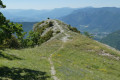
(9) Head left up through the meadows to reach the ridge of the But de l’Aiglette. Follow the ridge for a very long time (either on the path or along the edge of the cliffs, following the cairns). Make your way to the mast at the But de l’Aiglette.

(10) Begin the descent to the Col de Vassieux.

(11) At the pass, head down to the left towards Marignac. The path is very stony and quite steep (not recommended for mountain bikes or horse riders). Make your way to the Fournou mast.

(12) Follow the path to the right, heading down towards Les Chambards. Once you’ve rejoined the track you took on the way up, follow it to the right to return to the car park (S/E).


Waypoints

  1. S/E : mi 0 - alt. 1,952 ft - Chambards car park (for walkers only)
  2. 1 : mi 0.04 - alt. 1,962 ft - La Fare mast
  3. 2 : mi 0.26 - alt. 2,014 ft - Junction – Towards Serre de l’Adret
  4. 3 : mi 0.63 - alt. 1,962 ft - Fork
  5. 4 : mi 0.9 - alt. 1,995 ft - Serre de l’Adret mast
  6. 5 : mi 1.44 - alt. 1,985 ft - Bouillane mast
  7. 6 : mi 2.46 - alt. 2,894 ft - Small Pass du Chapeau Rouge
  8. 7 : mi 3.15 - alt. 3,566 ft - Access to the Rocher de la Cru viewpoint
  9. 8 : mi 3.21 - alt. 3,465 ft - Rocher de la Cru
  10. 9 : mi 4.43 - alt. 4,921 ft - Pass near the Rochers de Chironne
  11. 10 : mi 5.28 - alt. 4,826 ft - Mast at But de l’Aiglette
  12. 11 : mi 5.89 - alt. 4,357 ft - Col de Vassieux
  13. 12 : mi 8.19 - alt. 2,047 ft - Fournou mast
  14. S/E : mi 8.3 - alt. 1,952 ft - Chambards car park (for walkers only)

Notes

This route follows exactly the one shown on IGN map 3137 OT

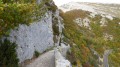
Do not attempt in foggy conditions, as the route runs along the edge of steep cliffs

There is a fountain near the Chambard car park, but is the water safe to drink?

Worth a visit

Rochers de Chironne, But Saint-Génix, But de Nève

Reviews and comments

5 / 5
Based on 2 reviews

Reliability of the description
5 / 5
Ease of following the route
5 / 5
Route interest
5 / 5
greggy26
greggy26

Overall rating : 5 / 5

Date of your route : Aug 01, 2022
Reliability of the description : ★★★★★ Very good
Ease of following the route : ★★★★★ Very good
Route interest : ★★★★★ Very good
Very busy route : Yes

The climb via Marignac is fairly steady and quite steep all the way to the Col de Vassieux
I took a detour via the But de l’Aiglette and the Chironne rocks along the ridge (with a view of the hairpin bends on the Col de Rousset), making for a 5 km round trip
At the Col de Vassieux, the slope is quite steep up to the summit of the But de Saint-Genix, but the summit is open, offering views of all the surrounding mountain ranges.
The descent is quite technical over the scree after the Pas du Bouillanain, which should be avoided in wet weather

Machine-translated

GP675
GP675

Overall rating : 5 / 5

Date of your route : Aug 07, 2021
Reliability of the description : ★★★★★ Very good
Ease of following the route : ★★★★★ Very good
Route interest : ★★★★★ Very good
Very busy route : No

A lovely walk; most of the ascent and descent are in the shade, and the view from the ridge is magnificent. There were quite a few people on the summits, but absolutely no one on the way up or down.

Machine-translated

Other walks in the area

For more walks, use our search engine .

The GPS track and description are the property of this route's author. Please do not copy them without permission.