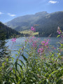
Col de Corne Noire and Pointe de Combe-Bénite

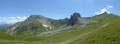
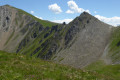
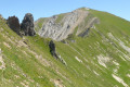
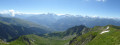
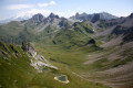
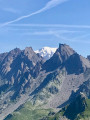
A superb, wild hike along the ridge, which is at times narrow and exposed. The summit offers a magnificent 360° panorama of Mont Coin, the Roc de la Charbonnière, Mont Blanc, the peaks and the Tarentaise valley.
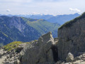
This walk features sections of very steep terrain which may be dizzying for those prone to vertigo.

Details

1454364
Creation:
Last update:
Last review:
  • Walking
    Activity: Walking
  • ↔
    Distance: 5.01 mi
  • ◔
    Average duration: 3h 50 
  • ▲
    Difficulty: Difficult

  • ⚐
    Back to start: Yes
  • ↗
    Ascent: + 1,719 ft
  • ↘
    Descent: - 1,719 ft

  • ▲
    Highest point: 8,435 ft
  • ▼
    Lowest point: 6,903 ft

Photos

Description of the walk

(S/E) From the Cormet d’Arêches car park, follow the signposted track (variant of the Tour du Beaufortain) southwards towards the Col de Corne Noire.
You’ll reach a first junction. Ignore it and continue straight ahead on the track.

(1) A few metres further on, at a fork, leave the signposted path to the right and follow the path straight ahead, heading south towards the Col de Corne Noire. Stay on this path, which is very well marked.

(2) You’ll reach a junction with theGRP® (another route on the Tour du Beaufortain). Continue to the right along the track, which is well signposted asthe GRP®, heading towards the Col de Corne Noire. A little further up, a path cuts across a bend in the track before reaching a junction.

(3) Leave theGRP® and follow a clearly visible and fairly well-marked path to the right, leading to the Col de Corne Noire, skirting the rocks of the Crête de la Raisse on the right.

(4) At the next junction, leave the path leading up to the Crêt du Rey on your right and continue straight ahead towards the Col de Corne Noire, which is now in sight.

(5) At the Col de Corne Noire, look out for the Pointe de Combe Bénite on your left. Take the path heading south-east, skirting the Roche de Corne Noire on the right. This path, which initially runs along the hillside, then climbs steeply before disappearing into the widening slope. Once in sight, reach the summit of the Pointe de Combe Bénite.

(6) From the summit of Pointe de Combe Bénite, return via the same route as on the way up to the Cormet d’Arêches car park (S/E).

Waypoints

  1. S/E : mi 0 - alt. 6,903 ft - Cormet d’Arêches car park
  2. 1 : mi 0.15 - alt. 6,949 ft - Straight ahead, off the marked trail
  3. 2 : mi 0.69 - alt. 7,110 ft - Junction with the GRP, turn right
  4. 3 : mi 1.04 - alt. 7,411 ft - Turn right off the GRP
  5. 4 : mi 1.43 - alt. 7,769 ft - Crossroads, straight ahead
  6. 5 : mi 1.96 - alt. 7,917 ft - Col de Corne Noire, path on the left
  7. 6 : mi 2.5 - alt. 8,435 ft - Pointe de Combe Bénite
  8. S/E : mi 5.01 - alt. 6,903 ft - Cormet d’Arêches car park

Notes

Only to be undertaken in dry weather.
Adizzying hike

You can set off from the Refuge de la Coire, heading south along theGRP® variant of the Tour du Beaufortain route, to point (2).

Worth a visit

Coming from Beaufort: Lake St-Guérin, Lac des Fées

Reviews and comments

5 / 5
Based on 2 reviews

Reliability of the description
5 / 5
Ease of following the route
5 / 5
Route interest
5 / 5
ecollain
ecollain

Overall rating : 5 / 5

Date of your route : Aug 30, 2023
Reliability of the description : ★★★★★ Very good
Ease of following the route : ★★★★★ Very good
Route interest : ★★★★★ Very good
Very busy route : No

The route is fairly straightforward; it’s a lovely hike with two or three exposed sections between the pass and the summit. And the reward is well worth it, with stunning panoramic views from the summit. It’s almost too short.

Machine-translated

Raoul 019
Raoul 019

Overall rating : 5 / 5

Date of your route : Oct 23, 2018
Reliability of the description : ★★★★★ Very good
Ease of following the route : ★★★★★ Very good
Route interest : ★★★★★ Very good

A lovely walk
A very good trail from the Laval car park above Granier

Machine-translated

Other walks in the area

For more walks, use our search engine .

The GPS track and description are the property of this route's author. Please do not copy them without permission.