Tête de la Dame - Bec Pointu - Courcousson from Les Arbods

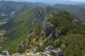
A magnificent ridge hike offering a wide variety of landscapes and sublime panoramas in a mountainous environment.
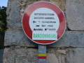
This route is closed to hikers from 1 November to 1 May, by order 0601.

Details

3455763
Creation:
Last update:
Last review:
  • Walking
    Activity: Walking
  • ↔
    Distance: 9.34 mi
  • ◔
    Average duration: 7h 25 
  • ▲
    Difficulty: Difficult

  • ⚐
    Back to start: Yes
  • ↗
    Ascent: + 3,593 ft
  • ↘
    Descent: - 3,593 ft

  • ▲
    Highest point: 4,934 ft
  • ▼
    Lowest point: 2,116 ft

Photos

Description of the walk

Car park in front of the Arbods town hall.

(S/E) Head east on the marked road opposite, following the stream towards La Tête de la Dame. Pass the houses in Pierroux and reach the crossroads of the path leading to Les Tonils.

(1) Take the marked trail climbing to the left to reach the Tonils farm. Turn right onto the well-marked ridge. The climb is steep. Stay on this trail to reach Pierre Plate, which offers a beautiful panorama.

(2) Continue climbing and pass the Bergerie des Sarnats sheepfold. Turn left to reach the Vercors plateau (altitude 1384 metres).

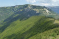
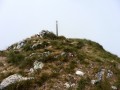
(3) When you leave the forest, at the Sarnats mast, turn right and follow the ridge to the summit of Tête de la Dame.

(4) Shortly after the summit of Tête de la Dame, take a small, unmarked path on the right, which then becomes a slightly wider trail, steep at first, passing through the Col de Pierre Rouge

(5). Continue to reach the Col des Teulières mast.

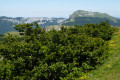
(6) Continue straight ahead towards Bec Pointu. Cross a wood, arrive on grassy slopes and continue to the summit of Bec Pointu via a final fairly steep climb up the ridge.

(7) At the Bec Pointu mast, descend from the summit by following the ridge along a very steep narrow path. Reach the Col Bernard mast.

(8) The path climbs back up towards the summit of Courcousson. Pass the first ledge. On the flat section below the rocks at the peak, veer left, almost horizontally. Find a small, barely visible path between the box trees. To help you find your way, this path roughly follows the bottom of the rocky outcrops. This section, which has been newly marked (but not signposted), is easy to cross. After a short stretch through the forest, you will reach Pré des Chaux.

(9) The Pré des Chaux mast is lying in the grass and is not very visible. Cross this vast meadow, staying on the highest part, heading south-west. Pass the Crêtes d'Omblèze marker and continue for a few metres until you reach a cairn formed by a large rock (shaped like a small menhir), which is clearly visible and easy to spot (located a few metres before the end of the ridge).

(10) This cairn marks a small three-way junction. Take the path to the right of the cairn, heading south-southwest, which runs parallel to the ridge and descends into the woods, sometimes steep and winding. Pass a rope handrail, then the path turns left along the hillside to rejoin the ridge. Continue until you reach a small pass and a clearly visible crossroads, marked Col d'Omblèze.

(11) At the Col d'Omblèze mast, turn right onto the gently sloping path down to the Col des Ayes telecommunications relay station.

(12) Continue along the track, taking a few shortcuts.
The first shortcut, a path on the left, is currently (and perhaps temporarily) impassable. Fallen trees and overgrown vegetation.
Follow the bottom of the valley, cutting across the track twice, then follow it.

(13) Reach and cross the hamlet of Les Blaches. Continue along the road on the right and return to the car park near the Town Hall (S/E).


Waypoints

  1. S/E : mi 0 - alt. 2,116 ft - Car park near the Arbods Town Hall. Close to the - Gervanne (rivière)
  2. 1 : mi 0.31 - alt. 2,172 ft - At the mast, on the left
  3. 2 : mi 1.86 - alt. 3,894 ft - Pierre Plate (flat area)
  4. 3 : mi 2.52 - alt. 4,537 ft - Mât des Sarnats, on the right
  5. 4 : mi 3.34 - alt. 4,925 ft - Tête de la Dame (1506m)
  6. 5 : mi 3.9 - alt. 4,016 ft - Col de Pierre Rouge (1227m)
  7. 6 : mi 4.78 - alt. 3,832 ft - Mât du - Col des Teulières (1170m)
  8. 7 : mi 5.45 - alt. 4,380 ft - Mât de - Bec Pointu (1342m)
  9. 8 : mi 5.74 - alt. 3,894 ft - Col Bernard (1188m)
  10. 9 : mi 6.01 - alt. 4,022 ft - Mât du Pré des Chaux lying down
  11. 10 : mi 6.33 - alt. 3,839 ft - At the cairn, on the right
  12. 11 : mi 6.7 - alt. 3,573 ft - Mast at Col d'Omblèze, on the right
  13. 12 : mi 7.04 - alt. 3,356 ft - Trail and shortcuts - Col des Ayes (1029m)
  14. 13 : mi 9.1 - alt. 2,159 ft - Hameau des Blaches
  15. S/E : mi 9.34 - alt. 2,116 ft - Car park near Arbods Town Hall

Notes

Worth a visit

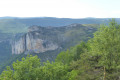
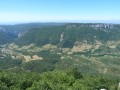
Panoramic views of the Ambel plateau, Roc de Toulaud, Font-d'Urle cliffs, But Saint-Génix, etc.
Canyon des Sauvages Gorges d'Omblèze, spectacular Cascade de la Pissoire waterfall and tufa waterfalls in the surrounding area.
Canyon des Gueulards, Cascade de la Druise waterfall, Romanesque chapel of Ansage.

Reviews and comments

4.5 / 5
Based on 9 reviews

Reliability of the description
4.7 / 5
Ease of following the route
4.1 / 5
Route interest
4.6 / 5
Pattogas
Pattogas

Overall rating : 4.3 / 5

Date of your route : Jul 23, 2024
Reliability of the description : ★★★★★ Very good
Ease of following the route : ★★★☆☆ Average
Route interest : ★★★★★ Very good
Very busy route : No

A magnificent route, thank you for allowing me to share it. I did it in very favourable weather conditions and the scenery is superb.
Nothing to complain about until Tête de la Dame, then the route to Bec Pointu was a bit surprising in terms of its relative difficulty, no doubt due to my insufficient physical abilities. The other difficulty was finding the trail (particularly between waypoints 7 and 10). This section is rarely used and the painted markings are only visible on the rocks, if at all. When I was there, the trail hadn't been cleared for some time and the overgrown vegetation hid any trail on the ground. In grassy areas, only the GPS track of the route was useful, and I must say that it was extremely accurate! Well done for the quality of the route, which allowed me to reach my destination before I was completely exhausted!
It's a remarkable route, in my opinion, and I will certainly do it again soon, more calmly, now that I've familiarised myself with it. Thank you for sharing.

Machine-translated

Canut XR
Canut XR

Overall rating : 4.3 / 5

Date of your route : May 05, 2024
Reliability of the description : ★★★★☆ Good
Ease of following the route : ★★★★☆ Good
Route interest : ★★★★★ Very good
Very busy route : No

Magnificent descent "off the beaten track", long, rare, uncrowded.

Machine-translated

jeanaymar
jeanaymar

Overall rating : 4 / 5

Date of your route : Apr 25, 2024
Reliability of the description : ★★★★☆ Good
Ease of following the route : ★★★☆☆ Average
Route interest : ★★★★★ Very good
Very busy route : Yes

It was splendid, thank you for the suggestion. Top
but too crowded as usual, and as usual, there were those who confuse the mountains with a sports field.
We didn't even get to see a mountain goat.
Fortunately, the mountains are still magnificent.

Machine-translated

FLOCH
FLOCH ★

Thank you for your prompt response.
Future hikers will thus be well informed.

Machine-translated

ardechom
ardechom

Hello,
It's done! Have a nice day.

Machine-translated

FLOCH
FLOCH ★

Hello,

Would it be possible to include this restriction in your description?
Thank you in advance.

Machine-translated

ardechom
ardechom
• Edited:

Especially since access to Tête de la Dame is prohibited via this route from 1 November to 1 May, by order no. 0601, partly for the reasons you mention, as conditions can become extremely dangerous, especially if snow is present on the plateau.

Machine-translated

Netra
Netra ★

Hello signobos, and thank you for your feedback.

Um... Neither the author nor Visorando are responsible for the weather conditions under which you undertook this hike.

Machine-translated

signobos
signobos

Overall rating : 4 / 5

Date of your route : Jan 08, 2023
Reliability of the description : ★★★★★ Very good
Ease of following the route : ★★★★★ Very good
Route interest : ★★☆☆☆ Disappointing
Very busy route : No

Hike undertaken in foggy weather, which detracted from the appeal of the route. To be redone in fair weather.

Machine-translated

bader
bader

Overall rating : 4.7 / 5

Date of your route : Oct 18, 2022
Reliability of the description : ★★★★★ Very good
Ease of following the route : ★★★★★ Very good
Route interest : ★★★★☆ Good
Very busy route : No

Five-hour hike, didn't meet anyone in the afternoon, so we continued on to the Gueulards Canyon.

Machine-translated

Dan Syl
Dan Syl

Overall rating : 5 / 5

Date of your route : Aug 30, 2022
Reliability of the description : ★★★★★ Very good
Ease of following the route : ★★★★★ Very good
Route interest : ★★★★★ Very good
Very busy route : No

A very beautiful route, varied, quite challenging and well balanced.

Machine-translated

guilh
guilh

Overall rating : 4 / 5

Date of your route : Jul 12, 2021
Reliability of the description : ★★★★☆ Good
Ease of following the route : ★★★☆☆ Average
Route interest : ★★★★★ Very good
Very busy route : No

Not much signage. No hikers with pointed beaks. A bit of a lady's head.

Machine-translated

Christian69210
Christian69210

Overall rating : 5 / 5

Date of your route : Feb 24, 2021
Reliability of the description : ★★★★★ Very good
Ease of following the route : Not used / Not applicable
Route interest : ★★★★★ Very good
Very busy route : No

Great hike with ideal spring weather for February.
Magnificent views all along the route except for the descent through the woods on the way back.
Quite a physically demanding route for experienced walkers, with a few snowfields to cross before reaching the Tête de la Dame.
Vultures flew overhead while we were having our picnic.
No problems with navigation as we used the app.

Machine-translated

Jj&Isa
Jj&Isa

Overall rating : 5 / 5

Date of your route : Aug 09, 2020
Reliability of the description : ★★★★★ Very good
Ease of following the route : ★★★★★ Very good
Route interest : ★★★★★ Very good
Very busy route : No

Very well described, with interesting points of view +++

Machine-translated

Other walks in the area

For more walks, use our search engine .

The GPS track and description are the property of this route's author. Please do not copy them without permission.