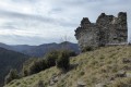
From Pont de Chervil, the Glo, Chalencon, Le Vigneron and "Dolce Via" route

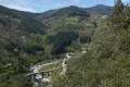
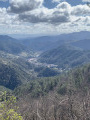
This very pretty and varied walk, offering beautiful scenery, follows old paths, tracks and quiet country lanes, climbing up to the lovely village of Chalencon before descending along the magnificent Eyrieux valley via the “Dolce Via” (a former railway line that has been converted).

Details

288126
Creation:
Last update:
Last review:
  • Walking
    Activity: Walking
  • ↔
    Distance: 10.11 mi
  • ◔
    Average duration: 6h 30 
  • ▲
    Difficulty: Moderate

  • ⚐
    Back to start: Yes
  • ↗
    Ascent: + 2,123 ft
  • ↘
    Descent: - 2,126 ft

  • ▲
    Highest point: 2,835 ft
  • ▼
    Lowest point: 915 ft

Photos

Description of the walk

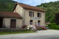
Park in the Pont de Chervil car park, opposite the old Chalencon railway station.

(S/E) With your back to the car park, head right to the hiking information sign, located at the “Dolce Via” picnic area, after crossing the junction.
Follow the yellow and red markings for theGR® de Pays de Vernoux, which follows the river.

(1) Pass by the confluence of the Eyrieux and Talaron rivers and continue towards Le Cheylard and Le Glo.

(2) At the Glo signpost, turn right towards Saint-Jean Chambre and Péallières. At the next two junctions, follow the path climbing to the right. Further on, it becomes slightly steeper; a chain has been installed on a very short, somewhat vertiginous section.
Continue through the woods, staying on this very well-marked path, cross the Glo stream and climb up the opposite side. You will reach a sign indicating a temporary diversion due to a landslide. Turn left onto this diversion path, which goes round the Péaillères farm on the left and leads to a small road of the same name.

(3) Mât de Péallières: continue on theGRP® by following the small road to the left leading to the hamlet of Glo, towards Saint-Jean Chambre and Le Freysse.
After the second left-hand bend, turn right onto a path heading north-north-west, climbing above the Glo farm and continuing to the buildings at La Pièce. The path becomes trickier due to the grass, brambles and nettles lining it. It follows the boundary wall below the house and, a little further up, joins the small road to Mourier.
Turn right onto this small road and pass through the buildings of the hamlet of Mourier.

(4) After a bend, take a path on the left (signposted ‘Serpoul l’Ancien’) leading up towards a small rocky outcrop and a small plateau.
The path continues, well signposted, through woods and vegetation sometimes overgrown with ferns, nettles... then the landscape opens up, offering some beautiful views. You reach the first houses of the hamlet of l'Aulagner, which you do not pass through.

(5) After the first house, the path turns sharply right (markings in the form of a rounded arrow on the ground, which can be misleading). Continue, ignoring the various path branches to the right or left. Reach the hamlet of Fraysse, then the small road on the right. Follow it to the signpost.

(6) Leave theGRP® and take thePR® path on the right, marked in yellow and white, towards Pracoulet and Chalencon.
Follow this wooded ridge line, heading south-southeast, ignoring the various paths that join it on the right or left until you reach a T-junction of two small roads.

(7) Head up the road to the right towards Chaumenasson, then a few metres further on, turn left onto the steps of a small path that continues to a three-way junction. Follow the path on the left, signposted ‘Oppidum’.
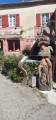
From the rampart wall above the orientation board (illegible), continue down the path to the Place de l’Église in Chalencon. A must-see visit through the narrow streets of this beautiful village with its rich heritage.
From the corner of Rue du Valla and Rue Principale, head straight down opposite, cross Rue Royale, and continue to the junction of Route de Lanteyron and Route de Chambaud.

(8) At this junction, head down Route de Chambaud to the right. At the next crossroads, by the Croix de l’Hubac, follow the small yellow and white-marked road straight ahead towards Saint-Sauveur de Montagut, le Vigneron. At the first fork, take the left-hand path, following the markings.

(8) Ignore the first track on the left leading to Chamba. The road winds in a hairpin bend, then heads towards houses belonging to the scattered hamlet of Bourdel.
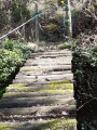
Walk past these houses. Descend along a very pretty paved slanting street winding through the woodland. Stay on this main path until you reach the "Dolce Via" (the route shown on the IGN map, which passes very close to the Vigneron farm, does not quite match the terrain, but this is not a problem as there are plenty of markers and the path is well signposted).

(10) Head back up to the right, staying on the "Dolce Via" at all times, until you reach the Pont de Chervil car park (S/E).


Waypoints

  1. S/E : mi 0 - alt. 1,027 ft - Chervil Bridge car park, opposite the station - Eyrieux (rivière) à finaliser
  2. 1 : mi 0.48 - alt. 1,056 ft - Confluence of the Eyrieux and - Talaron (cours d'eau)
  3. 2 : mi 0.83 - alt. 1,070 ft - Mât de Glo, on the right
  4. 3 : mi 1.23 - alt. 1,352 ft - Péallières, road on the left
  5. 4 : mi 2.77 - alt. 2,011 ft - Turn left towards Serpoul l'Ancien
  6. 5 : mi 3.46 - alt. 2,549 ft - On the right, arrow-shaped signposting
  7. 6 : mi 4.39 - alt. 2,707 ft - Turn right towards Pracoulet [
  8. 7 : mi 5.96 - alt. 2,605 ft - At the junction, take the road up to the right
  9. 8 : mi 6.6 - alt. 2,251 ft - Follow the Route de Chambaud to the right
  10. 9 : mi 7.17 - alt. 1,929 ft - Ignore the track leading to Chambaud
  11. 10 : mi 8.31 - alt. 922 ft - Dolce Via on the right
  12. S/E : mi 10.11 - alt. 1,027 ft - Chervil Bridge car park, opposite the station

Notes

The paths are in varying states of repair. However, the signposting is excellent.
- Hiking boots, as the ground can be slippery
- Trousers recommended rather than shorts, as the route passes through tall grass, ferns, nettles, etc.

Between (8) and (9), there is a possible shortcut by taking the first small road leading down to the right, towards Chervil.

Worth a visit

The magnificent village of Chalencon, whose history is said to date back to the Celts. A former Celtic oppidum, the site was a strategic location occupied very early on by the Gauls and Romans. Then, in the Middle Ages, under Charlemagne, it became an important administrative centre (viguerie) and a stronghold for the protection of its inhabitants.
From the 10th to the 16th century, Chalencon was a barony, with its own court of justice, to which the name of Diane de Poitiers is linked. In 1551, she established four annual fairs and a weekly market there.
During the 16th century, Chalencon was the scene of the Wars of Religion. Protestants could only practise their faith in secret.
At the time of the Revolution, Chalencon had a population of 1,500, comprising farmers, tanners, landowners, shopkeepers and traders.

Always be cautious and plan ahead when you're outdoors. Visorando and the author of this route cannot be held responsible for any accidents occurring on this route.

The GR® and PR® markings are the intellectual property of the Fédération Française de Randonnée Pédestre.

Reviews and comments

3.6 / 5
Based on 9 reviews

Reliability of the description
3.3 / 5
Ease of following the route
3.6 / 5
Route interest
4.1 / 5
CHAREYRON PHILIPPE
CHAREYRON PHILIPPE

Overall rating : 4 / 5

Date of your route : Mar 04, 2024
Reliability of the description : ★★★★☆ Good
Ease of following the route : ★★★☆☆ Average
Route interest : ★★★★★ Very good
Very busy route : Yes

A lovely walk along old, well-marked paths (often stony). No trouble finding your way with the route description and GPS track.

Machine-translated

ardechom
ardechom

Hello, I haven’t done this hike since 2020. Things have changed quite a bit since then, according to the hikers who’ve done it. Crisd describes his recent experience very well in his review dated 1 October 2023. I can’t add anything further.
Best regards.

Machine-translated

jacquetalain
jacquetalain

Hello.
As I’m planning to take a group on this hike, I’d like to know the latest news regarding Péallières/Glo!
Ardechom seems to know all about this!
Thanks
Kind regards.

Machine-translated

crisd
crisd
• Edited:

Done this Saturday, 30 September, but I did this walk three years ago – the signposts have disappeared in quite a few places!
Without a GPS, the hike must be tricky!!
Before Péailleres, to avoid going to Serre, there’s a lovely little path on the right that runs along a ledge above the stream; then you cross a small wooden bridge and have to go round the back of the house, following a wire fence – the route is marked on the IGN map,
After that, before Glo, there are no more markings and some dead wooden barriers have been put up on purpose, so of course you miss the path!! You have to take the highest path which goes over Glo.
Everything’s fine until you reach the clearing, where there are no further signs. You need to go underneath the house, following the wall; there was no one there, so no unpleasant encounters. Apparently under development in 2020, but it looks like no progress has been made!
After that, no more trouble with the GPS.
To avoid the long return journey along the Dolce Via, which is certainly pretty but it was hot, we took the very quiet Route de la Grange after Chalencon to Jonac and Pont de Chervil.
A very beautiful walk – a shame that house owners are also claiming the land as their own!!

Machine-translated

975langlademiquelon
975langlademiquelon

Overall rating : 4.3 / 5

Date of your route : Mar 31, 2022
Reliability of the description : ★★★★☆ Good
Ease of following the route : ★★★★☆ Good
Route interest : ★★★★★ Very good
Very busy route : No

A lovely hike in the Ardèche
The return via the Dolce Via was a bit long

Machine-translated

Thierryb26
Thierryb26
• Edited:

Hello,
Could this be related to the message posted on 30/09/2020 at 7.13 pm by Ardechom?

Machine-translated

Veronique de Gea
Veronique de Gea

Overall rating : 2.7 / 5

Date of your route : Mar 10, 2021
Reliability of the description : ★★☆☆☆ Disappointing
Ease of following the route : ★★☆☆☆ Disappointing
Route interest : ★★★★☆ Good
Very busy route : No

At the Glo signpost, we couldn’t find the sign for Péallières and ended up going back and forth twice, thinking we’d missed the turn-off!!! It seems the route might have been changed??? What’s the situation, please?

Machine-translated

Thierryb26
Thierryb26

Hello,
If you’re planning to do this hike, please check beforehand as a rockslide has led to the closure of the Dolce via between WPT 9 and the finish

Machine-translated

ardechom
ardechom

Hello, I don’t have any further information about the new circular route, but unfortunately, I’m afraid it will bypass that section, which is indeed superb. Without that section, the route will no longer be of any interest.
I’m sorry to hear that. To be continued...

Machine-translated

Thierryb26
Thierryb26

Hello,
Does that mean we won’t be able to use the balcony path above the Glo anymore?

Machine-translated

ardechom
ardechom
• Edited:

Hello, thank you for your feedback. I have contacted the town hall and the tourist office: the property in Péaillères has been sold and the new owner does not wish to renew the right-of-way agreement. As for La Pièce, the path is a rural track and, according to the tourist office, will form part of the new circular route currently being developed.
I am sorry for the inconvenience you have experienced.
Kind regards.
Ardechom

Machine-translated

simellimac
simellimac

Overall rating : 5 / 5

Date of your route : Aug 12, 2020
Reliability of the description : Not used / Not applicable
Ease of following the route : ★★★★★ Very good
Route interest : ★★★★★ Very good
Very busy route : No

Hello,

Great hike. We set off early from Chalencon (Point 7) and followed the route in reverse. Very easy to follow thanks to the markings! However, there is a small blind spot: once you reach La Pièce (between points 2 and 3), you need to turn onto the path leading to the house and then follow the path running alongside it. We were greeted by two dogs, and the owner told us that this path no longer existed and that we were on private property. He agreed to let us pass, explaining that he didn’t want to be disturbed and that he had contacted the hiking federation to have the routes amended. When we reached Les Péalliaires (point 2), where there was another ‘private property’ sign and the markings had been removed, we decided to cut the walk short by taking the main road to avoid another unwelcoming reception! I’m reading the comments now and realise we could have gone that way!
Thanks for this lovely walk!

Camille

Machine-translated

leyralon
leyralon

Hello, and thank you for this route, which we plan to take at a later date.
Kind regards.
René.

Machine-translated

patrick furminieux
patrick furminieux

Overall rating : 5 / 5

Date of your route : Mar 04, 2020
Reliability of the description : ★★★★★ Very good
Ease of following the route : ★★★★★ Very good
Route interest : ★★★★★ Very good

The route starts off on flat ground along the Dolce Via, then climbs along paths and tracks through old terraced farmland, following the ridge path down to the village of Chalencon; a pleasant detour along a footpath takes you back to the Dolce Via and on to the station. A lovely walk.

Machine-translated

Thierryb26
Thierryb26

Apart from the issue with the resident of Peallières and the water level in the stream, you need to be careful in La Châtaigneraie; it’s easy to lose your way amongst the small stone terraces that look like paths, and the fallen leaves that hide the tracks on the ground...

Machine-translated

Other walks in the area

For more walks, use our search engine .

The GPS track and description are the property of this route's author. Please do not copy them without permission.