Country:

 City:
City:


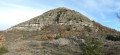
(S/E) From the car park at Place de la Mairie in Rompon, head up the road to Saint-Cierge-la-Serre on the left for about 150 m.
Yellow and white markings
(1) At the junction, take the left-hand track and cross the bridge over the Ruisseau de Chambaud. Then take the first road on the left, cross the Ruisseau des Blaches and continue.
(2) You will reach the community hall. Turn right towards Saint-Cierge-la-Branche and head uphill along the Route de Quintel until you reach the junction with theGR®42, ignoring the four successive paths branching off to the right of this road.
Red and whiteGR®42markings
(3) You’ll reach a crossroads. Turn right onto theGR®42and continue through the vineyards. You’ll cross a path before reaching the corner of a house. Here, the path curves slightly to the right. A little further on, cross the Ruisseau des Blaches (small wooden bridge). Head up the opposite side, reach a small road and follow it to the left.
(4) Just before a small fork leading to the houses in the hamlet of La Garde, head up to the right along a wide, fairly steep and rugged path. A few metres further on, in a tight hairpin bend, the path turns right and continues through the woodland.
(5) Reach a three-way junction and take the path on the left. Join the D265. Follow it to the left for about 200 m. At the next three-way junction, turn right. At the next junction, turn right onto the small road leading to La Branche.
(6) Before reaching this hamlet, turn left onto the Route de Champ Riond. A little further on, at a three-way junction, leave the houses of Champ Riond on your left and continue along the small road and theGR®42, heading north until you reach the RD 265a and the mast at La Plaine de Meyre.
Yellow and white markings
(7). Turn right and continue along the road and theGR®42. Pass the hamlets of Tallans and Le Clauzel on your right in turn. At a crossroads, you’ll reach the Serre de Praly signpost.
(8) Leave theGR®42and turn 90° to the right, heading east towards Fontbonne. Continue along the RD 265a. Walk past the houses in the hamlet of Rocher and carry on to the Fontbonne mast.
(9) Turn right and follow a wide track. At the first junction, ignore the path on the right and the track on the left. Head down the wide track, which gradually becomes narrower, more winding and rutted.
There is a slight discrepancy with the IGN map: the following junctions are not marked. There are no signposts at all. At the next two junctions, turn left, then right. Carry on until you reach the first houses in Celles-les-Bains.
(10) Turn right onto the Chemin du Dr Barrier. This is followed, on the left, by the Rue du Puits Artésien, leading to the D365. Follow this road to the right. Cross the bridge over the Ruisseau de Clauzel and head up the road to the Laval district. Walk past its imposing and beautiful church. Pass the Impasse des Coquelicots on your left and reach a crossroads and the Laval signpost.
Red and white markings
(11) Head up to the left on theGR®42towards Le Vieux Rompon and turn left twice. The climb becomes steeper. Pass a reservoir on the right and continue uphill until you reach the road.
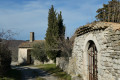
(12) Return to Le Vieux Rompon and the hiking information sign. Leave theGR®42and head towards Chat Gourmand. Walk past the chapel and through the narrow streets of Le Vieux Rompon. Heading south, descend along a wide farm track leading to Chat Gourmand.
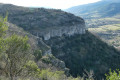
(13) At the signpost in Chat Gourmand, head straight on towards Rompon. This pleasant path winds round the cliffs before descending along the hillside. After a short, easy stretch over rocky ground, the path continues to a clearly visible cairn (located just before some large boulders on the right).
(14) At the cairn, in a very tight bend, head down to the right along a fairly steep path, which is tricky as it can be slippery in places. Further down, the path takes a wide bend to the left and heads towards the road. Ignore the various paths to the right of the track. Pass the first houses on the left and reach the road.
(15) Follow it to the left, heading south. At the next two junctions with main roads, carry straight on, heading south.
(1) Carry on straight ahead, heading south, until you reach the Town Hall and car park (S/E).




 Visorando Member
 Easy
Easy  Difficult