


Refine your search for walks in Waldbillig
Waldbillig walks


 Route 2/Stage 1: Mullerthal – Echternach
 Visorando Member
 13.80 mi
 +1,660 ft
 -1,811 ft
 7h 45
7h 45
 Difficult
 Departure from Waldbillig (Luxembourg (Country))
You’ll walk alongside the Black Ernz to the Schiessentumpel, a picturesque little waterfall that has become the symbol of the Mullerthal region. You’ll continue on to the spectacular rock formations of Eulenburg, Goldfralay and Goldkaul.You’ll also discover one of the region’s most beautiful rock ‘crevices’: the ‘Kohlscheuer’, and will then pass through a succession of rocky outcrops known as Daxelay, Einsiedelei and Härgottskapp, as well as through woodland, all the way to Echternach.
Circular route in the Müllerthal via the W8 Trail, Route 3 and the W7
 11.81 mi
+1,329 ft
-1,332 ft
6h 35
Difficult
Departure from Waldbillig (Luxembourg (Country))
11.81 mi
+1,329 ft
-1,332 ft
6h 35
Difficult
Departure from Waldbillig (Luxembourg (Country))
A walk suitable for all abilities in the Müllerthal, following signposted paths. The scenery is varied, with sections through woodland, a stretch across fields, and ending alongside stream beds.
Route 3/Stage 1: Mullerthal - Larochette
 11.10 mi
+1,293 ft
-1,093 ft
6h 15
11.10 mi
+1,293 ft
-1,093 ft
6h 15
 Moderate
Departure from Waldbillig (Luxembourg (Country))
Moderate
Departure from Waldbillig (Luxembourg (Country))
You’ll walk along forest paths, past sandstone rocks and through the Luxembourg countryside. Larochette Castle awaits you as the final stop on this journey.
Rammelay - Schelmelay - Goldfralay: spectacular rock formations
 5.96 mi
+974 ft
-984 ft
3h 35
Moderate
Departure from Waldbillig (Luxembourg (Country))
5.96 mi
+974 ft
-984 ft
3h 35
Moderate
Departure from Waldbillig (Luxembourg (Country))
Rammelay, Schelmelay, Goldkaul, Goldfralay and Eulenburg are the names of some of the rocks you will encounter along the way. Erosion has created bizarre shapes in the rocks, which can sometimes be compared to enormous heads.
Circular in Mullerthal
20.33 mi
+2,556 ft
-2,549 ft
11h 35
 Very difficult
Departure from Waldbillig (Luxembourg (Country))
Very difficult
Departure from Waldbillig (Luxembourg (Country))
This hike is rated as very difficult if done in a single day, but it is possible to complete it in two or three days with bivouacking. It is advisable to start near Consdorf and stop before Lauterborn to sleep; there are some beautiful spots.
Mullerthal - Luxembourg's Little Switzerland
 7.00 mi
+1,017 ft
-1,004 ft
4h 05
Moderate
Departure from Waldbillig (Luxembourg (Country))
7.00 mi
+1,017 ft
-1,004 ft
4h 05
Moderate
Departure from Waldbillig (Luxembourg (Country))
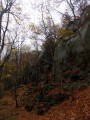
Discover spectacular caves and rock formations on a challenging trail to the Grotte de l'Enfer (Hell's Cave) and a gentle return along the Black Ernz.
Around Consdorf, Grand Duchy of Luxembourg
 6.90 mi
+538 ft
-518 ft
3h 40
Moderate
Departure from Consdorf (Luxembourg (Country))
6.90 mi
+538 ft
-518 ft
3h 40
Moderate
Departure from Consdorf (Luxembourg (Country))
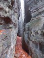
Narrow crevices, caves and impressive rock formations are on the agenda for this hike in Luxembourg's Little Switzerland.
The chasms, caves and crevices of Berdorf
 9.16 mi
+1,732 ft
-1,709 ft
5h 45
Difficult
Departure from Berdorf (Luxembourg (Country))
9.16 mi
+1,732 ft
-1,709 ft
5h 45
Difficult
Departure from Berdorf (Luxembourg (Country))
Trail leading through chasms, caves and crevices to viewpoints on vertiginous rocky plateaus.
Around Beaufort
 6.79 mi
+807 ft
-781 ft
3h 50
Moderate
Departure from Beaufort (Luxembourg) (Luxembourg (Country))
6.79 mi
+807 ft
-781 ft
3h 50
Moderate
Departure from Beaufort (Luxembourg) (Luxembourg (Country))
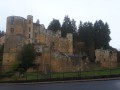
Hike starting from the ruins of the medieval castle of Beaufort and heading into the forest with rock formations, viewpoints and streams along the way.
Mullerthal Trail ExtraTour A
 13.95 mi
+1,837 ft
-1,841 ft
8h 00
Difficult
Departure from Larochette (Luxembourg (Country))
13.95 mi
+1,837 ft
-1,841 ft
8h 00
Difficult
Departure from Larochette (Luxembourg (Country))
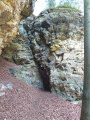
From Larochette, you cross the forest towards Meysembourg Castle. The path then leads through beautiful countryside of meadows and fields towards the rock formations at Nommerlayen, which are very well known in the region. From the village of Nommern, you pass through the Seitert Forest to Medernach, before returning to Larochette via a section of the Mullerthal Route 3.
Other rocks in Berdorf
 8.71 mi
+827 ft
-823 ft
4h 45
Moderate
Departure from Berdorf (Luxembourg (Country))
8.71 mi
+827 ft
-823 ft
4h 45
Moderate
Departure from Berdorf (Luxembourg (Country))
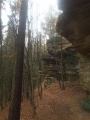
Probably the least touristy part of the Berdorf rock formations up to Perekop, and also the wettest. Walk along paths between rocks covered with moss and ferns.
Mullerthal Trail ExtraTour B
 8.14 mi
+807 ft
-801 ft
4h 25
Moderate
Departure from Beaufort (Luxembourg) (Luxembourg (Country))
8.14 mi
+807 ft
-801 ft
4h 25
Moderate
Departure from Beaufort (Luxembourg) (Luxembourg (Country))
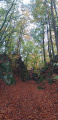
This hike is located between Beaufort and the Sûre Valley. Forest paths give way to open countryside as far as Bigelbach and end at an old quarry and rock formations typical of the region.
Mullerthal Trail ExtraTour C
 5.78 mi
+676 ft
-666 ft
3h 15
5.78 mi
+676 ft
-666 ft
3h 15
 Easy
Departure from Bech (Luxembourg (Country))
Easy
Departure from Bech (Luxembourg (Country))
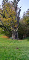
This circular route connects the villages of Bech and Altrier. You start next to the old Bech railway station, discover the natural site of Bildchen in Altrier (a large oak tree over 1,000 years old) and finish at the 300-metre-long Bech Tunnel. The section between Altrier and Bech offers beautiful views of the valley.
Nommerlayen
 2.92 mi
+446 ft
-466 ft
1h 45
Easy
Departure from Larochette (Luxembourg (Country))
2.92 mi
+446 ft
-466 ft
1h 45
Easy
Departure from Larochette (Luxembourg (Country))
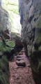
A leisurely walk through the rock fissures of Nommern with a gentle return via wide forest paths.
Circular route on both sides of the Sûre
 12.21 mi
+1,781 ft
-1,768 ft
7h 10
Difficult
Departure from Berdorf (Luxembourg (Country))
12.21 mi
+1,781 ft
-1,768 ft
7h 10
Difficult
Departure from Berdorf (Luxembourg (Country))
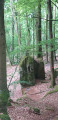
The Ferschweiler plateau on the German side, the Berdorf plateau on the Luxembourg side and between them the deep Sûre Valley. This route owes its charm to the mixture of rock formations, mazes and panoramic views.
Bettendorf, the Sure and its forest
12.44 mi
+1,522 ft
-1,496 ft
7h 05
Moderate
Departure from Bettendorf (Luxembourg) (Luxembourg (Country))
A lovely hike along the Sure river offering numerous viewpoints. Around 40% of the route is through forest, making it particularly suitable in spring and autumn.
I completed the hike in 5½ hours with a 50-minute break.