Country:
 City:
City:


Car park in Mullerthal. Head towards Waldbillig, then take thefirst road on the left towards Heringer Millen, the information centre.
Signposting: M – Dark red on a white background
(S) Heringer Millen is on your left; take the road towards the campsite.
(1) Just before the campsite entrance, veer right onto the path running alongside the stream. Cross the footbridge and take the steps. At the top, turn left. Follow the Black Ernz. Then cross two footbridges and climb the steps to reach the road. Continue to the right until you reach the Schiessentümpel, the iconic bridge of Luxembourg’s ‘Little Switzerland’.
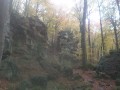
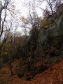
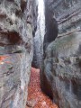
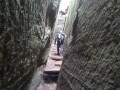
(2) When you reach the bridge, cross it carefully and take the steps. Climb up. Follow the path with its sparse wooden steps until you reach another road. Cross carefully and climb the steps opposite. Cross a footbridge, some steps and staircases until you reach thefirst crevice. There is no way round it. Continue through thesecond crevice. At the entrance to Eulenburg, climb the stairs and pass through the gap. Higher up, you’ll find a footbridge; you can reach it after the final steps.
(3) A path on your right leads to a round trip above Eulenburg. Then continue along the path, with the road below you. Walk along a rocky outcrop until you reach Goldfralay.
(4) Take the entrance to Goldfralay on your right, then head straight on towards the viewpoint. Make your way through the crevices. Once you’ve emerged, follow the path as close as possible to the rocks, go up a few steps and then past Goldkaul. The path takes a sharp left-hand bend. Continue until you reach the road.
(5) At the crossroads, go straight on. Further on, ignore the path on the left and continue along the forest track.
(6) Take the steps on your right leading up to the rock. Carry on, taking the next set of steps. This is your first passage through a crevice known as “Rittergang”. After passing through this crevice, continue along the path to reach the second passage: this one is called “Déiwepëtz”. It is dark here and the crevice is narrower, so make sure you have your torch with you. Carry on along the path after this passage.
(7) At the signpost, you can take the small path on the right to explore Kohlscheuer and its various points of interest. Alternatively, carry on along the path, passing two flights of steps. Enter a crevice. On your right, you’ll find other entrances to Kohlscheuer. Continue along the path, ignoring the one leading down to your left.
(8) At the crossroads, go straight on to immediately reach a Fork in the road where you turn right (not shown on the map), then come to another Fork in the road where you turn left. Pass through a crevice with a boulder wedged high up.
(9) Turn left and go down the steps between the rocks. Go down the steps between two rock faces and carry on.
(10) At the next junction, take the shortcut to the left. (Route 2 of the Mullerthal offers an extension to explore the Bildchen de Bech if you wish to go there -> § Practical information). At the crossroads, carry on straight ahead, crossing a small bridge. Follow the path uphill, keeping an eye out for the Neolithic grinding stones on your left. Further on, the path emerges from the forest and winds its way through meadows. The path becomes a farm track. At a junction, carry on straight ahead. The farm track turns right and becomes a tarmac road leading to a busy main road. Follow it to the left for a few metres and, as soon as you see the entrance to the forest track on the other side of the road, cross over carefully.
(11) Go round the gate. Ignore the path on the right behind the picnic table and follow the main path into the woods. On the other side of the woods, cross the minor road and join the cycle path. Turn left. At the junction with the farm track, turn right.
(12) Turn onto the first path on your left. Head down into the woodland, follow the stream, cross two footbridges and you’ll eventually arrive in front of Mëchelskiirch. Continue along the path until you reach a tarmac road (Dielchen). Turn right.
(13) Leave the road via the path leading down to your left. Further on, take the steps. Ignore the path coming from the right (the map is incorrect) and carry straight on at the junction.
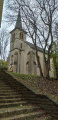
(14) At the T-junction, turn right. Go down a flight of steps made of beams and walk alongside Daxelay. Continue down the path. At the bottom, turn left and, at the next Fork in the road, turn right. Cross the bridge and turn left. At the next Fork in the road, turn right. Further on, walk past Einsiedelei. Then walk past Härgottskapp. Join a forest track and follow it to the right. Walk past a plaque in honour of Fred Welter and a rock carving featuring a crucifix in a niche; when you reach the road, turn right. Pass St Mathias’s Church in Scheidgen on your right, situated higher up.
(15) At the bus shelter, cross the road carefully, take the road opposite and head downhill. After the house, the road becomes a dirt track. Walk past the fountain and, a little further on, cross the bridge. Walk alongside a rocky outcrop on your right.
(16) At the fork in the road, turn right and head uphill. The signposting is very sparse. For 1.3 km, follow the main path as it winds between the rocks. Finally, go down the steps and head towards the gate.
(17) Take the path on the left before you reach the road. At the bottom, turn right and cross the bridge. Follow the Lauterbuerbaach; when you reach a tree lying across the path, take the path on the left and head downhill. At the site of an old bridge, take the muddy path on the right and cross the other bridge a little further on. Pass the site of another old bridge again. Head up the path as it curves to the right.
(18) At the junction with the old railway line, go straight on. Cross two footbridges and some stone steps. At thethird footbridge, turn right. Walk alongside a rocky outcrop; the path winds downwards. At the bottom, turn left.
(19) Look out for the steps on your left and climb them. Further up, turn right. Continue along the path, which consists of ascents, descents, steps and bridges, for 1.5 km until you reach the road. Turn right until you reach the bend.
(20) Turn left onto the forest track and head uphill. When you reach another forest track, turn right. Follow the track for just over 1 km.
(21) At the mast, turn right and head downhill. The path turns sharply to the left. At the bottom, carry on straight ahead. Walk past a building; a lovely view of Echternach opens up a little further on. At the end of the path, ignore the steps opposite and turn right onto the tarmac road. Head downhill. Ignore the path leading uphill on your left, as well as the next one leading downhill to the left. Continue along the road until you reach the next path.
(22) Turn left and walk down the cobbled path. Walk round the chapel. At the bottom, turn left. At the road, cross carefully and take Rue du Charly opposite. At the fountain, turn right and walk up the pedestrianised street to the Place du Marché (E).

 Visorando Member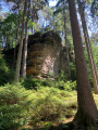
 Moderate
  Very difficult