


Marvellous rock formations from Bollendorf-Pont


This magnificent, fairly challenging walk takes you on a journey of discovery through some of the cross-border natural beauty of the Sûre Valley and its tributaries.
It’s hard to list all the interesting spots – there are so many.
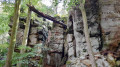
To name just a few: the Mandrack Pass is so narrow that an adult cannot walk through it upright whilst carrying a rucksack; the Tränenlay is at its most enchanting in winter; and Beaufort Castle is an attraction all year round.
Details
Creation:
Last update:
Last review:
–
–
-
 Activity: Walking
 -
 Distance: 13.13 mi
 -
 Average duration: 8h 15
 -
 Difficulty: Difficult
 -
-
 Back to start: Yes
 -
 Ascent: + 2,552 ft
 -
 Descent: - 2,546 ft
 -
-
 Highest point: 1,283 ft
 -
 Lowest point: 541 ft
-
 Country:
Luxembourg (Country)
Country:
Luxembourg (Country)
-
 City:
Berdorf
City:
Berdorf -
 Start/End: N 49.84998° / E 6.357971°
 -


 Hour-by-hour weather


Photos
Waypoints
- S/E : mi 0 - alt. 584 ft - Bollendorf-Pont - Sûre ou Sauer (rivière)
- 1 : mi 0.18 - alt. 568 ft - Bollendorf
- 2 : mi 1.03 - alt. 1,211 ft - Fork in the road
- 3 : mi 2.64 - alt. 1,165 ft - Crossroads
- 4 : mi 3.08 - alt. 610 ft - Tränenlay - Sûre ou Sauer (rivière)
- 5 : mi 3.29 - alt. 594 ft - Dillingen - Sûre ou Sauer (rivière)
- 6 : mi 6.81 - alt. 1,102 ft - Beaufort Castle
- 7 : mi 10.22 - alt. 591 ft - Grundhof
- 8 : mi 11.12 - alt. 1,142 ft - Casselt
- 9 : mi 12.19 - alt. 1,227 ft - Mandrack Pass
- S/E : mi 13.13 - alt. 584 ft - Bollendorf-Pont - Sûre ou Sauer (rivière)
Other walks in the area
Circular route on both sides of the Sûre
 Visorando Member
 12.21 mi
+1,781 ft
-1,768 ft
7h 10
Difficult
12.21 mi
+1,781 ft
-1,768 ft
7h 10
Difficult
 Departure from Berdorf (Luxembourg (Country))
The Ferschweiler plateau on the German side, the Berdorf plateau on the Luxembourg side and between them the deep Sûre Valley. This route owes its charm to the mixture of rock formations, mazes and panoramic views.
The devilish rocks of the Müllerthal
 13.47 mi
+1,972 ft
-1,946 ft
7h 55
Difficult
Departure from Berdorf (Luxembourg (Country))
13.47 mi
+1,972 ft
-1,946 ft
7h 55
Difficult
Departure from Berdorf (Luxembourg (Country))
This fairly challenging hike in the Müllerthal region takes you on a journey of discovery to devilish spots on either side of the Sûre: the Devil’s Island (Teufelsinsel) on the Luxembourg side and the Devil’s Hole (Teufelsloch) on the German side.The route between Berdorf and Bollendorf passes through many well-known spots in the region, notably Casselt and the Mandrack Pass, where you’ll need to take off your rucksack to navigate the narrow passage between the rock faces.The Teufelsloch is very similar, the only difference being that here it is possible to go round the obstacle.
Other rocks in Berdorf
 8.71 mi
+827 ft
-823 ft
4h 45
8.71 mi
+827 ft
-823 ft
4h 45
 Average
Departure from Berdorf (Luxembourg (Country))
Average
Departure from Berdorf (Luxembourg (Country))
Probably the least touristy part of the Berdorf rock formations up to Perekop, and also the wettest. Walk along paths between rocks covered with moss and ferns.
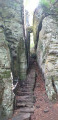
The Devil's Gorge or Teufelsschlucht
 11.18 mi
+932 ft
-925 ft
5h 55
Difficult
Departure from Ernzen (Eifelkreis Bitburg-Prüm)
11.18 mi
+932 ft
-925 ft
5h 55
Difficult
Departure from Ernzen (Eifelkreis Bitburg-Prüm)
The Devil's Gorge was formed towards the end of the last ice age, around 10,000 years ago, following one or more rock collapses. Gorges, faults and crevasses make up the rock formations of the Ferschweiler plateau.
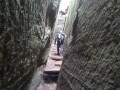
The chasms, caves and crevices of Berdorf
 9.16 mi
+1,732 ft
-1,709 ft
5h 45
Difficult
Departure from Berdorf (Luxembourg (Country))
9.16 mi
+1,732 ft
-1,709 ft
5h 45
Difficult
Departure from Berdorf (Luxembourg (Country))
Trail leading through chasms, caves and crevices to viewpoints on vertiginous rocky plateaus.
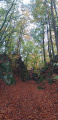
Mullerthal Trail ExtraTour B
 8.14 mi
+807 ft
-801 ft
4h 25
Average
Departure from Beaufort (Luxembourg) (Luxembourg (Country))
8.14 mi
+807 ft
-801 ft
4h 25
Average
Departure from Beaufort (Luxembourg) (Luxembourg (Country))
This hike is located between Beaufort and the Sûre Valley. Forest paths give way to open countryside as far as Bigelbach and end at an old quarry and rock formations typical of the region.
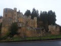
Around Beaufort
 6.79 mi
+807 ft
-781 ft
3h 50
Average
Departure from Beaufort (Luxembourg) (Luxembourg (Country))
6.79 mi
+807 ft
-781 ft
3h 50
Average
Departure from Beaufort (Luxembourg) (Luxembourg (Country))
Hike starting from the ruins of the medieval castle of Beaufort and heading into the forest with rock formations, viewpoints and streams along the way.
Devil’s Eight: From the Devil’s Gorge to the Irreler Suspension Bridge
 5.48 mi
+768 ft
-787 ft
3h 10
Average
Departure from Ernzen (Eifelkreis Bitburg-Prüm)
5.48 mi
+768 ft
-787 ft
3h 10
Average
Departure from Ernzen (Eifelkreis Bitburg-Prüm)
No work of the devil, but a fascinating creation of nature can be found in the Teufelsschlucht in the Südeifel Nature Park, not far from the border with Luxembourg. The steeply rising rock faces are up to 30 metres high, and some of them seem to glow green. The rocky landscape in and around the Teufelsschlucht is certainly mystical, with narrow, stony paths leading to the Irreler suspension bridge and the waterfalls.
For more walks, use our search engine .
The GPS track and description are the property of this route's author. Please do not copy them without permission.

