


Circular route in the Müllerthal via the W8 Trail, Route 3 and the W7


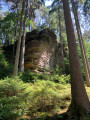
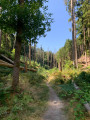
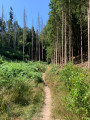
A walk suitable for all abilities in the Müllerthal, following signposted paths. The scenery is varied, with sections through woodland, a stretch across fields, and ending alongside stream beds.
Details
Creation:
Last update:
Last review:
–
–
-
 Activity: Walking
 -
 Distance: 11.81 mi
 -
 Average duration: 6h 35
 -
 Difficulty: Difficult
 -
-
 Back to start: Yes
 -
 Ascent: + 1,329 ft
 -
 Descent: - 1,332 ft
 -
-
 Highest point: 1,302 ft
 -
 Lowest point: 696 ft
-
 Country:
Luxembourg (Country)
Country:
Luxembourg (Country)
-
 City:
Waldbillig
City:
Waldbillig -
 Start/End: N 49.78955° / E 6.305127°
 -


 Hour-by-hour weather


Photos
Waypoints
- S/E : mi 0 - alt. 705 ft - Car park
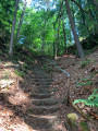
- 1 : mi 0.16 - alt. 833 ft - Top of the stairs
- 2 : mi 1.02 - alt. 1,033 ft - Crossroads
- 3 : mi 1.5 - alt. 1,047 ft - Route
- 4 : mi 1.7 - alt. 1,070 ft - Fork in the road
- 5 : mi 2.11 - alt. 1,027 ft - Christnach
- 6 : mi 2.28 - alt. 1,030 ft - Turn left
- 7 : mi 2.55 - alt. 1,070 ft - Route
- 8 : mi 2.96 - alt. 1,138 ft - Fork in the road
- 9 : mi 3.34 - alt. 1,079 ft - Turn left
- 10 : mi 3.72 - alt. 1,093 ft - Turn right
- 11 : mi 4.88 - alt. 876 ft - Route and ascent
- 12 : mi 5.3 - alt. 1,063 ft - Junction
- 13 : mi 5.73 - alt. 1,198 ft - Sharp bend to the right
- 14 : mi 6.64 - alt. 1,155 ft - Trail
- 15 : mi 6.73 - alt. 1,099 ft - Ascent via Route 3
- 16 : mi 7.32 - alt. 1,253 ft - Turn
- 17 : mi 7.51 - alt. 1,263 ft - Fork in the road
- 18 : mi 7.7 - alt. 1,296 ft - Turn
- 19 : mi 7.79 - alt. 1,253 ft - Junction
- 20 : mi 8.17 - alt. 1,201 ft - Junction
- 21 : mi 8.33 - alt. 1,207 ft - Staircase leading to the sundial
- 22 : mi 8.41 - alt. 1,165 ft - Sundial
- 23 : mi 8.98 - alt. 1,161 ft - Trail W7
- 24 : mi 9.52 - alt. 1,102 ft - Junction with the W7
- 25 : mi 10.46 - alt. 896 ft - Car park on the W7
- 26 : mi 10.53 - alt. 866 ft - Junction
- S/E : mi 11.81 - alt. 696 ft - Car park
Other walks in the area
Route 2/Stage 1: Mullerthal – Echternach
 Visorando Member
 13.80 mi
+1,660 ft
-1,811 ft
7h 45
Difficult
13.80 mi
+1,660 ft
-1,811 ft
7h 45
Difficult
 Departure from Waldbillig (Luxembourg (Country))
You’ll walk alongside the Black Ernz to the Schiessentumpel, a picturesque little waterfall that has become the symbol of the Mullerthal region. You’ll continue on to the spectacular rock formations of Eulenburg, Goldfralay and Goldkaul.You’ll also discover one of the region’s most beautiful rock ‘crevices’: the ‘Kohlscheuer’, and will then pass through a succession of rocky outcrops known as Daxelay, Einsiedelei and Härgottskapp, as well as through woodland, all the way to Echternach.
Route 3/Stage 1: Mullerthal - Larochette
 11.10 mi
+1,293 ft
-1,093 ft
6h 15
11.10 mi
+1,293 ft
-1,093 ft
6h 15
 Moderate
Departure from Waldbillig (Luxembourg (Country))
Moderate
Departure from Waldbillig (Luxembourg (Country))
You’ll walk along forest paths, past sandstone rocks and through the Luxembourg countryside. Larochette Castle awaits you as the final stop on this journey.
Circular in Mullerthal
20.33 mi
+2,556 ft
-2,549 ft
11h 35
 Very difficult
Departure from Waldbillig (Luxembourg (Country))
Very difficult
Departure from Waldbillig (Luxembourg (Country))
This hike is rated as very difficult if done in a single day, but it is possible to complete it in two or three days with bivouacking. It is advisable to start near Consdorf and stop before Lauterborn to sleep; there are some beautiful spots.
Rammelay - Schelmelay - Goldfralay: spectacular rock formations
 5.96 mi
+974 ft
-984 ft
3h 35
Moderate
Departure from Waldbillig (Luxembourg (Country))
5.96 mi
+974 ft
-984 ft
3h 35
Moderate
Departure from Waldbillig (Luxembourg (Country))
Rammelay, Schelmelay, Goldkaul, Goldfralay and Eulenburg are the names of some of the rocks you will encounter along the way. Erosion has created bizarre shapes in the rocks, which can sometimes be compared to enormous heads.
Mullerthal - Luxembourg's Little Switzerland
 7.00 mi
+1,017 ft
-1,004 ft
4h 05
Moderate
Departure from Waldbillig (Luxembourg (Country))
7.00 mi
+1,017 ft
-1,004 ft
4h 05
Moderate
Departure from Waldbillig (Luxembourg (Country))
Discover spectacular caves and rock formations on a challenging trail to the Grotte de l'Enfer (Hell's Cave) and a gentle return along the Black Ernz.
Around Consdorf, Grand Duchy of Luxembourg
 6.90 mi
+538 ft
-518 ft
3h 40
Moderate
Departure from Consdorf (Luxembourg (Country))
6.90 mi
+538 ft
-518 ft
3h 40
Moderate
Departure from Consdorf (Luxembourg (Country))
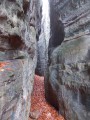
Narrow crevices, caves and impressive rock formations are on the agenda for this hike in Luxembourg's Little Switzerland.
For more walks, use our search engine .
The GPS track and description are the property of this route's author. Please do not copy them without permission.

