Country:
 City:


Signposting: red ‘M’ on a white background
(S) In front of Larochette church, with the entrance on your left, head round to the back of the church and the steps near the houses. Climb the steps and, at thethird door, turn left. Follow the winding path uphill until you join another path.
(1) Turn right after a few steps for your first view of Larochette. Retrace your steps and carry on straight ahead.
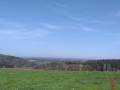
(2) Ignore the stony path on your left and carry on straight ahead. Pass the Himmelsbierg viewpoint. Continue along the path, taking a few steps as you go.
(3) Turn left and go down the steps. At the bottom, turn left. At the junction, turn right, cross the stream and then walk behind the houses.
(4) At the next junction, stay in the woodland and head up the path on the right. At the end of the meadow, take the path on the left.
(5) At the top of the stairs, turn right. Go uphill and then veer left. Walk along the field on your right and, at the corner of the plot, turn right. The dirt track turns sharply left and leads to the road.
(6) At the crossroads, carry straight on along the road. Walk through the farm.
(7) When you reach a chalet (set back from the road), turn right onto the path. At the road, turn left and then turn right at thefirst forest track you come to. Follow the main path, ignoring any side tracks, until you reach another road.
(8) At the crossroads, carry straight on along the road and then turn left onto the track. When you reach the road, turn right and, at the mast, turn left towards Webershaff. Pass in front of a farm. At the junction after the farm, carry straight on.
(9) At the fork in the road with the solitary fir tree, turn left. Stay on the main forest track until you reach a road further on.
(10) Just before this, turn right. Cross the road and carry on straight ahead.
(11) At the Fork in the road, head slightly to the left.
(12) At the next Fork in the road, head slightly to the left again.
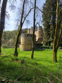
(13) Ford the stream and continue to the right. Go round the reservoir. Ignore the path leading off to the left. Then ignore the path on your left leading to the campsite. Walk past Klingelbour (the old wash house).
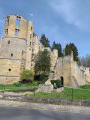
(14) Carry on straight ahead, go through the gate and cross the wooden footbridge. Ignore the path on your left leading to the Auberge Rustique. Carry on straight ahead until you reach the gate in front of the castle entrance. Go through it and head for thesecond car park on your right.
(15) Join the path at the far end of the car park and head downhill. Ignore the footbridge on your left a little further on past the pond. Continue along the Haupeschbaach. Cross two footbridges in quick succession and, a little further on, a final wooden footbridge. Keep heading downhill.
(16) At the junction, carry on straight ahead. Ignore a footbridge on your right and carry on. A path joins from your left; carry on straight ahead.
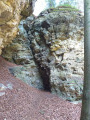
(17) Take the path on your right, which leads down to a footbridge; cross it. Follow the path running alongside the river. Head back up the path for a short while, pass a rock formation marking the tributary of the Haupeschbaach, and rejoin the path on the right, keeping as close to the river as possible.
(18) At the fork in the road on the right, do not go down to the steps but carry on straight ahead along the path. Leave the forest and continue along the path until you reach the road.
(19) Turn right onto the road. At the private entrance to the castle, take the path on the left. Walk along the river at a distance, with the meadows on your left and the forest on your right, before crossing a ford further on.
(20) At the junction, ignore the path on your right and head gently uphill to the left into the woodland. Follow this main path until you reach the road. Cross the road and return to the car park (E).

 Visorando Member
 Easy
 Moderate
 Very difficult