Country:
 City:
City:


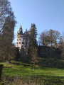
Car park at the rear of the village hall on Chemin Jean-Antoine Zinnen.
Markings: pink ‘M’ on a white background
(S/E) With the church entrance on your right, head straight ahead along Rue de Mersch. At No. 51, turn left onto the concrete path and take the steps. At the road, first turn left then right and go up the steps. At the top, head to the right and turn left at the junction with three trees. Take the path to the left of the sign. Walk alongside the football pitch and enter the forest.
(1) At the junction, turn right and head uphill. At the T-junction, turn right.
(2) At the multi-way junction, carry straight on. A path branches off to your left; ignore it and carry straight on.
(3) The path curves sharply to the left; ignore the path coming in from your right. Stay on the main path until you reach the road.
(4) Turn right onto the road and stay on it until you reach the junction with the CR118. Cross with care.
(5) Take the path starting at the corner of the junction. At the crossroads, carry straight on. The path turns sharply to the left. At the next junction, go straight on.
(6) At the forest track, turn right.
(7) At the car park, take the path on the left before the road and walk past the information boards about the Roman camp. Continue along the path. Go downhill and cross the crevice in the rock. Continue to the left and go downhill.
(8) At the forest track, carry on straight ahead. Cross the footbridge. The path branches off to the right; head uphill. Cross the crevice in the rock. The path runs along a ledge; cross further crevices.
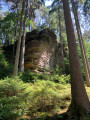
(9) At Drachelay, it’s impossible to get through if you’re carrying a large rucksack, so take the steps to the right of the rock; otherwise, cross the crevice. Continue along the rocks on the balcony-style path. Ignore the paths leading down to the forest track below. Pass through another rock crevice and then climb the steps. Cross the rock, ignore the steps on the right and head downhill.
(10) At the bottom, at the junction, turn right and walk alongside the campsite.
(11) At the road, turn right. At the CR 306, turn right. At the next junction, carry on straight ahead towards Aedelbur. Walk past the church and then past the school. At the bend, turn left and immediately take the road on the right, Alle wee. Once you’ve passed the houses, the road becomes for tractors, bicycles and walkers only.
(12) At the next junction, carry on straight ahead until you reach the CR 119. Cross over, take the path and go round the barriers.
(13) Turn onto the first path on the left. Head downhill and turn right onto the next path. Stay on the main path for about 750 metres.
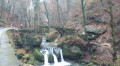
(14) Go straight ahead onto the track at the bend (not shown on the map). Cross the small bridge on the forest track and continue to the right.
(15) At the road, turn right.
(16) At the next junction, turn left. Go under the N14 and, after the bridge, take the no-entry road on the right. At the junction, carry on straight ahead. At the crossroads, go straight ahead, and at the fountain, take the road on the right. Pass below the church and, at the next fork in the road, turn left. Head up to the cemetery, turn right into the cemetery car park and turn left after the cemetery building. Head up to the CR358.
(17) Turn right, ignore the first path and take the road towards Theinshaff, to the right of the tree.
(18) Take thefirst path branching off to the right. At the end, turn left onto the road. Follow it to the crossroads after the farm. Continue straight ahead along the farm track, which curves sharply to the right. Turn left at the end of the field. At the end of the field, the path branches off to the right and heads downhill. At the bottom, take a few steps and turn right.
(19) At the fork in the road on the left, go down the steps, then back up and head off to the right. Ignore the path on the right leading towards the road and carry on, keeping to your left on the forest track. Go round the back of some houses, cross the stream and turn left.
(20) Halfway up the slope, turn right onto the path which becomes a flight of steps. At the top, turn right and follow the main path.
(21) Walk past the Himmelsbierg viewpoint.
(22) Ignore the gravel path leading down to your right and carry on. At the Fork in the road, turn right.
(23) At the next Fork in the road, turn right again. Go down the steps, following the winding path until you reach some houses. Go down the steps on your right. You’ll arrive at the church forecourt (S/E).

 Visorando Member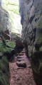
 Easy
Easy 
 Moderate
  Very difficult