Bettendorf, the Sure and its forest

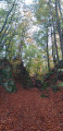
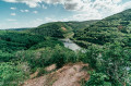
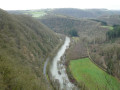
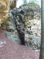
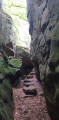
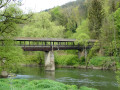
A lovely hike along the Sure river offering numerous viewpoints. Around 40% of the route is through forest, making it particularly suitable in spring and autumn.

I completed the hike in 5½ hours with a 50-minute break.

Details

72556181
Creation:
Last update:
Last review:
  • Walking
    Activity: Walking
  • ↔
    Distance: 12.44 mi
  • ◔
    Average duration: 7h 05 
  • ▲
    Difficulty: Moderate

  • ⚐
    Back to start: Yes
  • ↗
    Ascent: + 1,522 ft
  • ↘
    Descent: - 1,496 ft

  • ▲
    Highest point: 1,145 ft
  • ▼
    Lowest point: 600 ft

Description of the walk

D. Car park opposite the Bistro Cafe Blummen. Follow the road to the left.

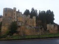
(1) Turn right at Moestroff Castle.

(2) Turn left, then continue uphill.

(3) Continue on the road opposite.

(4) At the fork, turn right.

(5) Turn left.

(6) Go straight ahead.

(7) Continue straight ahead.

(8) Follow the E9 on the right.

(9) Turn right onto the E9.

(10) Keep left.

(11) Turn left.

(12) Turn left.

(13) Cross the road and take the path opposite.

(14) Take the path on the right to the fields.

(15) Turn left and follow the tarmac road.

(16) Continue along this road, nice spot for a snack break.

(17) Turn right.

(18) Continue straight ahead.

(19) Turn right.

(20) Turn left and follow signs for La grotte de Lourdes.

(21) Lourdes Cave.

(22) Follow the ridge.

(23) Follow the ridge.

(24) Turn left.

(25) Continue straight ahead to the car park.

Waypoints

  1. S/E : mi 0 - alt. 610 ft - Car park opposite the Blummen Bistro café. - Sûre ou Sauer (rivière)
  2. 1 : mi 1.32 - alt. 623 ft - Crossroads
  3. 2 : mi 1.49 - alt. 699 ft - Fork
  4. 3 : mi 1.88 - alt. 991 ft - Intersection
  5. 4 : mi 2.28 - alt. 1,030 ft - Fork in the road
  6. 5 : mi 2.79 - alt. 978 ft - Junction
  7. 6 : mi 3.38 - alt. 915 ft - Crossroads
  8. 7 : mi 3.46 - alt. 958 ft - Y-shaped fork
  9. 8 : mi 3.97 - alt. 892 ft - E9
  10. 9 : mi 4.82 - alt. 1,024 ft - E9
  11. 10 : mi 5.91 - alt. 1,043 ft - Four paths
  12. 11 : mi 6.44 - alt. 1,122 ft - Crossroads
  13. 12 : mi 6.65 - alt. 1,099 ft - Intersection
  14. 13 : mi 7.37 - alt. 1,109 ft - Road
  15. 14 : mi 7.66 - alt. 1,056 ft - Trail
  16. 15 : mi 7.89 - alt. 1,066 ft - Field
  17. 16 : mi 8.1 - alt. 1,056 ft - Bend
  18. 17 : mi 9.06 - alt. 866 ft - Crossroads
  19. 18 : mi 9.49 - alt. 656 ft - Fork
  20. 19 : mi 9.68 - alt. 669 ft - Intersection
  21. 20 : mi 10.01 - alt. 850 ft - Crossroads
  22. 21 : mi 10.25 - alt. 932 ft - Lourdes Cave
  23. 22 : mi 10.54 - alt. 1,070 ft - Ridge
  24. 23 : mi 11.35 - alt. 1,027 ft - Ridge
  25. 24 : mi 11.52 - alt. 997 ft - Descent
  26. 25 : mi 11.93 - alt. 741 ft - Junction
  27. S/E : mi 12.44 - alt. 620 ft - Car park opposite the Blummen Bistro café.

Notes

The hike can be completed in 5½ hours with a 50-minute break.

Other walks in the area

For more walks, use our search engine .

The GPS track and description are the property of this route's author. Please do not copy them without permission.