


In terms of effort, the route shown here obviously does not take into account all the twists and turns of the paths, which are much less straight on the ground than they appear on the map.
The devilish rocks of the Müllerthal


This fairly challenging hike in the Müllerthal region takes you on a journey of discovery to devilish spots on either side of the Sûre: the Devil’s Island (Teufelsinsel) on the Luxembourg side and the Devil’s Hole (Teufelsloch) on the German side.
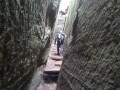
The route between Berdorf and Bollendorf passes through many well-known spots in the region, notably Casselt and the Mandrack Pass, where you’ll need to take off your rucksack to navigate the narrow passage between the rock faces.
The Teufelsloch is very similar, the only difference being that here it is possible to go round the obstacle.
Details
Creation:
Last update:
Last review:
–
–
-
 Activity: Walking
 -
 Distance: 13.47 mi
 -
 Average duration: 7h 55
 -
 Difficulty: Difficult
 -
-
 Back to start: Yes
 -
 Ascent: + 1,972 ft
 -
 Descent: - 1,946 ft
 -
-
 Highest point: 1,289 ft
 -
 Lowest point: 541 ft
-
 Country:
Luxembourg (Country)
Country:
Luxembourg (Country)
-
 City:
Berdorf
City:
Berdorf -
 Start/End: N 49.826957° / E 6.342626°
 -


 Hour-by-hour weather
Photos
Waypoints
- S/E : mi 0 - alt. 1,198 ft - Berdorf Tourist Information
- 1 : mi 0.72 - alt. 1,138 ft - Teufelsinsel
- 2 : mi 1.37 - alt. 1,132 ft - Berdorf climbing site
- 3 : mi 1.81 - alt. 1,142 ft - Casselt
- 4 : mi 2.9 - alt. 1,227 ft - Mandrack Pass
- 5 : mi 3.06 - alt. 1,211 ft - Kalekapp
- 6 : mi 3.89 - alt. 581 ft - Bollendorf-Pont (LU)
- 7 : mi 3.97 - alt. 551 ft - Bollendorf (DE)
- 8 : mi 5.86 - alt. 1,224 ft - Fahnenstange
- 9 : mi 7.68 - alt. 1,096 ft - Teufelsloch
- 10 : mi 9.29 - alt. 692 ft - Weilerbach Castle
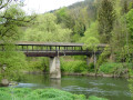
- 11 : mi 9.72 - alt. 561 ft - Covered footbridge
- S/E : mi 13.47 - alt. 1,198 ft - Berdorf Tourist Information
Notes
Worth a visit
Apart from the rocks, the German side offers a lovely view of the Sûre valley and Bollendorf from the picnic shelter at km 9.5 and passes by the Baroque castle of Weilerbach.
Other walks in the area
Other rocks in Berdorf
 Visorando Member
 8.71 mi
+827 ft
-823 ft
4h 45
8.71 mi
+827 ft
-823 ft
4h 45
 Average
 Departure from Berdorf (Luxembourg (Country))
Probably the least touristy part of the Berdorf rock formations up to Perekop, and also the wettest. Walk along paths between rocks covered with moss and ferns.
The chasms, caves and crevices of Berdorf
 9.16 mi
+1,732 ft
-1,709 ft
5h 45
Difficult
Departure from Berdorf (Luxembourg (Country))
9.16 mi
+1,732 ft
-1,709 ft
5h 45
Difficult
Departure from Berdorf (Luxembourg (Country))
Trail leading through chasms, caves and crevices to viewpoints on vertiginous rocky plateaus.
Circular route on both sides of the Sûre
 12.21 mi
+1,781 ft
-1,768 ft
7h 10
Difficult
Departure from Berdorf (Luxembourg (Country))
12.21 mi
+1,781 ft
-1,768 ft
7h 10
Difficult
Departure from Berdorf (Luxembourg (Country))
The Ferschweiler plateau on the German side, the Berdorf plateau on the Luxembourg side and between them the deep Sûre Valley. This route owes its charm to the mixture of rock formations, mazes and panoramic views.
Around Beaufort
 6.79 mi
+807 ft
-781 ft
3h 50
Average
Departure from Beaufort (Luxembourg) (Luxembourg (Country))
6.79 mi
+807 ft
-781 ft
3h 50
Average
Departure from Beaufort (Luxembourg) (Luxembourg (Country))
Hike starting from the ruins of the medieval castle of Beaufort and heading into the forest with rock formations, viewpoints and streams along the way.
Mullerthal Trail ExtraTour B
 8.14 mi
+807 ft
-801 ft
4h 25
Average
Departure from Beaufort (Luxembourg) (Luxembourg (Country))
8.14 mi
+807 ft
-801 ft
4h 25
Average
Departure from Beaufort (Luxembourg) (Luxembourg (Country))
This hike is located between Beaufort and the Sûre Valley. Forest paths give way to open countryside as far as Bigelbach and end at an old quarry and rock formations typical of the region.
Mullerthal - Luxembourg's Little Switzerland
 7.00 mi
+1,017 ft
-1,004 ft
4h 05
Average
Departure from Waldbillig (Luxembourg (Country))
7.00 mi
+1,017 ft
-1,004 ft
4h 05
Average
Departure from Waldbillig (Luxembourg (Country))
Discover spectacular caves and rock formations on a challenging trail to the Grotte de l'Enfer (Hell's Cave) and a gentle return along the Black Ernz.
Rammelay - Schelmelay - Goldfralay: spectacular rock formations
 5.96 mi
+974 ft
-984 ft
3h 35
Average
Departure from Waldbillig (Luxembourg (Country))
5.96 mi
+974 ft
-984 ft
3h 35
Average
Departure from Waldbillig (Luxembourg (Country))
Rammelay, Schelmelay, Goldkaul, Goldfralay and Eulenburg are the names of some of the rocks you will encounter along the way. Erosion has created bizarre shapes in the rocks, which can sometimes be compared to enormous heads.
Circular in Mullerthal
20.33 mi
+2,556 ft
-2,549 ft
11h 35
 Very difficult
Departure from Waldbillig (Luxembourg (Country))
Very difficult
Departure from Waldbillig (Luxembourg (Country))
This hike is rated as very difficult if done in a single day, but it is possible to complete it in two or three days with bivouacking. It is advisable to start near Consdorf and stop before Lauterborn to sleep; there are some beautiful spots.
For more walks, use our search engine .
The GPS track and description are the property of this route's author. Please do not copy them without permission.

