Route 3/Stage 1: Mullerthal - Larochette

You’ll walk along forest paths, past sandstone rocks and through the Luxembourg countryside. Larochette Castle awaits you as the final stop on this journey.

This walk is part of a multi-day hike: Mullerthal Trail

Details

2006485
Creation:
Last update:
Last review:
  • Walking
    Activity: Walking
  • ↔
    Distance: 11.10 mi
  • ◔
    Average duration: 6h 15 
  • ▲
    Difficulty: Moderate

  • ⚐
    Back to start: No
  • ↗
    Ascent: + 1,293 ft
  • ↘
    Descent: - 1,093 ft

  • ▲
    Highest point: 1,302 ft
  • ▼
    Lowest point: 696 ft

Photos

Description of the walk

Car park in Mullerthal. Head towards Waldbillig, then take thefirst road on the left towards the Heringer Millen information centre.

Signposting: Dark red M on a white background

(S) Heringer Millen on your left; take the road towards the campsite.

(1) Just before the campsite entrance, turn right onto the path running alongside the stream. Cross the footbridge and take the stairs. At the top, turn left. Follow the Black Ernz. Then cross two footbridges and climb the stairs to reach the road. Continue to your right until you reach the Schiessentümpel, the iconic bridge of Luxembourg’s Little Switzerland.

(2) Cross the bridge and continue along the path branching off to the left after the bridge. Follow the path alongside the Ernz Noire for about 500m and go down the stairs on your left. Cross the bridge, cross the road carefully and turn right. At the car park, cross the road and continue along the pavement to the right.

(3) At the ‘end of built-up area’ sign, take the path leading downwards. Go down the steps. Then cross a footbridge and continue. When you reach the road, cross with care and continue straight ahead. Cross the car park, continue straight ahead, go round the barrier and cross the small bridge.

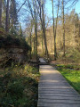
(4) Ignore the path branching off to your left and continue straight on along the forest track. At the water basin, go down the steps on your right. Cross the footbridge over the second basin, with a view of the Kallektuffquell: a spring flowing over tuffeau (limestone). Continue left along the wooden walkways until you reach the road. Turn left and then take the forest track on the right. Go uphill and turn left at thefirst track.

(5) Take thefirst path on the right and, at the top, turn left onto the forest path.

(6) Before the road, turn right onto the path. At the next road, go straight on. Before the meadow, turn left onto the path. At the multi-way junction, turn right onto the path running alongside the pond, continue ignoring the paths and tracks on your right and enter the forest.

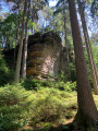
(7) Walk past the Sonnehauer rocks and continue straight on at thefirst junction.

(8) Turn right at the next path.

(9) Further on, when you reach another path, turn right. Leave the forest, continue right across the meadows and then turn left at the first track. Enter the forest and take the track on the left. The path then descends for a few hundred metres and further on it turns sharply right then left and descends to the road. Turn right, go over the bridge and cross.

(10) Continue along the forest track opposite for 1.5 km until you reach the crossroads.

(11) Turn right, go uphill and cross the cultivated fields. The dirt track becomes a road which bends to the right. Carry on.

(12) After the bench on the left. Ignore the path on the left and continue to the right. At the road, turn left.

(13) At the junction, turn left and then immediately right after the tree.
Please note: the signposting was being updated when we were there, so in April 2019 only the White Rectangle was visible at this point.
Stay on the grassy path with very faint markings on the ground. At the next road, first turn left then right, crossing with care. At the next junction, continue straight ahead.

(14) Further on, leave the forest track and turn right onto the path leading down to the concrete track. Head right until you reach the road. Cross with care and continue straight on.

(15) When you reach the house, turn right onto the ascending path. Ignore the path coming from the right and, a few hundred metres further on, the one coming from the left. Continue to the road. Go round the barrier and cross over.

(16) Take the path between the two safety rails.

(17) When you reach a bench, turn left. Take the path leading down onto a wide track and continue to the right. At the next junction, carry straight on. A path on your left is closed; carry straight on.

(18) At the next junction, with a picnic table, go straight on to see the view of Larochette and its castle. Retrace your steps and take the path leading down to your right. At the road on the right, continue straight on to the church. (E)


Waypoints

  1. S : mi 0 - alt. 696 ft - Car park near Heringer Millen
  2. 1 : mi 0.13 - alt. 728 ft - Campsite gate on the right
  3. 2 : mi 0.58 - alt. 873 ft - Schiessentümpel Bridge, straight ahead along the road
  4. 3 : mi 0.96 - alt. 869 ft - Town boundary sign, path to the left
  5. 4 : mi 1.35 - alt. 896 ft - Straight ahead on the forest track
  6. 5 : mi 2.71 - alt. 1,112 ft - Path on the right
  7. 6 : mi 2.83 - alt. 1,175 ft - Path on the right before the road
  8. 7 : mi 3.88 - alt. 1,207 ft - Sonnehauer Rocks
  9. 8 : mi 4.05 - alt. 1,201 ft - Path on the right
  10. 9 : mi 4.53 - alt. 1,296 ft - At the top, continue to the right
  11. 10 : mi 5.75 - alt. 1,004 ft - On the forest road opposite
  12. 11 : mi 6.72 - alt. 1,053 ft - Crossroads on the right
  13. 12 : mi 7.23 - alt. 1,201 ft - Bench on the left
  14. 13 : mi 7.82 - alt. 1,198 ft - Grassy path, faint trail to the right after the tree
  15. 14 : mi 8.65 - alt. 1,148 ft - Path on the right
  16. 15 : mi 9.41 - alt. 965 ft - At the house, take the path on the right leading uphill
  17. 16 : mi 10.36 - alt. 1,079 ft - Between the two safety rails
  18. 17 : mi 10.55 - alt. 1,060 ft - At the bench, the path descends to the left
  19. 18 : mi 10.91 - alt. 1,024 ft - Viewpoint straight ahead
  20. E : mi 11.1 - alt. 906 ft - Larochette Church

Notes

Picnic table after (9), at (10), after (14) and at the viewpoint over Larochette at (18)
There are several accommodation options in Larochette, including the Auberge de Jeunesse at 45 Rue Osterbour, offering single rooms.

Worth a visit

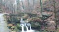
- Schiessentümpel: iconic bridge of the Mullerthal.
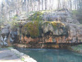
- Kallektuffquell tuffeau spring: very clear limestone water flows from a rock into a small pool.
- Sonnehauer: rocks.
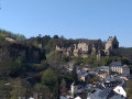
- Larochette Castle.

Reviews and comments

4.9 / 5
Based on 3 reviews

Reliability of the description
4.7 / 5
Ease of following the route
5 / 5
Route interest
5 / 5
Revolvert
Revolvert

Overall rating : 5 / 5

Date of your route : Oct 10, 2022
Reliability of the description : ★★★★★ Very good
Ease of following the route : ★★★★★ Very good
Route interest : ★★★★★ Very good
Very busy route : Yes

A brilliant hike with stunning scenery; the route is well-marked, though a bit off-course in places, but nothing major.
We finished the hike in 7 hours and 40 minutes, including our lunch break, so it’s definitely suitable for everyone! We’ll be back!

Machine-translated

men007
men007

Overall rating : 5 / 5

Date of your route : Apr 12, 2022
Reliability of the description : ★★★★★ Very good
Ease of following the route : ★★★★★ Very good
Route interest : ★★★★★ Very good
Very busy route : No

A lovely walk

Machine-translated

Anima2
Anima2

Overall rating : 4.5 / 5

Date of your route : Mar 16, 2022
Reliability of the description : ★★★★☆ Good
Ease of following the route : Not used / Not applicable
Route interest : ★★★★★ Very good
Very busy route : No

From point 10 to point 13, the signposting has changed from what is described (and from the map, as we have checked)
You need to head straight up to the right when you join the forest track. It climbs quite steeply then winds through a young forest. You then pass between fields to reach point 12 with the bench in sight (on the left) BUT you must turn left before reaching it.
Point 13: the signposting is back in place and correct!

We also took a detour at Schiessentümpel but it’s clearly signposted! You follow the road (on the left bank of the river) instead of following the river and taking the lovely path to the right of the river. This only lasts for 500 m

Apart from that, a lovely route!

Machine-translated

lazzerini
lazzerini

Hello everyone,

the diversion on Route 3 near Schiessentumpel (2) is no longer necessary; the original path has been made safe and reopened. I am updating the description accordingly.

Machine-translated

Other walks in the area

For more walks, use our search engine .

The GPS track and description are the property of this route's author. Please do not copy them without permission.