


Refine your search for walks in Vaux-devant-Damloup
Vaux-devant-Damloup walks
 Verdun battlefields
 Visorando Member
 5.63 mi
 +449 ft
 -463 ft
 3h 00
3h 00
 Easy
Easy
 Departure from Fleury-devant-Douaumont (Meuse)
Connect, in 9 km, the memorial, the destroyed village of Fleury, the ossuary, the Zigzag Trench and Fort Douaumont.
Around Douaumont
7.61 mi
+840 ft
-866 ft
4h 15
 Moderate
Departure from Fleury-devant-Douaumont (Meuse)
Moderate
Departure from Fleury-devant-Douaumont (Meuse)
A route steeped in the history of the Great War.This route offers a chance to explore the woods replanted following the 1914–1918 war between France and Germany.There are several historical remains to explore, such as bunkers, shelters and buildings including the Douaumont Ossuary and Fort Douaumont.
From the Verdun Memorial to Bezonvaux via Fort Douaumont
 Association / Club / Walk leader
 10.83 mi
+840 ft
-833 ft
5h 45
Moderate
Departure from Fleury-devant-Douaumont (Meuse)
10.83 mi
+840 ft
-833 ft
5h 45
Moderate
Departure from Fleury-devant-Douaumont (Meuse)
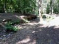
This walk takes you past many ruined structures, a destroyed village, monuments, memorial stones and recently restored trenches. It passes by Fort Douaumont and the Douaumont Cemetery. Look carefully at the ground – you’ll still find plenty of shell fragments and sometimes even whole shells.
Froideterre Fortification, Douaumont Ossuary and Zigzag Trench
 7.22 mi
+768 ft
-755 ft
4h 00
Moderate
Departure from Bras-sur-Meuse (Meuse)
7.22 mi
+768 ft
-755 ft
4h 00
Moderate
Departure from Bras-sur-Meuse (Meuse)
This history-filled route allows you to discover structures, shelters, command posts, entrenchments and an intermediate ammunition shelter still in good condition, as well as some remains of trenches and isolated combat posts.
Walk in the Azannais
6.05 mi
+509 ft
-505 ft
3h 15
Easy
Departure from Azannes-et-Soumazannes (Meuse)
A very pleasant walk with sweeping views.
 From Moirey (Ferme du Vallon) to Sedan (Camping du Lac de Douzy)
60.76 mi
+1,483 ft
-1,762 ft
8 hrs
 Difficult
Departure from Moirey-Flabas-Crépion (Meuse)
Difficult
Departure from Moirey-Flabas-Crépion (Meuse)
Passing through woods, meadows and sites of First World War battles, we reach the River Meuse at Stenay, a small town in department 55. Our route crosses several meanders and enters the Ardennes via Mouzon, from where EuroVelo 19 takes us to Sedan. On the way, we’ll pitch our tent near Lake Douzy and return there in the evening.
Amel Pond
 4.86 mi
+46 ft
-46 ft
2h 15
Easy
Departure from Senon (Meuse)
4.86 mi
+46 ft
-46 ft
2h 15
Easy
Departure from Senon (Meuse)
The Étang d’Amel, owned by the Conservatoire d’espaces naturels de Lorraine, was designated, along with the adjoining land, as a Regional Nature Reserve in 2006 by the Lorraine Regional Council.
The Étang d’Amel nature route, which runs through the villages of Senon and Amel-sur-l’Étang, features information boards and two observation points. This allows you to watch the birds without disturbing them.
The Crête des Éparges
 4.99 mi
+574 ft
-571 ft
2h 50
Moderate
Departure from Les Éparges (Meuse)
4.99 mi
+574 ft
-571 ft
2h 50
Moderate
Departure from Les Éparges (Meuse)
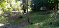
A memorial hike on a site where very deadly battles took place between February and April 1915, considered by some historians to be a prelude to the Battle of Verdun (nearby), which was triggered a year later. Several monuments and numerous remains mark the route, including impressive craters left by huge explosions.
Route des Fontaines
 2.49 mi
+92 ft
-72 ft
1h 15
Easy
Departure from Mercy-le-Bas (Meurthe-et-Moselle)
2.49 mi
+92 ft
-72 ft
1h 15
Easy
Departure from Mercy-le-Bas (Meurthe-et-Moselle)
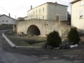
A beautiful walking route amongst the old stone buildings, tunnel fountains and the countryside.
Although described as a walking route, this route can also be tackled by mountain bike (in which case, adjust the starting point due to road signage; see description).
Mercéenne Valley
 5.68 mi
+243 ft
-269 ft
2h 50
Easy
Departure from Mercy-le-Bas (Meurthe-et-Moselle)
5.68 mi
+243 ft
-269 ft
2h 50
Easy
Departure from Mercy-le-Bas (Meurthe-et-Moselle)
Set in a very pretty rural setting with lush green valleys and a traditional village.
From the Meuse Valley to the banks of the Meuse
 Tourist office
 9.25 mi
+909 ft
-896 ft
5h 05
Moderate
Departure from Doulcon (Meuse)
9.25 mi
+909 ft
-896 ft
5h 05
Moderate
Departure from Doulcon (Meuse)
Starting from Doulcon, you will discover the typical landscapes of the Meuse coast. A detour through the pretty village of Mont-devant-Sassey has some beautiful architectural surprises in store for you! You will then reach the village of Sassey-sur-Meuse via the coast before reaching Dun-sur-Meuse and then Doulcon via the towpath along the navigable Meuse. Passing through four municipalities: Dun-sur-Meuse, Doulcon, Mont-devant-Sassey and Sassey-sur-Meuse, you can start your walk from any of them. You can also split this walk to shorten it or avoid the forest during the hunting season.
Marcaulieu Route
 7.10 mi
+840 ft
-860 ft
4h 00
Moderate
Departure from Thillombois (Meuse)
7.10 mi
+840 ft
-860 ft
4h 00
Moderate
Departure from Thillombois (Meuse)
Starting from the village of Lahaymeix, this ‘Vent des Forêts’ walk takes you on a journey to discover various works by artists in the heart of the Meuse forest.
Gros Caillou Route
 7.47 mi
+512 ft
-531 ft
3h 55
Moderate
Departure from Dompcevrin (Meuse)
7.47 mi
+512 ft
-531 ft
3h 55
Moderate
Departure from Dompcevrin (Meuse)
Near the village of Dompcevrin, this 12 km Vent des Forêts hike takes you on a journey of discovery through the Meuse forest, where you can admire various works of art.
Route of the three fountains in the Marcaulieu National Forest
 4.81 mi
+446 ft
-453 ft
2h 35
Easy
Departure from Dompcevrin (Meuse)
4.81 mi
+446 ft
-453 ft
2h 35
Easy
Departure from Dompcevrin (Meuse)
Close to the village of Dompcevrin, this Vent des Forêts hike takes you on a journey of discovery through the works of various artists in the heart of the Meuse forest.
Lachaussée Pond and its satellite lakes
 8.99 mi
+30 ft
-30 ft
4h 10
Moderate
Departure from Lachaussée (Meuse)
8.99 mi
+30 ft
-30 ft
4h 10
Moderate
Departure from Lachaussée (Meuse)
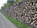
Listed as a Regional Nature Reserve, the Lachaussée pond has remained in its natural state. Many birds have made their home there or stop off during their migration. It is a haven of peace for flora and fauna.Please note: it is forbidden to stray from the existing paths, particularly around the ponds, otherwise you may be liable for a hefty fine.
Shortcut
 1.58 mi
+62 ft
-62 ft
0h 45
Easy
Departure from Lahaymeix (Meuse)
1.58 mi
+62 ft
-62 ft
0h 45
Easy
Departure from Lahaymeix (Meuse)
Near the village of Lahaymeix, this 3 km Vent des Forêts walk takes you on a journey to discover various works by artists in the heart of the Meuse forest.
Louvent Route
 6.45 mi
+463 ft
-463 ft
3h 20
Moderate
Departure from Fresnes-au-Mont (Meuse)
6.45 mi
+463 ft
-463 ft
3h 20
Moderate
Departure from Fresnes-au-Mont (Meuse)
Starting from Louvent Farm, this 9 km ‘Vent des Forêts’ walk takes you on a journey to discover various works by artists in the heart of the Meuse forest.
The Gros Charme route in the Pierrefitte Forest
 6.05 mi
+331 ft
-335 ft
3h 05
Easy
Departure from Pierrefitte-sur-Aire (Meuse)
6.05 mi
+331 ft
-335 ft
3h 05
Easy
Departure from Pierrefitte-sur-Aire (Meuse)
Near the village of Pierrefitte-sur-Aire, this 10 km Vent des Forêts walk takes you on a journey to discover various works by artists in the heart of the Meuse forest.
Savonnières - Woinville route
 9.61 mi
+938 ft
-925 ft
5h 15
Moderate
Departure from Valbois (Meuse)
9.61 mi
+938 ft
-925 ft
5h 15
Moderate
Departure from Valbois (Meuse)
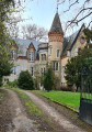
A route combining rural forest landscapes and some interesting monuments from the Great War. There is also a lovely view of the Woëvre plain, Montsec and Lake Madine.
Along the Chiers between Lexy and Cons-la-Grandville
 6.30 mi
+433 ft
-456 ft
3h 15
Moderate
Departure from Lexy (Meurthe-et-Moselle)
6.30 mi
+433 ft
-456 ft
3h 15
Moderate
Departure from Lexy (Meurthe-et-Moselle)
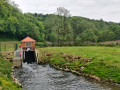
A walk along the Chiers, on a mainly tarmac-surfaced and easily accessible route. This walk takes you close to former industrial and production sites that are now disused. In the tranquillity of the forest, imagine the hum of activity from days gone by still echoing amongst the trees and the remnants of the past.
More walks in Vaux-devant-Damloup
Select a point of interest below: