From the Verdun Memorial to Bezonvaux via Fort Douaumont

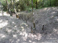
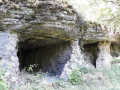
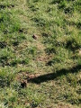
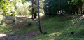
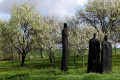
This walk takes you past many ruined structures, a destroyed village, monuments, memorial stones and recently restored trenches. It passes by Fort Douaumont and the Douaumont Cemetery. Look carefully at the ground – you’ll still find plenty of shell fragments and sometimes even whole shells.

Details

3349928
Creation:
Last update:
Last review:
  • Walking
    Activity: Walking
  • ↔
    Distance: 10.83 mi
  • ◔
    Average duration: 5h 45 
  • ▲
    Difficulty: Moderate

  • ⚐
    Back to start: Yes
  • ↗
    Ascent: + 840 ft
  • ↘
    Descent: - 833 ft

  • ▲
    Highest point: 1,283 ft
  • ▼
    Lowest point: 817 ft

Photos

Description of the walk

Park in the car park at the Verdun Memorial.

(S/E) Take the gravel track opposite and, at the junction, turn right onto the D 913, then turn left onto the Chemin des Chars. Continue through the woods until you reach the junction with the Chemin le Tacot.

(1) Turn right onto this for a few metres, then turn left onto the Chemin d’Hardaumont.

(2) Take a round trip to the Ravin de la Fausse Côte to explore the battery.
Back on the track, turn right and head towards Chemin de la Plume.

(3) Turn right onto this path and follow it to the four-way junction. Turn left at a 90° angle to reach the Ouvrage de Lorient.

(4) Continue by turning left, then join the Chemin d’Hardaumont and turn right onto it. Leave this path at the next bend and junction to reach the remains of the Alsace command post.

(5) Join the gravel track, continue by turning right at the Y-junction and head for the Bezonval Fort.

(6) Carry on straight ahead until you reach the edge of the forest at the junction with the D24. Turn left onto the D24 and continue to the junction at the ruined village of Bezonvaux.

(7) Keep to the right on the D24 and, at the car park, turn left to reach the Bezonvaux Chapel.

(8) Return to the crossroads of the village you passed earlier.

(7) Turn right onto the Chemin du Loup and follow this path to the multi-way junction.

(9) Leave the track on your left and take the path on the right heading due south. Take a detour to the right to reach the blockhouse and monument to the 74th Infantry Regiment.

(10) Return to the footpath, turn right for a few metres, reach the Chemin de la Plume and follow it to the right for a few metres. Turn sharply left to see the DV1 shelter.

(11) Return to Chemin de la Plume, turn left onto it and reach the Fort de Duaumont car park. Cross the car park to reach the fort.

(12) Return to the car park, turn right and join the D913d road. Discover the TD3 interval shelter and continue along the road to reach the TD2 infantry shelter or Adalbert Shelter.

(13) Continue along the road until you reach the Douaumont Cemetery and Memorial.

(14) Walk alongside the cemetery; at the next junction, turn left; at the barrier, take the path and you will soon come to Chemin le Tacot. Turn right onto it and follow it to the car park at the Verdun Memorial (S/E).


Waypoints

  1. S/E : mi 0 - alt. 1,135 ft - Car park at the - Mémorial de Verdun
  2. 1 : mi 1.01 - alt. 991 ft - Chemin le Tacot
  3. 2 : mi 1.7 - alt. 1,119 ft - Ravin de la Fausse Côte. Return
  4. 3 : mi 2.09 - alt. 1,155 ft - Chemin de la Plume
  5. 4 : mi 2.65 - alt. 1,168 ft - Remains of the L’Orient fortification
  6. 5 : mi 3.45 - alt. 1,148 ft - Rest of the - P.C. d'Alsace
  7. 6 : mi 4.49 - alt. 1,043 ft - Ruins of the - Ouvrage de Bezonvaux
  8. 7 : mi 5.32 - alt. 840 ft - Bezonvaux Monument
  9. 8 : mi 5.72 - alt. 830 ft - Chapelle Saint-Gilles (Bezonvaux)
  10. 9 : mi 7.57 - alt. 1,102 ft - Chemin du Loup junction – footpath
  11. 10 : mi 7.94 - alt. 1,227 ft - Monument and blockhouse of the 74th Infantry Regiment
  12. 11 : mi 8.27 - alt. 1,168 ft - DV 1 combat shelter
  13. 12 : mi 8.66 - alt. 1,283 ft - Fort de Douaumont
  14. 13 : mi 9.4 - alt. 1,181 ft - Infantry shelter TD2. Near the - Tranchée des Baïonnettes
  15. 14 : mi 9.72 - alt. 1,129 ft - Cemetery and - Ossuaire de Douaumont
  16. S/E : mi 10.83 - alt. 1,135 ft - Verdun Memorial car park. Near the - Chapelle Notre-Dame de l'Europe (Fleury-devant-Douaumont)

Notes

The route may be disrupted due to forestry work (damaged paths or fallen timber blocking the way). Depending on the season, the ground may be muddy.

Worth a visit

Reviews and comments

3.6 / 5
Based on 5 reviews

Reliability of the description
3.6 / 5
Ease of following the route
3.4 / 5
Route interest
3.8 / 5
Hirondelle1000
Hirondelle1000

Overall rating : 5 / 5

Date of your route : Sep 25, 2023
Reliability of the description : ★★★★★ Very good
Ease of following the route : ★★★★★ Very good
Route interest : ★★★★★ Very good
Very busy route : Yes

A superb walk that takes in some very interesting sites from the Battle of Verdun.

Machine-translated

Sophie1005
Sophie1005

Overall rating : 1.7 / 5

Date of your route : Aug 21, 2023
Reliability of the description : ★★☆☆☆ Disappointing
Ease of following the route : ★☆☆☆☆ Very disappointing
Route interest : ★★☆☆☆ Disappointing
Very busy route : No

Trails of little interest, with a section of the trail not yet restored following major forestry work. The boundary is impassable. Some of the points of interest listed on the route remain untraceable.

Machine-translated

randonnée pascal
randonnée pascal

Overall rating : 3.3 / 5

Date of your route : Jun 24, 2023
Reliability of the description : ★★★☆☆ Average
Ease of following the route : ★★★☆☆ Average
Route interest : ★★★★☆ Good
Very busy route : Yes

Hike on 18 June, hot and sunny weather, very dry terrain.
As I was already somewhat familiar with the Verdun massif, I wasn’t on unfamiliar ground; it was a relatively easy walk, following mainly forest tracks, with little shade, I did have a few difficulties finding certain paths; at point No. 3, the crossroads was very overgrown, and it’s a very narrow path that leads uphill. The Orient fortification and the Alsace command post were impossible to find, buried beneath the vegetation, though I did have the app just in case.
The same goes for the Bezonvaux fortification, which is also heavily overgrown, but nevertheless gives a sense of the murderous madness of men during the bombings.
Please note: paths 9 and 10 are passable in dry weather, but will be difficult in wet conditions, as forestry machinery has carved out very deep ruts.
It’s easy to forget you’re on a hike, as your thoughts turn to remembering those who fell, whatever their nationality.
The village of Bezonvaux still raises the question: why such madness?.....

Machine-translated

Loan_Icn
Loan_Icn

Overall rating : 4.3 / 5

Date of your route : Aug 05, 2021
Reliability of the description : ★★★★☆ Good
Ease of following the route : ★★★★☆ Good
Route interest : ★★★★★ Very good
Very busy route : No

Most of the historic sites can be reached by walking through the local vegetation along the main route.

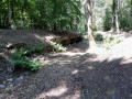
There are a few sections made difficult by muddy ditches created by vehicles passing through. There is a dangerous descent (see photo) in the first quarter of the route, near point 3, where the path is covered in branches and bark following partial deforestation.

There are few forest tracks; for the most part, the walk follows fairly wide gravel paths.

Douaumont Fort is the reward – a magnificent structure and a lovely viewpoint. No particular difficulties apart from the section mentioned above.

Machine-translated

Milor54
Milor54

Overall rating : 3.7 / 5

Date of your route : Aug 19, 2020
Reliability of the description : ★★★★☆ Good
Ease of following the route : ★★★★☆ Good
Route interest : ★★★☆☆ Average
Very busy route : No

Although the route and itinerary are fairly precise, the sites of interest along the route are difficult to access, or even impossible to find, due to dense vegetation and virtually non-existent signposting – apart from that found on the main roads, which is therefore intended for a different type of visitor.
From my point of view, the historical interest of this walk left me a little disappointed, as it was limited solely to sites developed for mass tourism.

Machine-translated

Other walks in the area

For more walks, use our search engine .

The GPS track and description are the property of this route's author. Please do not copy them without permission.