Country:
 City:
City:


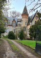
Starting from the village of Lahaymeix, when you’re facing the town hall, take the tarmac road on the right and follow it for 2 km. You’ll pass the Lahaymeix hunting lodge on your left as you go uphill. A few metres further on, on your right, there’s a car park where you can park.
The route is signposted with orange directional signs and is approximately 10 km long.
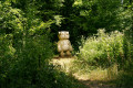
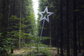
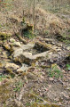
(S/E) Walk alongside the road on your left, then take the path opposite the hunting lodge. After a few metres, you’ll come across ‘Sans Titre’ (Faust Cardinali, 2004). Follow the signposts to a telecoms mast. Then walk alongside the fence on your right, carry on straight ahead and enter the forest. At the junction, turn right and continue. As you walk down the slope, you’ll see ‘Wikiki’ (Vincent Kohler, 2009) on your right. Then carry on to the bottom of the slope.
(1) Leave the woodland and turn left onto the white track crossing the fields and pastures. Carry on until you reach a junction.
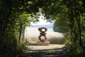
(2) You will then catch sight of ‘Utopia’ (Klaus HEID, 1997); turn right and carry on straight ahead. Walk alongside the woodland on your left, and you will see ‘Twisted Cube’ (Karina Bisch, 2010) on the left. Carry on along the path; further into the forest you’ll come across ‘Backbone’ (Collectif Humus, 2003). Continue on; a few metres further on, on your left, about thirty metres from the hillside path, you’ll find ‘Speranza’ (Charlotte Pringuey-Cessac, 2016). Follow the white path as it winds its way up the slope. At the top of the climb, you’ll come to a junction; turn right, then continue for 800 metres.
(3) Turn right onto the dirt track. Walk a few metres, then look out for a sign on your left indicating a path leading to ‘Cachée’ (Lorentino, 2006). Continue along the main path and you’ll see ‘Nul caillou n’est un faux’ (Béat Lipert, 2018) on your left, 10 metres away. Then carry on and turn left onto the white path.
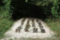
(4) You’ll see ‘Immigrare I’ (Sanaz Azari, 2007) on your right. Follow the path and, at the end of it, turn right onto the forest track until you spot ‘Bee’s Bunker’ (Nicolas Floc’h, 2015) in a clearing. Retrace your steps back to the white path and continue straight on. A few metres further on, on your right, you’ll find ‘Columbarii’ (Daniel Nadaud, 2016). Walk on and turn right at the junction. Look out for ‘Dédale’ (Maire/Schneider, 1999), signposted on your left.
(5) You’ll come to a fork in the path where you can see the Marcaulieu hunting lodge below. Turn right, continue along the white path, then 200 metres further on, turn right onto the signposted trail. On your left you’ll see ‘Les cent ciels plantés’ (Denis Malbos, 2001); carry on straight ahead until you emerge from the forest.
(6) Then follow the path which climbs across the fields.
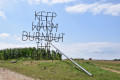
(7) You will then see “Keep warm burnout the rich” (Nøne Futbol Club, 2017). Carry on straight ahead. Further on, in an orchard on your left, you’ll see “Le silence divisé” (Christian Lapie, 2009). Continue until you cross the tarmac road and join the path running alongside the field. On your right stands ‘La fête du rrrhoh rrrhoh’ (Aurélie Ferruel & Florentine Guédon, 2018). At the orchard, turn left and follow the path. You’ll reach the village via a tarmac path. You’ve now arrived in Lahaymeix. At the junction, on your left, you’ll see ‘La marche’ (Matouš Lipus, 2018). Carry straight on.
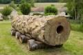
(8) Walk past the war memorial on your left. A little further on, you’ll find the tree trunks of ‘Chambre forte’ (The Chapuisat brothers, 2011) on your right, then ‘Le chant des géants’ (Eric Croes, 2007) on the façade of a building. Retrace your steps back to the war memorial.
(8) Turn left at the memorial, taking the tarmac road that runs alongside the football pitch, then follow it uphill for about 2 km.
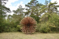
(9) A few metres past the junction with a dirt track, you’ll spot ‘Entrelacs’ (François Génot, 2005) hidden amongst the vegetation. Continue your climb and enter the forest. You’ll see the Lahaymeix hunting lodge on your left, then a few metres further on, on your right, is the car park (S/E).

 Visorando Member
 Easy
Easy