


Refine your search for walks in Vautorte
Vautorte walks


 The mills of Gastines and Fumeçon
 Visorando Member

 7.70 mi
 +423 ft
 -420 ft
 3h 55
 Moderate
 Departure from Vautorte (Mayenne)
There are only two old mills, no longer in operation, on this route, but it will also allow you to explore the woods and moors of the Gastinais region.
As far as Gué Guérin, following the Ernée
 9.02 mi
+358 ft
-335 ft
4h 25
Moderate
Departure from Montenay (Mayenne)
This route, known as the “Circuit des sentiers de l’Oscence”, originates in the Mayenne region.
It offers the pleasure of walking alongside the Ernée, a small river which flows into the Mayenne – a tributary of the Loire – as well as along some magnificent sunken paths.
The countryside around Chailland
9.16 mi
+617 ft
-620 ft
4h 45
Moderate
Departure from Chailland (Mayenne)
This route forms a figure of ‘8’; it can therefore be divided into two shorter circular loops: the upper circular loop is 9 km long, whilst the lower circular loop is just 5 km. It offers a lovely countryside stroll along quiet country lanes and very pleasant footpaths.
The Pouillé Copse in Larchamp
6.64 mi
+299 ft
-302 ft
3h 20
Moderate
Departure from Larchamp (Mayenne)
Unnoticeable to the hiker, this route has a unique feature: the waters encountered in the south feed into the Atlantic basin, whilst those in the north flow towards the English Channel.
It does, however, offer the chance to explore a site where woodworking was, for several centuries, the primary industry.
Gastard trail starting from Andouillé
6.65 mi
+413 ft
-430 ft
3h 25
Moderate
Departure from Andouillé (Mayenne)
A short detour to Rochefort, a charming hamlet on the banks of the Mayenne, is highly recommended to admire the river. You can quench your thirst at La Guinguette before continuing your journey.
Circular route starting from Andouillé via the Crennes moorland
4.55 mi
+233 ft
-243 ft
2h 20
 Easy
Departure from Andouillé (Mayenne)
Visit Andouillé and its countryside with its gentle hills and cross the Ernée via its stepping stones.
Long loop between Mayenne and Fontaine-Daniel
 13.36 mi
+676 ft
-653 ft
6h 45
 Difficult
Departure from Mayenne (Mayenne) (Mayenne)
Fontaine-Daniel, with its picturesque village and beautiful lake, is one of the best-known places in the Mayenne area, but there is only one busy road to get there and the hiking opportunities around it are limited. This route, which can be done by bike or on foot in a day, connects the town to the village via a greenway through the town of Mayenne, then crosses the rolling countryside of Saint-Georges-Buttavent. It also covers a large part of the Salair forest near Fontaine-Daniel. To shorten the route, you can skip Mayenne and start elsewhere to make a loop around Fontaine-Daniel.
Vals de la Mayenne and de l'Aron
7.50 mi
+354 ft
-354 ft
3h 45
Moderate
Departure from Moulay (Mayenne)
The towpath proves to be a veritable observatory of biodiversity. As you wander along, the landscapes change around every bend and take on a variety of colours depending on the season. A quick wave, a brief “hello” – these little encounters punctuate this peaceful and relaxing walk.
“Hedgerows and Rivers” route in Sacé
 Tourist office
 8.78 mi
+253 ft
-279 ft
4h 15
Moderate
Departure from Sacé (Mayenne)
A walk starting from Sacé, alternating between sunken paths and a stroll along the towpath.
Around Sacé
 3.44 mi
+180 ft
-180 ft
1h 45
Easy
Departure from Sacé (Mayenne)
A short route along the sunken paths of the small village of Sacé, passing by the River Mayenne.
From Sacé, the banks of the Mayenne
 7.82 mi
+318 ft
-302 ft
3h 50
Moderate
Departure from Sacé (Mayenne)
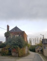
This route gives pride of place to the River Mayenne, following its course for over four kilometres. As you travel upstream, you will pass five lock-and-dam complexes, some of which are linked to a small power station.
The Lac de Haute-Mayenne and the Saint-Fraimbault-des-Prières dam
8.75 mi
+528 ft
-538 ft
4h 30
Moderate
Departure from Ambrières-les-Vallées (Mayenne)
The Lac de Haute Mayenne, artificially created by the Saint-Fraimbault dam, will charm you with its rich and varied flora and fauna. But this route will also allow you to discover the confluence of two rivers that feed into the Mayenne: the Varenne and the Colmont.
The sunken lanes of La Dorée
 7.05 mi
+541 ft
-528 ft
3h 45
Moderate
Departure from La Dorée (Mayenne)
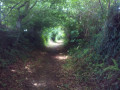
The Mayenne is a land of pastures where plots of land remain small. There are numerous sunken lanes here, and you are invited to explore several of them.
One slight drawback: due to their nature, there is no continuity. Walkers will therefore have to accept walking some distances on tarmac roads.
Around the Merveille stream
 10.81 mi
+512 ft
-492 ft
5h 25
Moderate
Departure from Saint-Jean-sur-Mayenne (Mayenne)
The Mayenne: first and foremost, it is a river 200 km long that has given its name to a town from which it is navigable, as well as to a department (53).
You’ll begin by exploring the countryside along a path through the scrub, then along so-called ‘traverse’ paths – some unpaved, some tarmacked – with views over the Vallon des Merveilles, before reaching the river as it cuts through the granite at Moulin Oger and then a deep gorge formed by two sandstone escarpments.
Hollow path route in Saint-Jean-sur-Mayenne
 4.56 mi
+236 ft
-236 ft
2h 20
Moderate
Departure from Saint-Jean-sur-Mayenne (Mayenne)
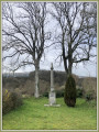
A very pleasant walk to rediscover the Mayenne countryside, between sunken paths, wooded areas, fields of cows and crops.
Claire-Fontaine and the Chapelle de Courbefosse in Fougerolles-du-Plessis
 9.08 mi
+440 ft
-413 ft
4h 35
Moderate
Departure from Fougerolles-du-Plessis (Mayenne)
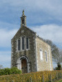
A very pleasant walk, starting with two lakes, followed by wide, straight paths through wooded countryside, before continuing along the circular western route with unobstructed views as you walk alongside a small stream. Along the way, you’ll see some beautiful country houses and two small chapels.
Around Genest-Saint-Isle
3.70 mi
+171 ft
-187 ft
1h 50
Easy
Departure from Le Genest-Saint-Isle (Mayenne)
An easy walk starting from Genest-Saint-Isle, with very little elevation gain. The paths are beautiful, and you may see deer. In rainy weather, two or three sections are flooded for a few metres, but you can get around this by walking along the edge of the adjacent field. A beautiful finish along a pretty little stream.
From Pontmain to Pont Dom Guérin
3.14 mi
+141 ft
-151 ft
1h 35
Easy
Departure from Pontmain (Mayenne)
This route takes you into the Parc des Oblats and its arboretum, then along a shaded path by the water’s edge leading to Mausson Castle, which is privately owned but can be admired from the outside. Pontmain is an important place of pilgrimage to Our Lady of Pontmain, who appeared to several children on 17 January 1871.
As far as Mausson Castle, staying within the Bazouge region
4.24 mi
+318 ft
-305 ft
2h 15
Easy
Departure from Landivy (Mayenne)
Tree-lined paths running alongside a river lead to the château. The return route mainly follows a winding path through the fields.
Along the Airon from Landivy
 11.43 mi
+466 ft
-489 ft
5h 40
Moderate
Departure from Landivy (Mayenne)
With one foot in Normandy and one in Brittany, this trail offers some truly stunning views. After taking in the panoramic scenery, you’ll wind your way through the shaded paths along the Futaie Valley.