Vals de la Mayenne and de l'Aron

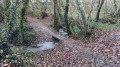
The towpath proves to be a veritable observatory of biodiversity. As you wander along, the landscapes change around every bend and take on a variety of colours depending on the season. A quick wave, a brief “hello” – these little encounters punctuate this peaceful and relaxing walk.

Details

11172574
Creation:
Last update:
Last review:
  • Walking
    Activity: Walking
  • ↔
    Distance: 7.50 mi
  • ◔
    Average duration: 3h 45 
  • ▲
    Difficulty: Moderate

  • ⚐
    Back to start: Yes
  • ↗
    Ascent: + 354 ft
  • ↘
    Descent: - 354 ft

  • ▲
    Highest point: 433 ft
  • ▼
    Lowest point: 266 ft
  • ⚐ Country: France
  • ⚐ City: Moulay (53100)
  • ⚑
    Start/End: N 48.273129° / W 0.627925°
  • ❏
    IGN map(s): Ref. 1517SB, 1518SB
  • Hour-by-hour weather

Description of the walk

Start from the football stadium car park, Rue de la Maitairie.

Yellow signposting

(S/E) Take the path opposite the northern corner of the car park and continue to the towpath.

(1) Continue to the left, keeping the River Mayenne on your right, for approximately 2.6 km, crossing the Aron – a tributary on the left bank – and reach a right-angled junction on the left.

(2) Turn onto this path, ignoring the side paths to the right and left. Continue to Le Haut Mont.

(3) Turn right and, at La Base Bretonnière, at the junction, continue left after crossing the road with care. Walk for 200 m until you reach a path on the right.

(4) Turn right onto the grassy path that runs alongside the N162 bypass.

(5) At the roundabout, carry on straight ahead, crossing carefully at a pedestrian crossing. Follow the signposts along the gentle downhill path.

(6) Pass under the ring road viaduct, then head back up towards La Hucherie until you reach the road.

(7) Keep left, pass La Hucherie, ignore a road on your left and head for the next path on the left.

(8) Turn left onto this country lane. At the road, continue to the right then quickly turn right again. Cross a stream then follow the old railway line to the left. Walk alongside the hamlet of La Conterie until you reach the entrance to the hamlet of La Monnerie. Walk a few metres to the right until you reach the start of the path on the left.

(9) Please note: there are no signposts at this point. Follow this path to the end.

(10) At the T-junction, turn left, walk alongside the horse-riding track, cross the Aron and take the first road on the left towards L’Assière and Le Petit Mesnil. Cross the old railway line, walk alongside Le Petit Mesnil on your left, then pass under the bypass.

(11) At the corner by the fence of the flood retention area, leave the cycle path and continue straight on along the road. At the Stop sign, turn left and look out for a road on the right.

(12) Cross carefully and follow this small road (signposted for a restaurant 200 m ahead) which passes through the hamlet of Beau Rivage to reach the towpath along the River Mayenne.
Carry on to the left with the river on your right and reach the junction you passed at the start.

(1) Turn left and head back to the football ground car park via the same route you took on the way there (S/E).

Waypoints

  1. S/E : mi 0 - alt. 371 ft - Football stadium car park
  2. 1 : mi 0.14 - alt. 272 ft - Towpath - Mayenne (rivière)
  3. 2 : mi 1.77 - alt. 269 ft - Vehicle access road on the left
  4. 3 : mi 2.42 - alt. 407 ft - Le Haut Mont
  5. 4 : mi 2.69 - alt. 397 ft - Grassy path on the right
  6. 5 : mi 3.03 - alt. 423 ft - Pedestrian crossing
  7. 6 : mi 3.49 - alt. 312 ft - Passing under the ring road
  8. 7 : mi 3.68 - alt. 387 ft - Road, on the left
  9. 8 : mi 4.26 - alt. 427 ft - Country lane on the left
  10. 9 : mi 5.21 - alt. 397 ft - La Monnerie, path on the left
  11. 10 : mi 5.48 - alt. 387 ft - Training track
  12. 11 : mi 6.49 - alt. 387 ft - Passage under the bypass
  13. 12 : mi 6.8 - alt. 354 ft - On the right, towards Beau Rivage
  14. S/E : mi 7.5 - alt. 371 ft - Football stadium car park

Reviews and comments

3.7 / 5
Based on 4 reviews

Reliability of the description
3.5 / 5
Ease of following the route
3.8 / 5
Route interest
3.8 / 5
charlie53
charlie53

Overall rating : 4.3 / 5

Date of your route : Nov 20, 2025
Reliability of the description : ★★★★★ Very good
Ease of following the route : ★★★★☆ Good
Route interest : ★★★★☆ Good
Very busy route : No

Lovely walk

Machine-translated

Les Woodies
Les Woodies

Overall rating : 3.3 / 5

Date of your route : Jul 02, 2022
Reliability of the description : ★★★★☆ Good
Ease of following the route : ★★★☆☆ Average
Route interest : ★★★☆☆ Average
Very busy route : No

Signposting needs reviewing – it spoils the walk

Machine-translated

Willys
Willys

Overall rating : 3.7 / 5

Date of your route : Jul 03, 2022
Reliability of the description : ★★★☆☆ Average
Ease of following the route : ★★★★☆ Good
Route interest : ★★★★☆ Good
Very busy route : No

A relatively easy and enjoyable walk.

Machine-translated

balou17
balou17

Overall rating : 3.3 / 5

Date of your route : Apr 30, 2022
Reliability of the description : ★★☆☆☆ Disappointing
Ease of following the route : ★★★★☆ Good
Route interest : ★★★★☆ Good
Very busy route : No

A very pleasant, gently undulating walk. Narrow paths and a bit of minor road.

Machine-translated

Other walks in the area

For more walks, use our search engine .

The GPS track and description are the property of this route's author. Please do not copy them without permission.