Around the Merveille stream

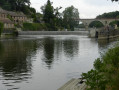
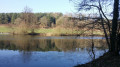
The Mayenne: first and foremost, it is a river 200 km long that has given its name to a town from which it is navigable, as well as to a department (53).
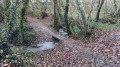
You’ll begin by exploring the countryside along a path through the scrub, then along so-called ‘traverse’ paths – some unpaved, some tarmacked – with views over the Vallon des Merveilles, before reaching the river as it cuts through the granite at Moulin Oger and then a deep gorge formed by two sandstone escarpments.

Details

3156455
Creation:
Last update:
Last review:
  • Walking
    Activity: Walking
  • ↔
    Distance: 10.81 mi
  • ◔
    Average duration: 5h 25 
  • ▲
    Difficulty: Moderate

  • ⚐
    Back to start: Yes
  • ↗
    Ascent: + 512 ft
  • ↘
    Descent: - 492 ft

  • ▲
    Highest point: 420 ft
  • ▼
    Lowest point: 164 ft

Photos

Description of the walk

Parking is available in the car park on the opposite bank of the Mayenne.

(S/E) Leave the car park by heading towards the River Mayenne and set off southwards.
Pass under the road bridge and take the hairpin bend to the left to join the departmental road. Follow it to the right and, after 100 m, take the road on the right towards Bel Air. At the cross at the top of the hill, turn left onto the track to rejoin the departmental road.

(1) Cross over and continue straight ahead; after 150 m, take the track on the right. You’ll come to a road; follow it as it continues. Ignore the turn-off for La Bigrie on the left and carry on for a further 150 m.

(2) Turn left and, when the track joins another, take the latter to the right at the hairpin bend. Carry on until you reach a road at a junction with several roads. Take the one furthest to the left. Pass in front of Les Vénots and head due north to Mézière.

(3) Turn left. After crossing the river “Le Fresne”, keep to the left and you’ll reach a road.

(4) Turn right, cross another road and carry on straight ahead. Continue along this road, ignoring a track on the left which leads to La Vigneule. You’ll reach the D101.

(5) Turn left, keeping to the left-hand verge, cross Le Cormier and continue for 200 m behind the safety barriers. At the right-hand bend, carry on straight ahead along the path and enter Montflours. Follow the road to the right for 50 m

(6) Turn left to walk past the church via the Place de la Sergenterie and continue along the path that leads on from there. It descends, curving to the left.

(7) Where it meets another path, turn right at the hairpin bend. At the end of the path, turn left to follow the departmental road north-west.

(8) Leave this departmental road by turning left, then follow the road downhill as it curves sharply to the right. You will then join the Greenway after passing under the road bridge.

(9) Off the route: 150 m to the right, you can see lock no. 13 on the Upper Fourmandière
Turn left to pass under the road bridge once more.

(10) Lock No. 14 of the Lower Fourmandière. Follow the Mayenne along the Greenway, heading south-west.

(11) Lock No. 15 at Moulin Oger – Continue along the Mayenne on the Voie Verte, heading south-east.

(12) Lock No. 16 at L’Âme – Continue along the River Mayenne on the Greenway, heading west.

(13) Lock No. 17 at La Maignannerie – Carry on along the Mayenne on the Greenway, heading south-southeast.

You’ll find the car park where you started on the left, about 120 metres before the bridge (S/E).


Waypoints

  1. S/E : mi 0 - alt. 167 ft - Car park on the banks of the - Mayenne (rivière)
  2. 1 : mi 1.18 - alt. 351 ft - Turn left before the houses
  3. 2 : mi 2.06 - alt. 400 ft - Path on the left
  4. 3 : mi 3.19 - alt. 417 ft - Turn left after the bridge
  5. 4 : mi 3.93 - alt. 318 ft - Turn right
  6. 5 : mi 5.13 - alt. 289 ft - Turn left onto the departmental road
  7. 6 : mi 5.91 - alt. 325 ft - Rue de la Sergenterie – turn left
  8. 7 : mi 6.34 - alt. 285 ft - Turn right at the T-junction
  9. 8 : mi 6.74 - alt. 266 ft - Access road on the left
  10. 9 : mi 6.95 - alt. 194 ft - Greenway - Mayenne (rivière)
  11. 10 : mi 7.06 - alt. 194 ft - Lock No. 14 at Lower Foumandière
  12. 11 : mi 7.51 - alt. 187 ft - Lock No. 15 at Moulin Oger
  13. 12 : mi 8.8 - alt. 180 ft - Lock No. 16 at L’Âme
  14. 13 : mi 9.95 - alt. 174 ft - Lock No. 17 at La Maignannerie
  15. S/E : mi 10.81 - alt. 167 ft - Car park on the banks of the Mayenne

Notes

This walk continues by following the Mayenne northwards via another walk, numbered 3166350, and entitled[...]. These two walks share a common section:
- for this one (between 6 and 9)
- corresponding to section (2 to 4) of the other walk.

Worth a visit

In Saint-Jean-sur-Mayenne, be sure to visit:
- the 19th-century Church of Saint John the Baptist
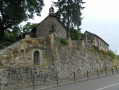
- the 19th-century Saint-Trèche Chapel - the remains of a surrounding wall of an ancient Carolingian monastery
- the oppidum at Château Meignan, 1.4 km to the north at a place called Le Bois Testards. This is an ancient fortified settlement of which a few remains can still be seen

In the surrounding area, along the River Mayenne, no fewer than six châteaux can be seen:
- To the left of the car park, the 19th-century Château de la Girardière
- On the road to the right after the ‘4 ’ sign, 1.5 km further on: the 19th-century Château de Grondin
- At the (9), take the Voie Verte to the right after lock no. 10 on the Nourrière, situated 2 km to the right: the Château de la Juvaudière.
- After the (11) on the left: the Château de la Motte Sérent – in the commune of Montflours
- At the bend in the river, on the right, the Château d’Orange.
- Just after that, on the hillside to the right: the 19th-century Château de la Chaussonnerie.

The River Mayenne rises at Mont des Avaloirs (417 m), in the north-east of the department and 15 km west of Alençon (Orne).
It is only truly navigable from the town of Mayenne, situated 85 km from its source.

A total of 45 dams with lock chambers have been built on the Mayenne to make it navigable; these include:
- between Mayenne (town) and Laval: 20 structures over 34 km.
- between Laval and Angers, where it joins the Sarthe to form the Maine, which flows into the Loire: 25 structures over 82 km.

Reviews and comments

4.2 / 5
Based on 3 reviews

Reliability of the description
4.3 / 5
Ease of following the route
4.3 / 5
Route interest
4 / 5
User 23017868

Overall rating : 4 / 5

Date of your route : Jun 29, 2026
Reliability of the description : ★★★★☆ Good
Ease of following the route : ★★★★☆ Good
Route interest : ★★★★☆ Good
Very busy route : No

A pleasant walk with some very beautiful views of the Mayenne countryside.

Machine-translated

piron
piron

Overall rating : 4.7 / 5

Date of your route : Mar 10, 2025
Reliability of the description : ★★★★★ Very good
Ease of following the route : ★★★★★ Very good
Route interest : ★★★★☆ Good
Very busy route : No

A very pleasant walk, with few other people about; unfortunately, the paths were very damp and difficult to walk on in places as they were soaked

Machine-translated

Le randonneur breton
Le randonneur breton ★

That’s absolutely right. Thank you for pointing that out; I’ll correct it straight away.

Machine-translated

daniel conq
daniel conq

Overall rating : 4 / 5

Date of your route : Sep 28, 2023
Reliability of the description : ★★★★☆ Good
Ease of following the route : ★★★★☆ Good
Route interest : ★★★★☆ Good
Very busy route : No

Very few pedestrians but a few cyclists – the cycle path is ideal for cycling.
We had a slight query at point 5, at the entrance to Montflours. We didn’t see Rue de la Sergenterie, but we did see Place de la Sergenterie.

Machine-translated

Other walks in the area

For more walks, use our search engine .

The GPS track and description are the property of this route's author. Please do not copy them without permission.