The sunken lanes of La Dorée

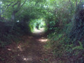
The Mayenne is a land of pastures where plots of land remain small. There are numerous sunken lanes here, and you are invited to explore several of them.
One slight drawback: due to their nature, there is no continuity. Walkers will therefore have to accept walking some distances on tarmac roads.

Details

1213040
Creation:
Last update:
Last review:
  • Walking
    Activity: Walking
  • ↔
    Distance: 7.05 mi
  • ◔
    Average duration: 3h 45 
  • ▲
    Difficulty: Moderate

  • ⚐
    Back to start: Yes
  • ↗
    Ascent: + 541 ft
  • ↘
    Descent: - 528 ft

  • ▲
    Highest point: 791 ft
  • ▼
    Lowest point: 538 ft
  • ⚐ Country: France
  • ⚐ City: La Dorée (53190)
  • ⚑
    Start/End: N 48.448812° / W 0.96487°
  • ❏
    IGN map(s): Ref. 1416O
  • Hour-by-hour weather

Photos

Description of the walk

Car park at the Town Hall in the village of La Dorée.

(S/E) Head west and, on the D116, turn left.
After 100m, take a path on the right leading to a small pond.
Follow the shore and join Rue des Sabotiers. Follow it to the left.

(1) Take the first road on the left towards La Jarias and L’Angotière. Ignore the road on the left towards La Jarias and continue to L’Angotière.

(2) Continue straight ahead along the tree-lined path. Cross a stream and join the Route du Bas Valandré. Continue straight on to Valandré.
Take the path on the left. Follow it as it makes a first turn left then right and joins a road.

(3) Take this country road on the right. Cross the D515 road with care and continue along the path opposite (heading north-west).
Go through the metal gate and make sure you close it properly
At La Fourmondais, follow the road to the right. After 200m, pass under a medium-voltage power line.

(4) Cross the D102 road and continue straight ahead, slightly to the right, towards La Rianterie.
Continue along this road. Ignore Maison Neuve on the left and reach the first houses of La Piffetiére.
Please note: it is very common for the route indicated to be impassable from this point onwards due to flooding. Please refer to the alternative route in the Practical Information section.

(5) After the first building, turn right and follow the path eastwards.
After a bend to the right and then to the left, the path leads onto the access road to La Monnerie (on the right).
Turn left.

(6) Leave the Landrière buildings on your left and continue along the path. Ignore a path on the left and go round the copse
Continue round a bend to the left, crossing a stream, then round another bend to the right to reach the road leading to Quesle.
Take this road on the left for 100m, then turn right onto the D515 for 250m.

(7) Opposite the Longueraie house, follow the path to the left. Continue along this path until you reach the houses at La Légerie.

(8) Follow this country road to the right. It runs alongside the Ruisseau de la Rouërie at varying distances.

(9) Before it bends right to join the D102, take the path on the left. Head towards La Taille Ferrière. Continue straight ahead on the road. After 100m, follow the path on the right heading south.

(10) Note: don’t miss this – yellow arrow on a post
Turn left towards the Lucien Daniel housing estate. On the road, turn left then right after 100m. Go round the housing estate and continue along the path on the left which goes round a field and then the football pitch.
Join Rue des Écoles. Turn right and return to the Town Hall car park (S/E).

Waypoints

  1. S/E : mi 0 - alt. 673 ft - Town Hall car park
  2. 1 : mi 0.32 - alt. 620 ft - Road to the left
  3. 2 : mi 0.74 - alt. 636 ft - Straight ahead along the path
  4. 3 : mi 1.66 - alt. 764 ft - Road on the right
  5. 4 : mi 2.52 - alt. 709 ft - Crossing the D102
  6. 5 : mi 3.06 - alt. 673 ft - Piffetiére
  7. 6 : mi 3.67 - alt. 663 ft - La Landrière
  8. 7 : mi 4.51 - alt. 689 ft - Path opposite La Longueraie
  9. 8 : mi 4.89 - alt. 568 ft - Turn right at La Légerie
  10. 9 : mi 5.47 - alt. 558 ft - Path on the left towards La Taille Ferrière
  11. 10 : mi 6.14 - alt. 636 ft - Path on the left
  12. S/E : mi 7.05 - alt. 673 ft - Town Hall car park

Notes

Almost the entire route (except for the alternative route) is signposted with “Circuit du Valandré” signs. Yellow lettering on a black background.

Alternative route at (5): if the path to the right, heading east, is impassable due to flooding, follow this route:
- Turn back to (4).
- At (4), turn left and follow the main road.
- Ignore the first road on the right towards La Bayette. You can rejoin the route described at elevation 213, but crossing the stream may also be problematic.
- Turn left onto the D515 towards Chantepie and rejoin the route at (7). You must then turn right.

Reviews and comments

4.5 / 5
Based on 5 reviews

Reliability of the description
4.6 / 5
Ease of following the route
4.6 / 5
Route interest
4.4 / 5
michdefoug
michdefoug

Overall rating : 5 / 5

Date of your route : Nov 25, 2024
Reliability of the description : ★★★★★ Very good
Ease of following the route : ★★★★★ Very good
Route interest : ★★★★★ Very good
Very busy route : No

Some lovely sunken lanes and a few quiet roads

Machine-translated

Martine MAROCHAIN
Martine MAROCHAIN

Overall rating : 4.7 / 5

Date of your route : Jan 31, 2022
Reliability of the description : ★★★★★ Very good
Ease of following the route : ★★★★★ Very good
Route interest : ★★★★☆ Good
Very busy route : No

A very pleasant walk along sunken paths. There’s a reasonable amount of tarmac, and we walk along quiet roads.
However, the markings on posts or trees have faded in some places; a fresh coat of paint would be no bad thing!
Please note that in winter the route can be quite wet in places.

Machine-translated

hantrayecolette
hantrayecolette

Overall rating : 4 / 5

Date of your route : Jul 20, 2020
Reliability of the description : ★★★★☆ Good
Ease of following the route : ★★★★☆ Good
Route interest : ★★★★☆ Good
Very busy route : No

Good signage

Machine-translated

Stef-Rando
Stef-Rando

Overall rating : 5 / 5

Date of your route : Sep 01, 2018
Reliability of the description : ★★★★★ Very good
Ease of following the route : ★★★★★ Very good
Route interest : ★★★★★ Very good

a lovely route along sunken paths, with beautiful views of the Mayenne countryside

Machine-translated

marchalombre3
marchalombre3

Overall rating : 4 / 5

Date of your route : Aug 20, 2018
Reliability of the description : ★★★★☆ Good
Ease of following the route : ★★★★☆ Good
Route interest : ★★★★☆ Good

A pleasant walk along narrow, shaded paths.
The distance on tarmac roads is reasonable. These are mainly small country lanes.
The signposting is adequate, but do take care not to miss any arrows, as the route creator points out.

Machine-translated

Other walks in the area

For more walks, use our search engine .

The GPS track and description are the property of this route's author. Please do not copy them without permission.