“Hedgerows and Rivers” route in Sacé

A walk starting from Sacé, alternating between sunken paths and a stroll along the towpath.

Details

46575094
Creation:
Last update:
Last review:
  • Walking
    Activity: Walking
  • ↔
    Distance: 8.78 mi
  • ◔
    Average duration: 4h 15 
  • ▲
    Difficulty: Moderate

  • ⚐
    Back to start: Yes
  • ↗
    Ascent: + 253 ft
  • ↘
    Descent: - 279 ft

  • ▲
    Highest point: 400 ft
  • ▼
    Lowest point: 194 ft
  • ⚐ Country: France
  • ⚐ City: Sacé (53470)
  • ⚑
    Start/End: N 48.186112° / W 0.713628°
  • ❏
    IGN map(s): Ref. 1418SB, 1518SB
  • Hour-by-hour weather

Photos

Description of the walk

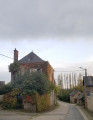
The route starts near the church on Rue des Blanches, where there are a few parking spaces.

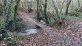
(S/E) Leave the church on your right and follow the Chemin de la Croix to the left. At the end, it turns into a sunken lane, lined with hedges, and soon passes through some woodland. After a gentle descent, cross the Ruisseau de Corbinu.

(1) Follow the path as it winds to the right, then take the dirt track on the left. Continue along this track until you reach a pond.

(2) Pass a small pond on your right, then further on, turn left towards Le Verger. After passing through the hamlet, you’ll find yourself on the main road.

(3) Turn right, then take the first street on the left towards the “Le Port” lock and the towpath.

(4) Stop off at the “Le Port” lock keeper’s house to do a bit of shopping, then continue downstream along the river towards the Rochefort bridge. During your walk, you’ll be able to enjoy the charm of the four locks you pass through and the tranquillity of the river. You’ll come to a junction.

(5) If you wish to shorten your walk, you can take “Le Bréchet” on your left, which will lead you to the centre of Sacé. Otherwise, carry on straight on to Rochefort.

(6) Go under the bridge and take the small tarmac road that climbs parallel to the D101. First turn right then left and walk along the D101 with great care towards Montflours. Continue to the wayside shrine at Petit Montflours.

(7) Turn right to rejoin a track. The path winds down past some charming houses, then branches off to the left below the road. You’ll arrive in the village of Montflours.

(8) Take the first road on the left and cross the village’s main junction. Carry on straight ahead until you leave the village. Head straight on to the next junction at a bend.

(9) Turn right and head onto a dirt track. The path continues to the right until it reaches the D250. Turn left, then take the second road on the right towards Le Fougeray.

(10) Carry on along this road and turn left. Pass Mézoué’s house on your left, then turn left onto a hedge-lined path leading to La Dalbardière.

(11) The path becomes a hollow way; you’ll cross the Ruisseau d’Ouvrain. The slope becomes steeper. The path leads out onto the D250.

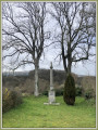
(12) At the wayside cross, turn right to enter the village of Sacé. Pass the church on your right, then turn left to return to the starting point. (S/E)

Waypoints

  1. S/E : mi 0 - alt. 381 ft - Car park
  2. 1 : mi 0.59 - alt. 282 ft - Corbinu stream
  3. 2 : mi 1.1 - alt. 318 ft - Pond
  4. 3 : mi 1.81 - alt. 315 ft - Departmental
  5. 4 : mi 2.43 - alt. 230 ft - “Le Port” lock - Mayenne (rivière)
  6. 5 : mi 2.81 - alt. 226 ft - Junction
  7. 6 : mi 5 - alt. 197 ft - Rochefort
  8. 7 : mi 5.46 - alt. 322 ft - Le Petit Montflours
  9. 8 : mi 5.95 - alt. 338 ft - Montflours
  10. 9 : mi 6.47 - alt. 371 ft - Junction
  11. 10 : mi 7.23 - alt. 341 ft - Le Fougeray
  12. 11 : mi 8.09 - alt. 335 ft - La Dalbardière
  13. 12 : mi 8.56 - alt. 364 ft - D250
  14. S/E : mi 8.78 - alt. 381 ft - Car park

Notes

Dirt tracks: 84%
Circular: Yes
Markings: Yellow Pr

Worth a visit

-Banks of the Mayenne

Reviews and comments

4.6 / 5
Based on 3 reviews

Reliability of the description
4.7 / 5
Ease of following the route
4.7 / 5
Route interest
4.3 / 5
User 29388665

Overall rating : 4 / 5

Date of your route : Jun 07, 2026
Reliability of the description : ★★★★☆ Good
Ease of following the route : ★★★★☆ Good
Route interest : ★★★★☆ Good
Very busy route : Yes

A route with no major difficulties. Runs alongside the River Mayenne. Tarmac towards the end of the route (around 3–4 kilometres of tarmac)

Machine-translated

MR CAT
MR CAT

Overall rating : 5 / 5

Date of your route : Jan 18, 2026
Reliability of the description : ★★★★★ Very good
Ease of following the route : ★★★★★ Very good
Route interest : ★★★★★ Very good
Very busy route : No

A very pleasant and well-marked hike with few paved sections during the first two-thirds of the walk. The footpaths are very well maintained, with a few trees that recently fell due to a storm at the end of the trail, but they are easy to get around.

Machine-translated

piron
piron

Overall rating : 4.7 / 5

Date of your route : Dec 01, 2025
Reliability of the description : ★★★★★ Very good
Ease of following the route : ★★★★★ Very good
Route interest : ★★★★☆ Good
Very busy route : No

Beautiful scenery, easy hike with clear signposting

Machine-translated

Other walks in the area

For more walks, use our search engine .

The GPS track and description are the property of this route's author. Please do not copy them without permission.