


Refine your search for walks in Valuéjols
Valuéjols walks


 Valuéjols - Saint-Flour
 Visorando Member
 13.01 mi
 +974 ft
 -1,608 ft
 6h 50
6h 50
 Difficult
 Departure from Valuéjols (Cantal)
Third and final stage of the Planèze tour. Entirely on the GR®4. This stage crosses varied environments and allows you to discover some very interesting, albeit little-known, sites. In particular, the route runs alongside the Narse de Nouvialle (a remarkable wetland) and passes close to the Château du Sailhant and the Babory waterfall.
Route du Bois des Fraux
 6.59 mi
+486 ft
-489 ft
3h 25
6.59 mi
+486 ft
-489 ft
3h 25
 Moderate
Departure from Valuéjols (Cantal)
Moderate
Departure from Valuéjols (Cantal)
This is a route that captures the mountain atmosphere of the Haute Planèze – the land of burons and summer pastures – starting from Saint-Maurice, a hamlet of Valuéjols, and leading to one of the few wooded areas in the Planèze. The route follows signposted sections (local PR® and GRP® trails) along tracks suitable for vehicles, which link the hamlets and farms scattered across the area. The Bois des Fraux, meanwhile, is maintained by foresters who have cleared tracks there for walking or cross-country skiing, provided there is still snow in winter.
The Narse de Lascols
 7.52 mi
+417 ft
-417 ft
3h 50
Moderate
Departure from Paulhac (Cantal)
7.52 mi
+417 ft
-417 ft
3h 50
Moderate
Departure from Paulhac (Cantal)
The ‘Grande Randonnée’ trail in the Pays de Saint-Flour allows you to walk several circular routes around the capital of the Planèze and Margeride regions and passes through the village of Paulhac. The circular route crosses the Narse de Lascols from south to north, starting from Cussac, passing the Puy de Mercou, and heading back up towards the Bois des Fraux via the mountain pastures. The route described below is inspired by this, offering a wonderful exploration of the Planèze de Saint-Flour by combining the GR® de Pays and PR® trails around Paulhac.
The Mercou Woods
 6.79 mi
+558 ft
-574 ft
3h 35
Moderate
Departure from Paulhac (Cantal)
6.79 mi
+558 ft
-574 ft
3h 35
Moderate
Departure from Paulhac (Cantal)
Circuit no. 1 in the guidebook of walking, horse riding and mountain biking routes in the commune of Paulhac.
Les Fonds de la Salesse
 3.87 mi
+262 ft
-240 ft
2h 00
3.87 mi
+262 ft
-240 ft
2h 00
 Easy
Departure from Paulhac (Cantal)
Easy
Departure from Paulhac (Cantal)
Discovery hike around Paulhac, very easy and ideal for those new to mountain biking, especially children. It is also accessible to pedestrians, horses and even people with all-terrain pushchairs (3 wheels).
Paulhac - Valuéjols
9.60 mi
+2,005 ft
-1,916 ft
6h 10
Moderate
Departure from Paulhac (Cantal)
Second stage of the Saint-Flour Planèze tour. This is the shortest and highest stage. It takes place in the foothills of the Plomb du Cantal and crosses the wildest parts of the circuit.
Lavergne and Belinay Woods
 8.21 mi
+1,086 ft
-1,086 ft
4h 45
Moderate
Departure from Paulhac (Cantal)
8.21 mi
+1,086 ft
-1,086 ft
4h 45
Moderate
Departure from Paulhac (Cantal)
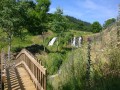
An encounter with nature in the heart of the Monts du Cantal, with a complete change of scenery guaranteed.
The Church of Bredons
4.75 mi
+938 ft
-935 ft
3h 00
Easy
Departure from Murat (Cantal) (Cantal)
Walk in the hills above Murat. Beautiful views over the Alagnon and Benet valleys. Beautiful old houses in the village of Bredons and the remarkable site of Bredons Church, an 11th-century Cluniac site.
Chapelle Saint-Antoine via Rocher de Bonnevie, starting from Murat
 5.16 mi
+1,148 ft
-1,138 ft
3h 20
Easy
Departure from Murat (Cantal) (Cantal)
5.16 mi
+1,148 ft
-1,138 ft
3h 20
Easy
Departure from Murat (Cantal) (Cantal)
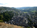
The route passes through the old town of Murat and then two religious buildings on their respective promontories. These offer views of the town of Murat and the Cantal mountains.
Murat – Prat de Bouc
 10.24 mi
+2,474 ft
-899 ft
6h 50
Difficult
Departure from Murat (Cantal) (Cantal)
10.24 mi
+2,474 ft
-899 ft
6h 50
Difficult
Departure from Murat (Cantal) (Cantal)
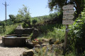
First stage ofthe GR® 400 walking clockwise (the official guidebook follows the opposite direction).
The landscape gradually takes on its typical Cantalian character, particularly in the Cirque de Chamalière and, of course, beneath the Plomb du Cantal at Prat de Bouc.
Circuit of the Cantalien volcano via the GR®400, clockwise
 88.49 mi
+21,634 ft
-21,604 ft
8 days
Difficult
Departure from Murat (Cantal) (Cantal)
88.49 mi
+21,634 ft
-21,604 ft
8 days
Difficult
Departure from Murat (Cantal) (Cantal)
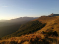
This 8-day route covers the entireGR®®400, in a clockwise direction (the FFRP guidebook describes it in the opposite direction).
Three waterfalls at Albepierre-Bredons
 3.88 mi
+505 ft
-515 ft
2h 15
Easy
Departure from Albepierre-Bredons (Cantal)
3.88 mi
+505 ft
-515 ft
2h 15
Easy
Departure from Albepierre-Bredons (Cantal)
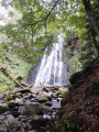
A route starting from a charming village that takes you to three waterfalls.
The Cascade des Vergnes, the uppermost of the three, is only visible from a viewing point. From here, take the opportunity to visit the Roman milestone a few metres further up.
The Cascade des Prés Longs, visible from a viewpoint and then from its base, is far more impressive than its neighbours.
The Cascade de Prapsou, superb, with a drop of several metres near the village.
Ideal spots offering a haven of greenery and coolness.
The waterfalls from Albepierre-Bredons
 5.68 mi
+981 ft
-988 ft
3h 30
Moderate
Departure from Albepierre-Bredons (Cantal)
5.68 mi
+981 ft
-988 ft
3h 30
Moderate
Departure from Albepierre-Bredons (Cantal)
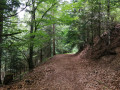
This route invites you to discover the pretty village of Albepierre-Bredons and explore the Pays de Murat national forest, which is home to many remarkable trees. In the cool woods, the Prés Long, Vergnes and Prapsou waterfalls are the main attractions of this shaded route.
Route not accessible from December to April due to snow.
The Benet Valley
10.13 mi
+1,854 ft
-1,860 ft
6h 15
Moderate
Departure from Albepierre-Bredons (Cantal)
The Cirque de Chamalière was formed by a glacier that reshaped the landscape after the formation of the Cantal stratovolcano. It is a very pleasant place for summer grazing and, incidentally, for picnics. The small streams that run down its slopes feed into a brook, the Benet. This hike follows the valley of this short brook, a tributary of the Alagnon.
A picnic on the Prés Marty
10.82 mi
+1,860 ft
-1,860 ft
6h 35
Moderate
Departure from Albepierre-Bredons (Cantal)
Les Prés Marty are summer pastures on the slopes of Plomb du Cantal, where beautiful Salers cows graze on lush grass. On the way there, discover three beautiful waterfalls, and on the way back, a renovated buron (shepherd's hut), an oratory and a fourth waterfall. In season, dessert will be provided by the many wild raspberry bushes that line the path.
The Cirque de Chamalière via the waterfalls and the forest
 8.05 mi
+1,227 ft
-1,227 ft
4h 45
Moderate
Departure from Albepierre-Bredons (Cantal)
8.05 mi
+1,227 ft
-1,227 ft
4h 45
Moderate
Departure from Albepierre-Bredons (Cantal)
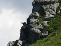
This route is ideal in hot weather. You will enjoy the coolness near the waterfalls and especially in the forest. In spring and autumn, this route will undoubtedly allow you to discover the wild flora and fauna in the Cirque. You will leave the coolness behind at the Col de la Molède, just long enough to descend towards Albepierre.
⚠️ At the point (3) , the hamlet of Raveyrol is replaced by Buron de Joaniol haut. This is a naming error on the IGN map.
Chambeuil Mill and Waterfall
 0.46 mi
+226 ft
-223 ft
0h 25
Easy
Departure from Laveissière (Cantal)
0.46 mi
+226 ft
-223 ft
0h 25
Easy
Departure from Laveissière (Cantal)
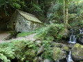
Discover a magnificent mill and a waterfall in an idyllic setting.
Le Puy du Rocher as seen from Chambeuil
 13.58 mi
+3,720 ft
-3,704 ft
7 hrs
13.58 mi
+3,720 ft
-3,704 ft
7 hrs
 Very difficult
Departure from Laveissière (Cantal)
Very difficult
Departure from Laveissière (Cantal)
To stay largely off the marked and well-trodden paths, the route to the summit starts from a fairly low point, following the very gentle ridge south of the Alagnon. This hike requires a good sense of direction due to the lack of signposting and sections through ‘summer pastures’ without a defined path; a GPS is a great help.
The return journey along the lower section follows a fairly long stretch of road, though it is very pleasant and has very little traffic.
The peat bogs of Chastel-sur-Murat
 5.04 mi
+600 ft
-587 ft
2h 50
Easy
Departure from Chastel-sur-Murat (Cantal)
5.04 mi
+600 ft
-587 ft
2h 50
Easy
Departure from Chastel-sur-Murat (Cantal)
Although it takes a while to get there, this walk takes you along a wild trail through pastureland, where you can see several peat bogs at different stages of development and enjoy magnificent views of the Cantal mountains and the Planèze plateau on the Saint-Flour side.
The historical heritage of Neussargues en Pinatelle
9.06 mi
+1,056 ft
-1,033 ft
5h 05
Moderate
Departure from Chalinargues (Cantal)
Discover the history of this part of the Cézalier through the archaeological and historical remains that dot this route. Prehistoric rock shelters, tumuli, Merovingian sarcophagi, medieval forest trails, 12th-century churches, a monumental 15th-century cross, a communal oven, a wash house and beautiful old houses.
More walks in Valuéjols
Select a point of interest below: