Refine your search for walks in Valderiès
Valderiès walks


 Around Valderiès
 Visorando Member
 8.26 mi
 +702 ft
 -712 ft
 4h 25
4h 25
 Moderate
 Departure from Valderiès (Tarn)
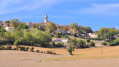
Walk from the village of Valderiès. The route follows part of the Sentier du Ségala and passes at the foot of Puy Saint-Georges, offering lovely views over the Tarn Ségala plateau.
Le Puy Saint-Georges
 1.62 mi
+164 ft
-164 ft
0h 55
1.62 mi
+164 ft
-164 ft
0h 55
 Easy
Departure from Andouque (Tarn)
Easy
Departure from Andouque (Tarn)
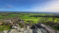
On the Ségala plateau, in the Tarn, rises Mont du Puy Saint-Georges, dominated by the ruins of the 13th-century Saint-Barthélémy Church. From the summit, a splendid view unfolds before us and, in fine weather, one can see the Pyrenees and admire the sunsets.This short route is a return walk, with no signposting.
Via the Maux bridge in Saint-Jean-de-Marcel
 5.50 mi
+541 ft
-554 ft
3h 00
Easy
Departure from Saint-Jean-de-Marcel (Tarn)
5.50 mi
+541 ft
-554 ft
3h 00
Easy
Departure from Saint-Jean-de-Marcel (Tarn)
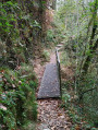
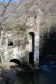
After descending the rocky path that leads to the banks of the Cérou, follow the river to Pont de Maux. Climb back up to Bellerive, then take the road back to Saint-Jean-de-Marcel.
Path to the Château de Labastide-Vassals
 6.56 mi
+853 ft
-853 ft
3h 45
Easy
Departure from Saint-Grégoire (Tarn) (Tarn)
6.56 mi
+853 ft
-853 ft
3h 45
Easy
Departure from Saint-Grégoire (Tarn) (Tarn)
This magnificent and surprisingly unexpected circuit takes place on the outskirts of Albi. Its undergrowth, meadows and small rollercoaster-like hills will quickly make you forget the 900 m of road at the start. The trail takes you down to the Lézert, passing through Puech Miral and Puech Mège, where you can discover the ruins of the Château de Labastide-Vassals and its mill. You will walk through a wild and invigorating landscape.
Pride de Crespin fords
 4.86 mi
+751 ft
-758 ft
2h 55
Moderate
Departure from Crespin (Tarn) (Tarn)
4.86 mi
+751 ft
-758 ft
2h 55
Moderate
Departure from Crespin (Tarn) (Tarn)
An excursion in the coolness of the Andouquette. You will be charmed by this stream that will accompany you all along its gorge. You will be surrounded by unspoilt nature.
Along the River Tarn from Saint-Juéry
 3.81 mi
+141 ft
-148 ft
1h 55
Easy
Departure from Saint-Juéry (Tarn) (Tarn)
3.81 mi
+141 ft
-148 ft
1h 55
Easy
Departure from Saint-Juéry (Tarn) (Tarn)
Just a stone’s throw from the town and running alongside the River Tarn for much of the way, this lovely little path offers a pleasant stroll along the riverbank, with vegetation that boasts a wealth of biodiversity. Yellow markings.
Discovery Trail: the Laurentians
 3.65 mi
+210 ft
-203 ft
1h 50
Easy
Departure from Le Garric (Tarn)
3.65 mi
+210 ft
-203 ft
1h 50
Easy
Departure from Le Garric (Tarn)
Walking or mountain biking route: this circular loop around the Sainte-Marie Trench starts at the Esplanade de Cap Découverte and offers a bird’s-eye view of the trench. It passes through the Bassin de Nicou and Lac des Laurentides.
We will also follow the botanical garden and its wetland, home to water irises and water lilies.
Finally, we’ll finish this walk by crossing the Parc des Titans, then taking a section of the Charbon au Soleil interpretive trail in the Parc du Carbonifère.
From Carmaux to Albi under the sign of coal
14.19 mi
+758 ft
-978 ft
7h 10
 Difficult
Departure from Carmaux (Tarn)
Difficult
Departure from Carmaux (Tarn)
A hike in the footsteps of the old coal mines.
Cap'Découverte: Sainte-Marguerite
 6.08 mi
+482 ft
-463 ft
3h 15
Easy
Departure from Le Garric (Tarn)
6.08 mi
+482 ft
-463 ft
3h 15
Easy
Departure from Le Garric (Tarn)
Walking or mountain biking route: This route starts at the site’s main roundabout and follows the GR®36 to the outskirts of Cité des Homps. Running alongside the large field of solar panels, it passes a small lake before reaching the greenway. A small path then leads to Cagnac-les-Mines (below the school), passes near the supermarket and joins the GR®36. You then follow a nature trail offering panoramic views of the valley, the Montagne Noire and the Pyrenees.
The industrial Tarn in Saint-Juéry
9.45 mi
+804 ft
-804 ft
5h 05
Moderate
Departure from Saint-Juéry (Tarn) (Tarn)
A circular route through the Saint-Juérienne countryside before approaching the Tarn, its steelworks and power stations. A prelude to a visit to the Saut du Tarn Museum, on a natural site that remains exceptional despite human development.
Circular Puy de Bar to Moulares
 6.32 mi
+696 ft
-673 ft
3h 30
Moderate
Departure from Moularès (Tarn)
6.32 mi
+696 ft
-673 ft
3h 30
Moderate
Departure from Moularès (Tarn)
This circular is part of the Grand 8 route in Ségala Carmausin. You will walk through the Tarn countryside along pretty paths lined with low walls and wooden bridges, enjoying lovely views of the surrounding area.
From the Tarn to Puech Mergou
10.50 mi
+1,345 ft
-1,319 ft
6h 00
Moderate
Departure from Saint-Juéry (Tarn) (Tarn)
Starting from Les Avalats on the banks of the Tarn, climb up to the agricultural plateau towards Cunac and then head back east towards Marsal through the woods on the left bank of the Tarn.
After the Puech Mergou farm, the return journey is downhill through the woods towards the river and then along the riverbank on a path isolated from the D172.
The route is poorly signposted. The use of GPS is recommended.
The peaceful Tarn from Longouyrou to Pécotte
9.98 mi
+1,309 ft
-1,319 ft
5h 45
Moderate
Departure from Crespinet (Tarn)
A hike along a bend in the Tarn, taking the tourist route which is very quiet but not suitable for hikers who dislike tarmac. Passes by a viewpoint, the hamlet of Pécotte where an old ferry is on display, a chapel and an old fortified house.
Lands of light and shadow around Carmaux
 9.08 mi
+482 ft
-492 ft
4h 35
Moderate
Departure from Carmaux (Tarn)
9.08 mi
+482 ft
-492 ft
4h 35
Moderate
Departure from Carmaux (Tarn)
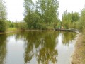
Wandering through mining country, the hiker’s footsteps take the place of the train’s, laden with precious ore. A lovely route steeped in history.
A walk in the Ségala region around Sainte-Gemme
 Tourism professional
 5.18 mi
+748 ft
-755 ft
3h 00
Easy
Departure from Sainte-Gemme (Tarn) (Tarn)
5.18 mi
+748 ft
-755 ft
3h 00
Easy
Departure from Sainte-Gemme (Tarn) (Tarn)
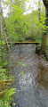
This route will take you through part of the Ségala region in the Tarn and along the paths once used by mining peasants to reach the mines around Carmaux.
Along the Céret from the Roucarié Reservoir
 5.47 mi
+620 ft
-646 ft
3h 05
Easy
Departure from Monestiés (Tarn)
5.47 mi
+620 ft
-646 ft
3h 05
Easy
Departure from Monestiés (Tarn)
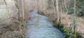
A walk that will allow you to discover the landscapes of the Ségala Carmausin, a land of farmers and miners. This walk is fully signposted (PR® Yellow) and also features directional signs. The entire route follows small roads and local paths. Small signs featuring quotes on biodiversity adorn this trail. Scan the QR code for information about the route and other walks.
The two valleys of Cunac
6.64 mi
+679 ft
-689 ft
3h 40
Easy
Departure from Cunac (Tarn)
This is a circular trail that winds east and west of Cunac, jumping from one stream to another.
Along the way, walkers will discover the meadows and valleys of the Albi plateaus.
Circular route from Cunac to Saint-Juéry via Les Avalats
 5.69 mi
+469 ft
-492 ft
3h 00
Easy
Departure from Cunac (Tarn)
5.69 mi
+469 ft
-492 ft
3h 00
Easy
Departure from Cunac (Tarn)
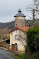
An ideal route for a breath of fresh air in winter, right on the outskirts of Albi.It will take you from valleys to plateaus across the hillsides around Albi, overlooking the River Tarn.
The long version of the Méridienne trail
 9.95 mi
+1,598 ft
-1,594 ft
6h 00
Moderate
Departure from Sérénac (Tarn)
9.95 mi
+1,598 ft
-1,594 ft
6h 00
Moderate
Departure from Sérénac (Tarn)
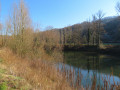
A walk through the Ségala Tarnais, offering a variety of agricultural and woodland landscapes on schist bedrock deeply carved by numerous streams and tributaries of the Tarn.
This route descends towards the Tarn valley, which you follow for a while before returning to the plateau via the left bank of the Aygou.
See practical information regarding the shorter version of this walk.
From (10 to 11) there are no signposts. After that,PR® signposts lead you back to the starting point.
The short version of the Méridienne trail
 7.94 mi
+1,109 ft
-1,109 ft
4h 35
Moderate
Departure from Sérénac (Tarn)
7.94 mi
+1,109 ft
-1,109 ft
4h 35
Moderate
Departure from Sérénac (Tarn)
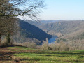
Hike in the Ségala Tarnais, which offers a variety of agricultural and forest landscapes on a schistose subsoil deeply carved by numerous streams and rivers that flow into the Tarn.
This route descends towards the Tarn valley, which you follow for a while before returning to the plateau via the right bank of the Aygou.
This is a yellow-markedPR® trail with signposts at major crossroads.
Walk to Gô Castle
 1.87 mi
+43 ft
-43 ft
0h 55
Easy
Departure from Tarn
1.87 mi
+43 ft
-43 ft
0h 55
Easy
Departure from Tarn
A short walk along a bend in the River Tarn. You’ll pass the Renaissance-style Château de Gô on your way.
Along the Tarn in Marsal
 4.49 mi
+102 ft
-102 ft
2h 10
Easy
Departure from Marsal (Tarn) (Tarn)
4.49 mi
+102 ft
-102 ft
2h 10
Easy
Departure from Marsal (Tarn) (Tarn)
A lovely family walk, there and back, strolling along the Tarn.
Short circular around Marsal
 4.77 mi
+689 ft
-666 ft
2h 50
Easy
Departure from Marsal (Tarn) (Tarn)
4.77 mi
+689 ft
-666 ft
2h 50
Easy
Departure from Marsal (Tarn) (Tarn)
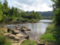
This short route is ideal for getting back into shape. It is easy and runs alongside the Tarn for long enough to allow for a bit of effort at the end of the route, in the middle of the woods.
The Saint-Quintin woods via the GR® 36
 5.94 mi
+509 ft
-486 ft
3h 10
Easy
Departure from Tarn
5.94 mi
+509 ft
-486 ft
3h 10
Easy
Departure from Tarn
The green lung of the Albigeois region, the Saint-Quintin Forest in Cagnac-les-Mines is a paradise for walkers.
Located between the Ruisseau de la Mouline stream and the old Albi-Cagnac railway line, this path is appreciated for its tranquillity and bucolic walks.
Yellow and white-redGR®36markings.
The Miners’ Trail
7.76 mi
+620 ft
-594 ft
4h 05
Moderate
Departure from Tarn
A short walk starting in the north of Albi, following theGR® 36, which has been converted into a greenway.
For most of the route, it is a return walk. This route was once used to transport coal from the Cagnac mines to the Pélissier thermal power station.
Marsal Grand Circular
 7.20 mi
+1,161 ft
-1,145 ft
4h 20
Moderate
Departure from Villefranche-d'Albigeois (Tarn)
7.20 mi
+1,161 ft
-1,145 ft
4h 20
Moderate
Departure from Villefranche-d'Albigeois (Tarn)
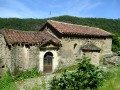
This hike allows you to discover the Tarn valley between Albi and Ambialet. You will walk from the plateaus to the banks of the Tarn, discovering pretty villages and the hamlet of Nicolaï Greschny.
Cambon d’Albi Mill Trail
2.33 mi
+128 ft
-128 ft
1h 10
Easy
Departure from Cambon (Tarn)
Cambon is a circular village, typical of the South, which overlooks the valley from the top of its rocky outcrop.
This walk consists of two circular loops offering lovely views of the village and showcasing the varied landscape on either side of the Lézert stream.
The route follows the stream and its tributaries, then winds past a13th-century mill, amidst a peaceful and restful setting of water and greenery.
Tarn River in Albi tourist loop
5.86 mi
+453 ft
-430 ft
3h 05
Easy
Departure from Tarn
The 'Jardin de la Berbie' garden, the Parc Rochegude, a route along the 'Ruisseau du Caussels' stream, a stroll along the Tarn river and, of course, the architectural highlights of Albi beautiful pink city, all enhance this urban tour.
From Bellegarde to Les Avalats
 7.31 mi
+899 ft
-906 ft
4h 10
Moderate
Departure from Saint-Juéry (Tarn) (Tarn)
7.31 mi
+899 ft
-906 ft
4h 10
Moderate
Departure from Saint-Juéry (Tarn) (Tarn)
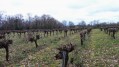
A lovely circular route close to Albi, which takes you to Les Avalats with beautiful views of the Tarn valley. Wild paths through the woods alternate with meadows and vineyards.
From Tanus to Las Planques
 9.86 mi
+1,759 ft
-1,759 ft
6h 05
Moderate
Departure from Tanus (Tarn)
9.86 mi
+1,759 ft
-1,759 ft
6h 05
Moderate
Departure from Tanus (Tarn)
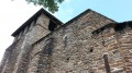
The Las Planques chapel is a remarkable example of southern Romanesque art.It is nestled on a rocky promontory in the middle of the woods and majestically overlooks the Viaur Gorges.This long circular route is less difficult to access than the one from Pampelonne (published on Visorando).Although classified as moderately difficult, you will need to be reasonably fit to cover the distance and negotiate the rollercoaster terrain of the Viaur.
PLEASE NOTE: Following the flooding of the Viaur, as of 20 February 2026, the trail is inaccessible between the Viaduct and the Tanus Bridge, and most likely for the section leading to the Las Planques footbridge.
10,000-Step Trails in Albi – Easy and intermediate routes
 Association / Club / Walk leader3.23 mi
+187 ft
-187 ft
1h 40
Easy
Departure from Tarn
Association / Club / Walk leader3.23 mi
+187 ft
-187 ft
1h 40
Easy
Departure from Tarn
Route proposed by the Maison Sport Santé of the OMEPS in Albi. A walking route in the heart of Albi, linking the two banks of the Tarn and allowing you to discover the city’s main iconic sites. Two levels are available to suit everyone’s abilities and goals.
The easy route is designed to get everyone moving again. It involves walking to Rochegude Park, going round it, then returning to the starting point, the footbridge. The intermediate route extends the walk towards Pratgraussals Park, allowing you to gradually increase the duration and distance.
These routes allow you to reap the initial health benefits, even with a limited amount of walking, provided you walk regularly and at a moderate intensity (between 4,000 and 7,000 steps a day).
They form part of an initiative to promote daily physical activity, demonstrating that the benefits appear well before reaching 10,000 steps.
Albi and its history
 2.74 mi
+207 ft
-190 ft
1h 25
Easy
Departure from Tarn
2.74 mi
+207 ft
-190 ft
1h 25
Easy
Departure from Tarn
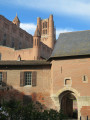
A route through the city to discover the beautiful city of Albi, clad entirely in brick, as you stroll through its streets lined with half-timbered houses.
Lasbordes route in the Albi region, from the countryside to the city
 5.07 mi
+98 ft
-98 ft
2h 25
Easy
Departure from Tarn
5.07 mi
+98 ft
-98 ft
2h 25
Easy
Departure from Tarn
This short, unpretentious walk offers a glimpse of the countryside, just a stone’s throw from the cathedral.This route is pleasant in cooler weather or during winter, just to get a breath of fresh air.This circular loop is ideal for those who love the sunshine and want to keep their shoes clean.
 The Chemin des Droits de l’Homme from Albi to Castres