Cap'Découverte: Sainte-Marguerite

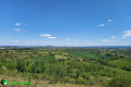
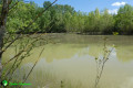
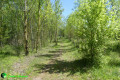
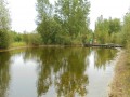
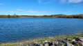
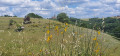
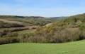
Walking or mountain biking route: This route starts at the site’s main roundabout and follows the GR®36 to the outskirts of Cité des Homps. Running alongside the large field of solar panels, it passes a small lake before reaching the greenway. A small path then leads to Cagnac-les-Mines (below the school), passes near the supermarket and joins the GR®36. You then follow a nature trail offering panoramic views of the valley, the Montagne Noire and the Pyrenees.

Details

9789585
Creation:
Last update:
Last review:
  • Walking
    Activity: Walking
  • ↔
    Distance: 6.08 mi
  • ◔
    Average duration: 3h 15 
  • ▲
    Difficulty: Easy

  • ⚐
    Back to start: Yes
  • ↗
    Ascent: + 482 ft
  • ↘
    Descent: - 463 ft

  • ▲
    Highest point: 1,224 ft
  • ▼
    Lowest point: 840 ft

Photos

Description of the walk

Head to the Cap’Découverte roundabout in Blaye-les-Mines and park in the car park.

(S/E) From the car park, cross the roundabout to reach the tarmac road that passes under the road bridge. Follow the yellow markings.
Under the bridge, turn left onto a narrow path that climbs through the broom. When you reach a tarmac road, follow it to the left for 100 m, then turn right onto the track.

(1) At the junction with the tarmac road, follow it for about 200 m before taking the path that descends to the right.

(2) When you reach the other end of the Sainte-Marguerite plateau, head down to the right along the winding path,

(3) Cross the tarmac road and continue along the track before turning onto a path on the right which leads to the RD25.

(4) Follow the RD 25 on the left towards Cagnac-les-Mines until you reach the junction where you can access the Mining Museum and the ‘Balade en sol mineur’ heritage trail.

(5) Cross the junction and carry on straight ahead. After 300 m, first turn right then left.

(6) Take the track on the left for 350 m and turn left onto a path. You’ll come to a small pond.

(7) Turn left onto the greenway.

(8) Follow the path straight ahead. Join a wider track, and further on, turn right to reach the roundabout.

(9) At the roundabout, walk along the small square for 100 m until you reach the entrance to Cap Découverte. Follow the winding path uphill, continue due east and walk in a general north-north-easterly direction.

(3) Join the path you took on the way there and follow it to the right. At the second sharp bend to the right, take the path straight ahead heading due south, which then turns northwards and leads back to the junction you passed on the way there.

(1) Turn right and return to the car park (S/E).

Waypoints

  1. S/E : mi 0 - alt. 1,096 ft - Cap’Découverte car park
  2. 1 : mi 0.33 - alt. 1,184 ft - Out-and-back junction. Tarmac road
  3. 2 : mi 1.13 - alt. 1,165 ft - On the right, descent
  4. 3 : mi 1.42 - alt. 1,043 ft - Cross the road
  5. 4 : mi 1.74 - alt. 1,030 ft - Follow the RD 25
  6. 5 : mi 1.92 - alt. 1,040 ft - Le Boual. Crossroads
  7. 6 : mi 2.22 - alt. 919 ft - Track on the left
  8. 7 : mi 2.79 - alt. 846 ft - Greenway
  9. 8 : mi 3.02 - alt. 912 ft - Straight ahead
  10. 9 : mi 3.43 - alt. 1,007 ft - Roundabout
  11. S/E : mi 6.08 - alt. 1,099 ft - Cap’Découverte car park

Always be cautious and plan ahead when you're outdoors. Visorando and the author of this route cannot be held responsible for any accidents occurring on this route.

The GR® and PR® markings are the intellectual property of the Fédération Française de Randonnée Pédestre.

Reviews and comments

3.8 / 5
Based on 4 reviews

Reliability of the description
3.8 / 5
Ease of following the route
4 / 5
Route interest
3.8 / 5
Philippe Bourgine
Philippe Bourgine

Overall rating : 5 / 5

Date of your route : Jan 19, 2023
Reliability of the description : ★★★★★ Very good
Ease of following the route : ★★★★★ Very good
Route interest : ★★★★★ Very good
Very busy route : No

A good walk to do in wet weather as the path isn’t muddy. Wells 1, 2 and 3 are of historical interest.
It’s worth noting that on 19 January the path was blocked, but the day before we’d scouted the route for the group and had a view of the snow-capped Lacaune mountains and the snow-capped Pyrenees in the beautiful orange light of the evening.

The route description between point 8 and point 9 at Cagnac-les-Mines needs correcting. You actually need to follow the greenway, which must have been created or extended since the route was first mapped out; this is true on the climb up to Cagnac and, in particular, when you reach the stadium, you must continue along the greenway past the stadium towards the mining museum (do not go into the village, especially as the route currently leads into a building site) and further on, turn right to join the road, which you must cross to rejoin the route; from there, you need to head away from the route for about 300 metres, as far as I can recall.

Machine-translated

Bernard MARTY
Bernard MARTY

Overall rating : 4 / 5

Date of your route : Dec 12, 2022
Reliability of the description : ★★★★☆ Good
Ease of following the route : ★★★★☆ Good
Route interest : ★★★★☆ Good
Very busy route : No

A pleasant walk in the winter sunshine.

Machine-translated

Julie31300
Julie31300
• Edited:

Overall rating : 2.7 / 5

Date of your route : Apr 04, 2022
Reliability of the description : ★★☆☆☆ Disappointing
Ease of following the route : ★★★☆☆ Average
Route interest : ★★★☆☆ Average
Very busy route : Yes

The directions are a bit hard to follow, but these are well-maintained paths around Cap Découverte.
More of a stroll than a hike.

Machine-translated

jacky gasc
jacky gasc

Overall rating : 3.7 / 5

Date of your route : Jan 09, 2022
Reliability of the description : ★★★★☆ Good
Ease of following the route : ★★★★☆ Good
Route interest : ★★★☆☆ Average
Very busy route : No

Best done in wet weather; however, the signposts are quite far apart, so do take care

Machine-translated

Other walks in the area

For more walks, use our search engine .

The GPS track and description are the property of this route's author. Please do not copy them without permission.