Circular route from Cunac to Saint-Juéry via Les Avalats

An ideal route for a breath of fresh air in winter, right on the outskirts of Albi.
It takes you from valleys to plateaus across the Albi hillsides, overlooking the River Tarn.

Details

1713653
Creation:
Last update:
Last review:
  • Walking
    Activity: Walking
  • ↔
    Distance: 5.69 mi
  • ◔
    Average duration: 3h 00 
  • ▲
    Difficulty: Easy

  • ⚐
    Back to start: Yes
  • ↗
    Ascent: + 469 ft
  • ↘
    Descent: - 492 ft

  • ▲
    Highest point: 925 ft
  • ▼
    Lowest point: 627 ft

Photos

Description of the walk

The route combines sections ofthe PR® trail marked in yellow and sections ofthe GR®36 trailmarked in red and white.
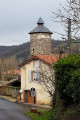
The route starts in front of Cunac Town Hall. Park in the car park on the right; this is a former tarmac football pitch.

PR Yellow markings

(S/E) From the town hall, walk along the car park via the Grand Rue, and at the next junction turn left onto the Route des Avalats. After crossing the Ruisseau de la Pontésié and before reaching the hamlet of the same name, turn onto the path on the right to reach the Route de Villefranche. Turn left just before Autanet.

(1) At the junction marked 266, take the road on the right. When you reach the Ruisseau de Cunac, cross it and immediately turn onto the path on the left. At the road, turn left and head north until you join theGR®36at elevation 281.

GR36 Red and white markings

(2) Follow theGR®36as you cross the junction. Head down towards the Conte farm, ignoring the path coming from the left. At Conte, leave thePR® behind and take the hairpin bend to the right. 200 metres further on, turn left towards Auxillou.

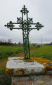
(3) In front of the wayside cross, turn onto the path on the left. At the T-junction, join the Truel on the right and continue past it. Keep to the right to head down towards Les Avalats. The path gives way to the tarmac of the Côte du Castel, at the first houses in the village.

(4) At the bottom of the Côte du Castel, take the Route de Cunac on the left. At the wide bend, continue straight on towards Hazard, elevation 228.

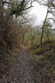
(5) Opposite the farm, take the path on the left. Climb gently up to the track.

PR Yellow markings

(6) Leave theGR®36and follow the track westwards. You’ll reach the D77.

(7) Cross the departmental road. Head off towards La Palatié. After 300m, veer onto the path climbing to the left. The path leads, at a bend, onto the Route des Avalats, which leads to Artigues and Jalet.

(8) Turn right towards the village and walk through it. You’ll reach the Pontésié five-way junction.

(9) Take the second road on the right, the Chemin de la Rivière. Follow this path to the end to reach the Town Hall and the car park (A/D).

Waypoints

  1. S/E : mi 0 - alt. 794 ft - Car park at Cunac Town Hall
  2. 1 : mi 0.99 - alt. 876 ft - Crossroads marked 266
  3. 2 : mi 1.79 - alt. 919 ft - Meeting point on the GR36
  4. 3 : mi 2.51 - alt. 889 ft - Auxillou
  5. 4 : mi 3.15 - alt. 627 ft - Foot of the Côte du Castel
  6. 5 : mi 3.63 - alt. 751 ft - Hazard
  7. 6 : mi 3.95 - alt. 748 ft - End of the GR36
  8. 7 : mi 4.2 - alt. 748 ft - Crossing the D77
  9. 8 : mi 4.86 - alt. 764 ft - Turn off towards Artigues and Jalet
  10. 9 : mi 5.25 - alt. 797 ft - La Pontésié
  11. S/E : mi 5.7 - alt. 794 ft - Car park at Cunac Town Hall

Notes

An easy route, though it does involve a bit of elevation gain and requires moderate effort.

Route completed by the author on 4 January 2019

Worth a visit

Saut du Tarn Museum
Saint-Juéry Leisure Centre.
Leisure centre and canoeing/kayaking at Les Avalats.
The Episcopal City of Albi with its many points of interest.

Always be cautious and plan ahead when you're outdoors. Visorando and the author of this route cannot be held responsible for any accidents occurring on this route.

The GR® and PR® markings are the intellectual property of the Fédération Française de Randonnée Pédestre.

Reviews and comments

4.4 / 5
Based on 3 reviews

Reliability of the description
4.7 / 5
Ease of following the route
4.7 / 5
Route interest
4 / 5
madydou
madydou ★

You're welcome 😊

Machine-translated

lutgad
lutgad

Yes, I know it, but we’ll give it a miss (it’s manageable on the way up but dangerous on the way down). Thank you very much for your reply.

Machine-translated

madydou
madydou ★

It’s not ideal for a horse. There’s a very narrow and steep section of the path as you approach the Avalats.

Machine-translated

lutgad
lutgad

Hello. Is it possible to do this route on horseback? Thank you.

Machine-translated

SMeredith
SMeredith

Overall rating : 4.3 / 5

Date of your route : Apr 14, 2025
Reliability of the description : ★★★★☆ Good
Ease of following the route : ★★★★☆ Good
Route interest : ★★★★★ Very good
Very busy route : No

A very pleasant walk that takes you from the Cunac plateau to the Tarn valley. I altered the route so that I could walk alongside the Tarn at Les Avalats – it would have been a shame not to see the river. I carried on along the greenway between Les Avalats and Saint-Juéry, before heading back up onto the plateau via waypoint 6. A lovely walk

Machine-translated

aza
aza

Overall rating : 4.3 / 5

Date of your route : Nov 04, 2024
Reliability of the description : ★★★★★ Very good
Ease of following the route : ★★★★★ Very good
Route interest : ★★★☆☆ Average
Very busy route : Yes

Very easy, with two short climbs that might prove challenging for those who aren’t very fit; take great care at the two crossings on very busy roads.

Machine-translated

Thut
Thut

Overall rating : 4.7 / 5

Date of your route : Nov 13, 2021
Reliability of the description : ★★★★★ Very good
Ease of following the route : ★★★★★ Very good
Route interest : ★★★★☆ Good
Very busy route : Yes

A well-described and well-signposted route. Be careful, however, with the yellow markings, as they correspond to different routes which may lead you off your original route.

Machine-translated

Other walks in the area

For more walks, use our search engine .

The GPS track and description are the property of this route's author. Please do not copy them without permission.