


Refine your search for walks in Vaïre (rivière)
Vaïre (rivière) walks


 The Annot Sandstone
 Visorando Member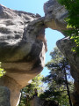
 3.58 mi
 +1,394 ft
 -1,378 ft
 2h 50
2h 50
 Moderate
 Departure from Annot (Alpes-de-Haute-Provence)
A very pretty, magical and interactive hike under oak trees, hundred-year-old chestnut trees and among huge sandstone boulders.
Most of the walk is in the cool forest.
The Grès d'Annot are world famous and are a listed and protected site.
From Allons station to Fugeret station
 8.90 mi
+1,975 ft
-2,349 ft
5h 50
Moderate
Departure from Allons (Alpes-de-Haute-Provence)
8.90 mi
+1,975 ft
-2,349 ft
5h 50
Moderate
Departure from Allons (Alpes-de-Haute-Provence)
This allows you to use the ‘Train des Pignes’ as a means of exploring the area whilst hiking, by changing valleys. The route runs partly through former farmland and partly through mixed woodland (with remarkable trees during the descent towards Fugeret).
Three sections, three landscapes:1/ from the station to the village of Allons,2/ from the village to La Basse d’Annot,3/ from the ridge to Fugeret station.
The village of Peyresq
 10.25 mi
+2,674 ft
-2,582 ft
7h 00
10.25 mi
+2,674 ft
-2,582 ft
7h 00
 Difficult
Departure from Thorame-Haute (Alpes-de-Haute-Provence)
Difficult
Departure from Thorame-Haute (Alpes-de-Haute-Provence)
A journey on the Train des Pignes. An acrobatic river crossing and the magnificent village of Peyresq with its sweeping views.
The Combe Renard circular route starting from Annot
2.67 mi
+922 ft
-912 ft
2h 00
 Easy
Departure from Annot (Alpes-de-Haute-Provence)
Easy
Departure from Annot (Alpes-de-Haute-Provence)
Follow the paths of La Colle Basse d’Annot to reach the Combe Renard Spring.
An easy hike featuring a steep climb at the start, followed by a flat forest path before beginning the descent.
(!) In winter, this section is very shaded and patches of ice may be present.
Walks near Vaïre (rivière)
Daluis Gorges
 2.33 mi
+482 ft
-676 ft
1h 30
Moderate
Departure from Guillaumes (Alpes-Maritimes)
2.33 mi
+482 ft
-676 ft
1h 30
Moderate
Departure from Guillaumes (Alpes-Maritimes)
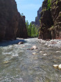
A route at the bottom of the superb Daluis Gorges! A water hike to be undertaken only in good weather, ideal in summer during hot weather. A hike accessible to children who can swim. Closed shoes are essential.
This hike crosses a protected natural site that is subject to regulations. See practical information.
From the Pont des Roberts to Valberg via the Baisse du Barrot
 13.13 mi
+4,921 ft
-1,949 ft
8 hrs
13.13 mi
+4,921 ft
-1,949 ft
8 hrs
 Very difficult
Departure from Guillaumes (Alpes-Maritimes)
Very difficult
Departure from Guillaumes (Alpes-Maritimes)
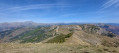
A beautiful, long, straight-line hike, with significant elevation gain but no technical difficulties. It requires at least two vehicles: one at the start and one at the finish.
Lac d’Allos – Tête de Valplane – La Cluite car park
 4.56 mi
+1,306 ft
-2,707 ft
3h 15
Moderate
Departure from Allos (Alpes-de-Haute-Provence)
4.56 mi
+1,306 ft
-2,707 ft
3h 15
Moderate
Departure from Allos (Alpes-de-Haute-Provence)
Alternative route to reach the Cluite car park from the Lac d’Allos refuge. The route passes via the Tête de Valplane, which offers breathtaking views of Lac d’Allos, the Cirque de l’Encombrette and the valley leading to Colmars. You are in the Mercantour National Park; there are regulations to be observed, and failure to do so may result in a fine of up to €1,500 – see the practical information.This route takes you off the marked trails; please read the reviews.
Lac d’Allos Mountain Hut – La Cantonnière Mountain Hut
 6.84 mi
+1,253 ft
-2,493 ft
4h 15
Moderate
Departure from Allos (Alpes-de-Haute-Provence)
6.84 mi
+1,253 ft
-2,493 ft
4h 15
Moderate
Departure from Allos (Alpes-de-Haute-Provence)
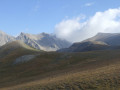
The final stage, which is longer than the other two, takes you back to the starting point.
Route from Val d’Allos le Seignus to Colmars-les-Alpes
 Tourist office
 5.21 mi
+568 ft
-1,834 ft
2h 55
Easy
Departure from Allos (Alpes-de-Haute-Provence)
5.21 mi
+568 ft
-1,834 ft
2h 55
Easy
Departure from Allos (Alpes-de-Haute-Provence)
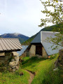
A route alternating between meadows and forest sections, offering the chance to explore the Val d’Allos and Haut-Verdon mountain ranges.
From Allos to Colmars via the Autapie ridge
 7.35 mi
+659 ft
-4,324 ft
3h 55
Moderate
Departure from Allos (Alpes-de-Haute-Provence)
7.35 mi
+659 ft
-4,324 ft
3h 55
Moderate
Departure from Allos (Alpes-de-Haute-Provence)
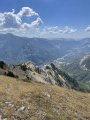
An easy hike starting from the Gros Tapi chairlift terminus. A ridge walk offering constantly stunning and unforgettable panoramic views of the Haut Verdon mountain ranges. An easy route with a final descent to Colmars through the forest on signposted paths. Best undertaken in summer whilst the chairlifts are operating.
Gueydan Bridge – Entrevaux via the summit of La Lette
 10.68 mi
+3,665 ft
-3,845 ft
8h 05
Difficult
Departure from Saint-Benoît (Alpes-de-Haute-Provence) (Alpes-de-Haute-Provence)
10.68 mi
+3,665 ft
-3,845 ft
8h 05
Difficult
Departure from Saint-Benoît (Alpes-de-Haute-Provence) (Alpes-de-Haute-Provence)
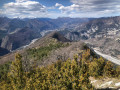
A beautiful, challenging route that keeps you on the ridgelines. The C-shaped configuration of the Var means that throughout this ascent you can admire the river’s banks on both the north and south sides. At the end of the hike, wander through the narrow streets lined with old walls in this magnificent village.
Allos - Mont Pelat
 10.09 mi
+5,577 ft
-328 ft
9h 30
Difficult
Departure from Allos (Alpes-de-Haute-Provence)
10.09 mi
+5,577 ft
-328 ft
9h 30
Difficult
Departure from Allos (Alpes-de-Haute-Provence)
The first part of this two-day circular is challenging and breathtaking, taking you through the heart of Mercantour National Park from the village of Allos, via Lac d'Allos and its refuge, Mont Pelat, Lac du Trou de l'Aigle, Le Cimet and its many waterfalls, including Cascade du Pich and Les Bois de Vacheresse.
From the Refuge de la Cantonnière to the Refuge de la Cayolle via the Col de la Boucharde
 6.90 mi
+2,874 ft
-1,503 ft
5h 40
Moderate
Departure from Entraunes (Alpes-Maritimes)
6.90 mi
+2,874 ft
-1,503 ft
5h 40
Moderate
Departure from Entraunes (Alpes-Maritimes)
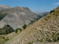
This route from the Refuge de la Cantonnière to the Refuge de la Cayolle via the Col de la Boucharde is the first day of a three-day route in the Haut-Var. After a shaded climb alongside the Ruisseau de Sanguinière, the route ascends the Ravin de la Boucharde before descending to the Bachelard after crossing the pass. You then need to follow the left bank of the Bachelard back up to the Refuge de la Cayolle, where you will spend the night.
Around Les Garrets
 14.67 mi
+4,055 ft
-4,108 ft
3 days
Moderate
Departure from Entraunes (Alpes-Maritimes)
14.67 mi
+4,055 ft
-4,108 ft
3 days
Moderate
Departure from Entraunes (Alpes-Maritimes)
A 3-day mountain hike going from refuge to refuge.
The daily stages are relatively short (3 to 5 hours), making it accessible to people of average fitness.
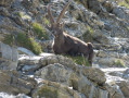
Wildlife (marmots, chamois, ibex and birds of prey) can be spotted quite easily at higher altitudes.